ISRA FACTSHEETS
ISRA FACTSHEETS
MEDITERRANEAN AND BLACK SEAS REGION
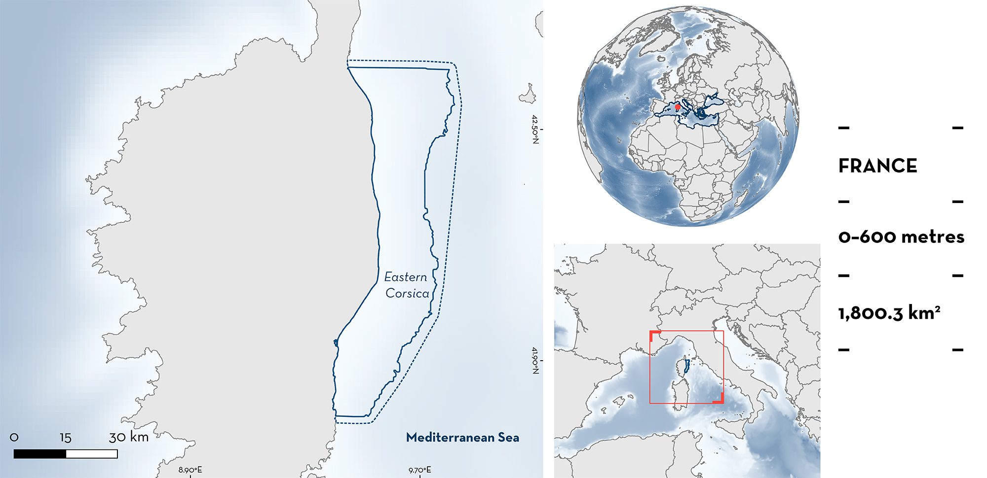
Eastern Corsica
Summary
Eastern Corsica is located in the French northern Tyrrhenian Sea, Western Mediterranean Basin. This area is characterised by its wide expanses of sandy substrates and seagrass meadows. It includes benthic habitats of the continental shelf, slope, and underwater canyons. The area is recognised as a Site of Community Importance through the Natura 2000 network, overlaps with a Key Biodiversity Area, and sits within the Pelagos Marine Mammal Sanctuary. Within this area, there are: threatened species (Angelshark Squatina squatina); reproductive areas (e.g., Smallspotted Catshark Scyliorhinus canicula); and undefined aggregations (Angelshark).
Download factsheet
Eastern Corsica
DESCRIPTION OF HABITAT
Eastern Corsica is situated within Corsican waters, a French island located between the Gulf of Genoa, the Tuscan archipelago, and the island of Sardinia. The northern part of the area is shallow, characterised by wide expanses of soft sandy substrates and scattered sites of infralittoral algae, and hosts one of the widest meadows of seagrass in the Mediterranean Sea. This makes the area of high conservation value (Pasqualini et al. 1998; Valette-Sansevin et al. 2019). Its large continental shelf (up to 150 m depth, 11 km offshore) is connected to the four largest lagoons of Corsica and seven estuaries, providing significant amounts of sediments and nutrients to the coastal area, therefore increasing the productivity of the ecosystem (Guinnos et al. 2001). The southern part of the area is deeper and comprises circalittoral soft substrates and several submarine canyons (Valette-Sansevin et al. 2018). Deep-sea habitats are also present in the southern part of the area and the area includes part of the Corsica Trough, a narrow and shallow basin that separates the continental shelves of Corsica and Tuscany-Elba and connects the Ligurian and Tyrrhenian Seas (Toucanne et al. 2012; Harris et al. 2014).
The area is recognised as a Site of Community Importance through the Natura 2000 network, sits within the Pelagos Marine Mammal Sanctuary, and overlaps with the Etang d’Urbino et zones humides périphériques Key Biodiversity Area (KBA 2023).
This Important Shark and Ray Area is delineated from the surface (0 m) to a depth of 600 m based on the bathymetry of the area.
CRITERION A
VULNERABILITY
One Qualifying Species considered threatened with extinction according to the IUCN Red List of Threatened SpeciesTM regularly occurs in the area. The Angelshark is assessed as Critically Endangered (Morey et al. 2019).
CRITERION C
SUB-CRITERION C1 – REPRODUCTIVE AREAS
Eastern Corsica is an important reproductive area for two shark species.
Benthic trawl surveys document the regular and predictable occurrence of egg-laying individuals of Blackmouth Catshark (n = 729 of 2,268 individuals) at depths between 190 m and 604 m and of Smallspotted Catshark (n = 426 out of 3,465 individuals) at depths between 96 m and 564 m each year from 2008 to 2011 (Mediterranean International Trawl Surveys [MEDITS] database). Gravid females are recorded when eggs are expelled by a slight pressure on the abdomen or when eggs naturally evacuate (Bertrand et al. 2002).
Blackmouth Catshark young-of-the-year (n = 94,357 out of 237,683 individuals; <23 cm total length [TL], Zicarelli et al. 2023) have been recorded each year from 2008 to 2019, and egg-laying individuals (n = 729 out of 43,845) each year from 2008 to 2011, at depths between 190 m and 604 m (MEDITS database).
Smallspotted Catshark young-of-the-year (n = 9,847 out of 84,337; <25 cm TL, Ivory et al. 2004, Abella et al. 2017) have been recorded each year from 2008 to 2019 and egg-laying individuals (n = 426 out of 15,546 individuals) each year from 2008 to 2011, at depths between 96 m and 564 m (MEDITS database).
CRITERION C
SUB-CRITERION C5 – UNDEFINED AGGREGATIONS
Eastern Corsica is an area of undefined aggregations for one shark species.
Aggregations of Angelsharks are known to occur both in the southern and northern part of the area according to fishers (C. Bousquet unpubl. data 2023). These aggregations are observed yearly in March and April by two small-scale-fishers. Up to 50 sharks can be caught in a single 300–600 m net, with soak time not exceeding 24 hours. The area may serve as a reproductive area for the species (Lapinski & Giovos 2019), however, further information is required on the function of the aggregations.
Download factsheet
SUBMIT A REQUEST
ISRA SPATIAL LAYER REQUEST
To make a request to download the ISRA Layer in either a GIS compatible Shapefile (.shp) or Google Earth compatible Keyhole Markup Language Zipped file (.kmz) please complete the following form. We will review your request and send the download details to you. We will endeavor to send you the requested files as soon as we can. However, please note that this is not an automated process, and before requests are responded to, they undergo internal review and authorization. As such, requests normally take 5–10 working days to process.
Should you have questions about the data or process, please do not hesitate to contact us.


