ISRA FACTSHEETS
ISRA FACTSHEETS
POLAR WATERS REGION
Eastern Del Cano
Summary
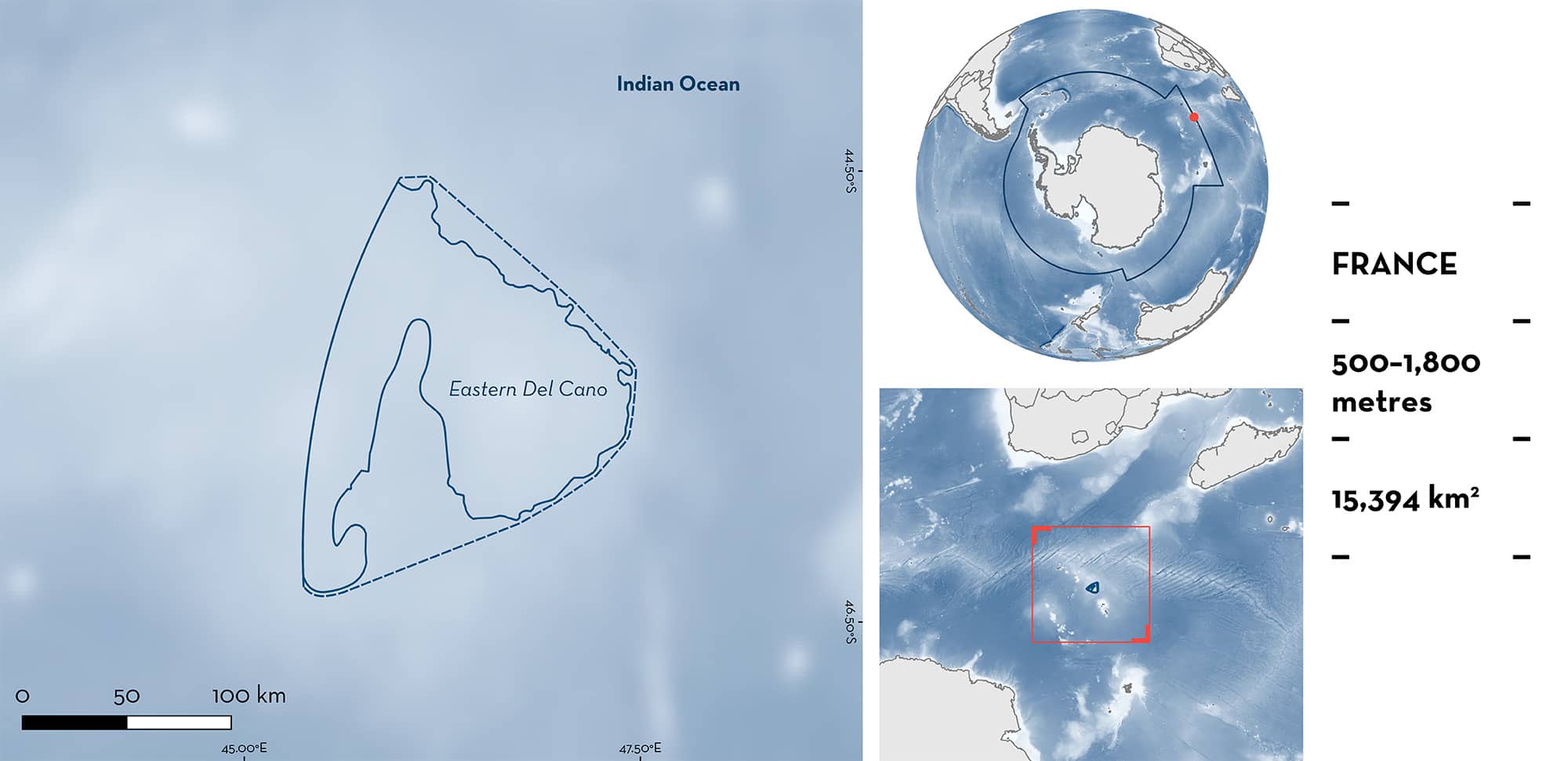
Eastern Del Cano is located in the French exclusive economic zone of the Crozet Archipelago, halfway between Antarctica and the southern tip of Madagascar. The area is characterised by the presence of abyssal hills and plains. It is influenced by the sub-Antarctic Front flowing eastward with elevated productivity. The area overlaps with the Prince Edward Islands, Del Cano Rise and Crozet Islands Ecologically or Biologically Significant Marine Area. Within this area, there are: range-restricted species (Whiteleg Skate Amblyraja taaf).
Download factsheet
Eastern Del Cano
DESCRIPTION OF HABITAT
Eastern Del Cano is located in the French exclusive economic zone (EEZ) of the Crozet Archipelago in the Terres australes et antarctiques françaises/French Southern and Antarctic Lands (TAAF). It sits on the Del Cano Rise which is found halfway between the southern tip of Madagascar and Enderby Land, Antarctica and extends from the South African EEZ of Prince Edward and Marion Islands to the French EEZ of Crozet Archipelago. Eastern Del Cano is characterised by the presence of abyssal hills and plains.
The area is broadly influenced by the eastward flowing Antarctic Circumpolar Current, with one of its main branches, the sub-Antarctic Front, also flowing eastward through the area (Bon et al. 2015). In addition, it is influenced by the Southern Ocean Subtropical Front that merges with the sub-Antarctic Front east of Kerguelen Islands (Graham & De Boer 2013). This is a dynamic area with eddies and fronts concentrating productivity (Graham & De Boer 2013; Bon et al. 2015).
This Important Shark and Ray Area is benthic and subsurface and is delineated from 500–1,800 m based on the depth range of Qualifying Species in the area.
CRITERION B
RANGE RESTRICTED
This area holds the regular presence of Whiteleg Skate as a resident range-restricted species. Whiteleg Skates are incidentally captured in the Patagonian Toothfish Dissostichus eleginoides longline fishery which operates year-round in this area but with a peak in effort during February and March (CCAMLR Secretariat 2023). Longlines are set between 500–1,800 m depth (Pruvost et al. 2015). Whiteleg Skates make up ~13% of the total incidental catch in the whole Crozet region (des Clers & Deleau 2021). Reported catch of the species from 2009–2022 in the Crozet region had a mean of 29.3 t per year, with a total of ~235,000 individuals released (CCAMLR Secretariat 2023). Locations available from individuals caught indicate a hotspot around Del Cano Rise, within the Crozet Islands EEZ (MNHN & TAAF 2020). Between 2007 and 2020, Whiteleg Skate abundance on Eastern Del Cano was the second largest found in the whole Crozet EEZ (average: 8 individuals/1,000 hooks, maximum: 55 individuals/1,000 hooks; MNHN & TAAF 2020; Martin et al. 2021). Although the species is also found at other sites like Ob and Lena Banks and Marion and Prince Edwards Banks, it is rarely captured in most sites outside the Crozet Islands EEZ and Elan Bank (Péron et al. 2019; des Clers & Deleau 2021; Faure 2023), highlighting the importance of this area for the Whiteleg Skate which is only found in the Southern Ocean and marginally in the southern Indian Ocean.
Download factsheet
SUBMIT A REQUEST
ISRA SPATIAL LAYER REQUEST
To make a request to download the ISRA Layer in either a GIS compatible Shapefile (.shp) or Google Earth compatible Keyhole Markup Language Zipped file (.kmz) please complete the following form. We will review your request and send the download details to you. We will endeavor to send you the requested files as soon as we can. However, please note that this is not an automated process, and before requests are responded to, they undergo internal review and authorization. As such, requests normally take 5–10 working days to process.
Should you have questions about the data or process, please do not hesitate to contact us.


