ISRA FACTSHEETS
ISRA FACTSHEETS
MEDITERRANEAN AND BLACK SEAS REGION
Eastern Gulf of Lion
Summary
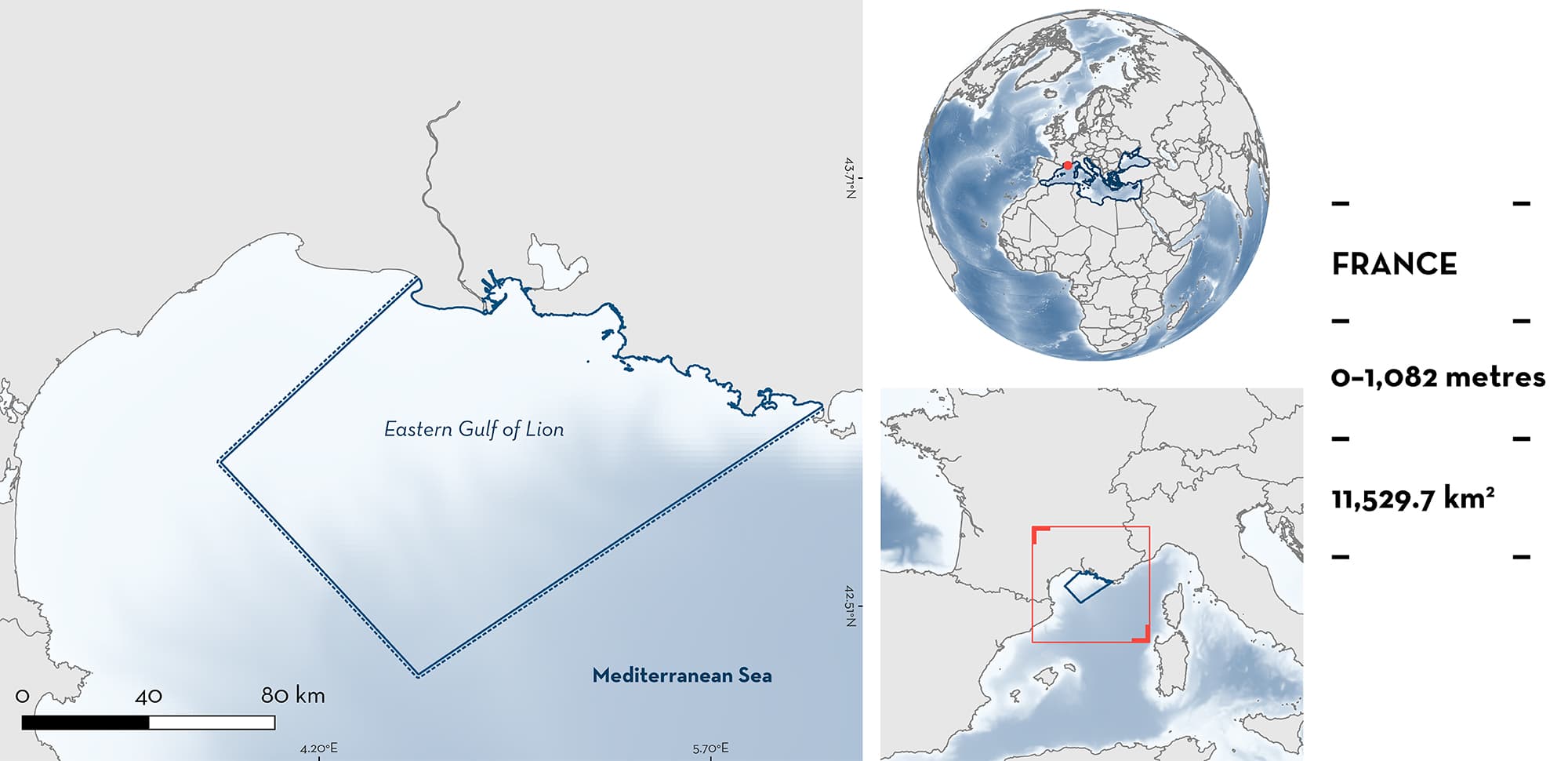
Eastern Gulf of Lion is in the northwestern Mediterranean Sea, bordering the coast of Provence in France. It is located in continental shelf edge, slope, and underwater canyon head zones. Surface waters are dominated by the oligotrophic Northern Mediterranean Current flowing westward. Within this area there are: threatened species and areas important for movement (Blue Shark Prionace glauca).
Download factsheet
Eastern Gulf of Lion
DESCRIPTION OF HABITAT
Eastern Gulf of Lion is located along, and offshore from, the coast of Provence in France. It overlaps the continental shelf edge, slope, and underwater canyon head zones of the Gulf of Lion. In this area, the oligotrophic Northern Mediterranean Current flows west and southward along the continental slope (Barrier et al. 2016). Occasionally, the current penetrates onto the shelf, influencing primary production in the area. These intrusions are mainly forced by easterly and north-westerly wind events (Barrier et al. 2016).
This Important Shark and Ray Area is pelagic and is delineated from surface waters (0 m) to 1,000 m based on the global depth range of the Qualifying Species and the bathymetry of the area.
CRITERION A
VULNERABILITY
The one Qualifying Species within the area is considered threatened with extinction according to the IUCN Red List of Threatened SpeciesTM. The Blue Shark is assessed as Near Threatened globally (Rigby et al. 2019) and Critically Endangered in the Mediterranean Sea (Sims et al. 2016).
CRITERION C
SUB-CRITERION C4 – MOVEMENT
Eastern Gulf of Lion is an important movement area for one shark species.
From July 2012 to May 2017, 39 Blue Sharks were tagged in three areas of the Western Mediterranean Basin with contrasting oceanographic features: (1) Gulf of Lion, (2) Ligurian Sea, and (3) Northern Alboran Sea near the Strait of Gibraltar (Poisson et al. submitted). Individuals were tagged with different satellite transmitters: three types of fin-mounted satellite tags (n = 32) and two types of pop-up satellite archival transmitting (PSAT) tags (n = 8). Animals tagged had a male : female sex ratio that greatly favoured females (1 : 2.9) and included 3 juvenile males (110–127 cm fork length [FL]), 6 juvenile females (119–130 cm FL), 3 large juvenile males (142–167 cm FL), 22 large juvenile females (131–178 cm FL), 4 adult males (185–295 cm FL), and 1 adult female (208 cm FL).
Kernel Utilisation Distribution (KUD) modelling was used to create 50%, 75%, and 95% KUDs for all track locations and by season. This model for all tracking locations identified the Eastern Gulf of Lion as a major hotspot (50% KUD based on all tracks) of Blue Shark movement. These densities were observed during summer (from June to August), with individuals overwintering in the Alboran and Tyrrhenian Sea (Poisson et al. submitted).
Download factsheet
SUBMIT A REQUEST
ISRA SPATIAL LAYER REQUEST
To make a request to download the ISRA Layer in either a GIS compatible Shapefile (.shp) or Google Earth compatible Keyhole Markup Language Zipped file (.kmz) please complete the following form. We will review your request and send the download details to you. We will endeavor to send you the requested files as soon as we can. However, please note that this is not an automated process, and before requests are responded to, they undergo internal review and authorization. As such, requests normally take 5–10 working days to process.
Should you have questions about the data or process, please do not hesitate to contact us.


