ISRA FACTSHEETS
ISRA FACTSHEETS
WESTERN INDIAN OCEAN REGION
El Ikhwa Islands
Summary
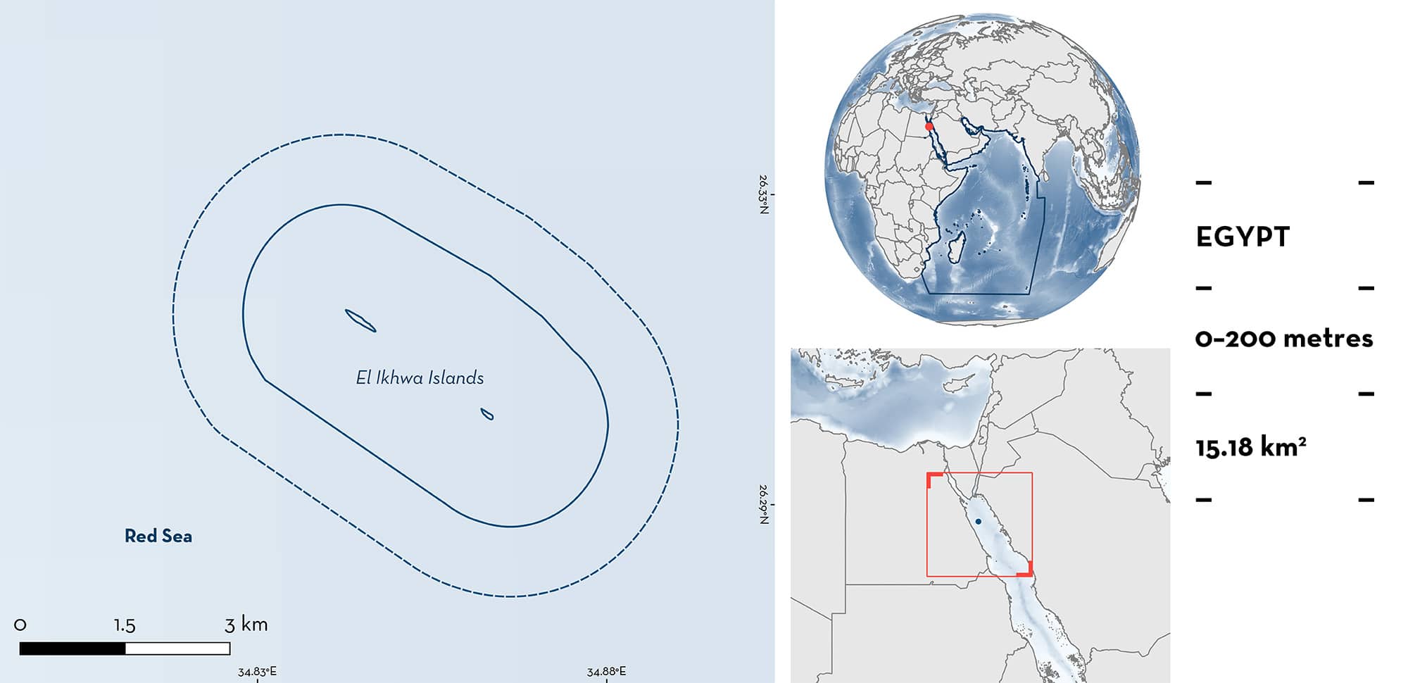
El Ikhwa Islands consists of two offshore islands (individually known as Big- and Little-Brother) found ~70 km off the Red Sea coast of Egypt. They are characterised by shallow flats, deep plateaus, reef walls, and open waters. El Ikhwa Islands is a marine protectorate. Within this area there are: threatened species and undefined aggregations (Oceanic Whitetip Shark Carcharhinus longimanus).
Download factsheet
El Ikhwa Islands
DESCRIPTION OF HABITAT
El Ikhwa Islands consists of a pair of offshore islands (named Big- and Little- Brother) surrounded by deep water. The islands are located ~67 km from shore, and ~1 km from each other (MDUP 2018). This area includes shallow flats, deep plateaus, reef walls, and open waters (E Bojanowski pers. obs. 2023).
El Ikhwa Islands is a marine protectorate, a preserve of the Egyptian Environmental Affairs Agency.
This Important Shark and Ray Area is pelagic and extends from inshore and surface waters (0 m) to 200 m based on the bathymetry of the area.
CRITERION A
VULNERABILITY
The one Qualifying Species within the area is considered threatened with extinction according to the IUCN Red List of Threatened SpeciesTM. The Oceanic Whitetip Shark is assessed as Critically Endangered (Rigby et al. 2019).
CRITERION C
SUB-CRITERION C5 – UNDEFINED AGGREGATIONS
El Ikhwa Islands is important for undefined aggregations of one shark species.
Oceanic Whitetip Sharks are regularly and predictably observed in aggregations of up to 25 individuals at El Ikhwa Islands (E Bojanowski unpubl. data 2023). This area has the second largest known aggregations of Oceanic Whitetip Sharks in the Red Sea (the largest area is also in Egyptian waters). The high abundances of Oceanic Whitetip Sharks at this Egyptian site have been documented for more than 15 years (2003–2019) (E Bojanowski unpubl. data 2023) with 469 individuals (163 males, 214 females, and 92 undefined sex) identified at El Ikhwa Islands. Encounter rates peak in October and November. Further information is required to define the nature and function of these aggregations.
Download factsheet
SUBMIT A REQUEST
ISRA SPATIAL LAYER REQUEST
To make a request to download the ISRA Layer in either a GIS compatible Shapefile (.shp) or Google Earth compatible Keyhole Markup Language Zipped file (.kmz) please complete the following form. We will review your request and send the download details to you. We will endeavor to send you the requested files as soon as we can. However, please note that this is not an automated process, and before requests are responded to, they undergo internal review and authorization. As such, requests normally take 5–10 working days to process.
Should you have questions about the data or process, please do not hesitate to contact us.


