ISRA FACTSHEETS
ISRA FACTSHEETS
MEDITERRANEAN AND BLACK SEAS REGION
El Toro – Sa Dragonera
Summary
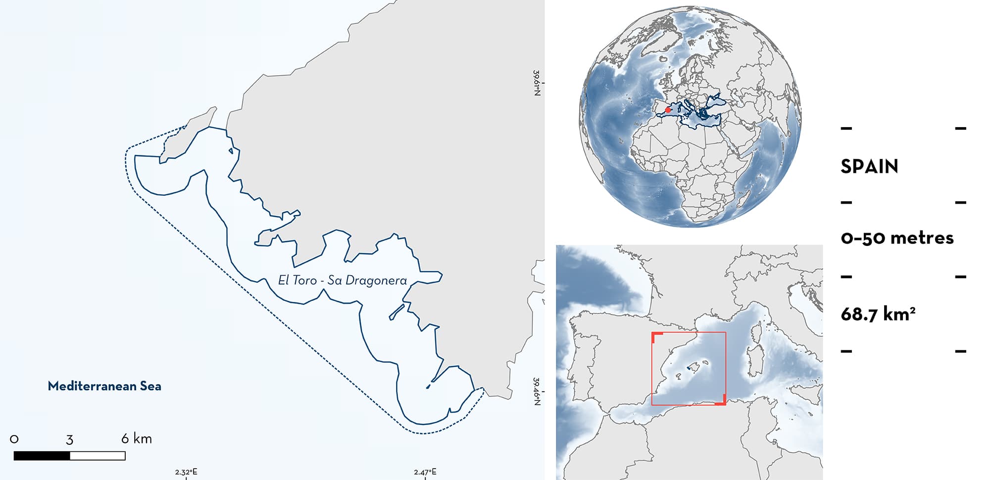
El Toro-Sa Dragonera is located on the southwest coast of Mallorca Island in the Balearic Sea off Spain, northwestern Mediterranean Sea. The area is characterised by coastal detrital substrates, with seagrass meadows and scattered coralligenous habitats. The area overlaps with two Ecologically and Biologically Significant Marine Areas and one Key Biodiversity Area, two marine reserves, and two Natura 2000 sites. Within the area there are: threatened species and undefined aggregations (Spiny Butterfly Ray Gymnura altavela).
Download factsheet
El Toro – Sa Dragonera
DESCRIPTION OF HABITAT
El Toro-Sa Dragonera is located on the southwest coast of Mallorca Island in the Balearic Sea off Spain between Sa Dragonera Island and Morro d’en Feliu (east Punta de El Toro). The Balearic Sea is a transitional area between two sub-basins: the Gulf of Lions, with cold, saline water, and the Alborán basin, with warmer and less saline Atlantic water (García et al. 1994). The Balearic Islands form a topographical barrier between the two, and their coasts are affected by one or other of these waters coming from the east, depending on the time of year and the mesoscale processes in adjacent areas (Pinot et al. 2002). The coastline in the area is characterised by cliffs and sandy bays, and a seafloor with a very gentle slope (Domínguez et al. 2013). The dominating habitat is coastal detrital substrates with seagrass meadows of Neptune Grass Posidonia oceanica in shallow and sheltered waters, and scattered coralligenous habitats (EEA 2021; Domínguez et al. 2013).
The area overlaps with two marine reserves: Illa del Toro, and the Illes Malgrats declared in 2004, and Freu de sa Dragonera declared in 2016 (GOIB 2023). The area also overlaps with two Natura 2000 sites: Espacio marino del poniente de Mallorca (ES0000519) included in the Birds Directive, and Sa Dragonera (ES0000221) included in both Birds and Habitats Directive (EEA 2021). The area also overlaps with two Ecologically and Biologically Significant Marine Areas (EBSA): the North-western Mediterranean Benthic Ecosystems EBSA (CBD 2023a), and the North-western Mediterranean Pelagic Ecosystems EBSA (CBD 2023b). It also overlaps with one Key Biodiversity Area (KBA), the Aguas del Poniente de Mallorca KBA (KBA 2023).
This Important Shark and Ray Area is benthopelagic and is delineated from 0 m to a depth of 50 m based on the distribution of the Qualifying Species in this area.
CRITERION A
VULNERABILITY
The one Qualifying Species within the area is considered threatened with extinction according to the IUCN Red List of Threatened SpeciesTM. The Spiny Butterfly Ray is assessed as Critically Endangered (Walls et al. 2016).
CRITERION C
SUB-CRITERION C5 – UNDEFINED AGGREGATIONS
El Toro-Sa Dragonera is an important area for undefined aggregations of one ray species. Spiny Butterfly Rays have been observed each year since 2017 regularly from the boreal late spring to mid-autumn (between May to October) at specific locations within the area between 0 and 50 m depth. Groups of up to nine individuals have been reported in an area of ~10,000 m2 (G. Morey pers. obs. 2023). These observations have been made by recreational divers who dive regularly in this area down to 40 m for the last five years.
Download factsheet
SUBMIT A REQUEST
ISRA SPATIAL LAYER REQUEST
To make a request to download the ISRA Layer in either a GIS compatible Shapefile (.shp) or Google Earth compatible Keyhole Markup Language Zipped file (.kmz) please complete the following form. We will review your request and send the download details to you. We will endeavor to send you the requested files as soon as we can. However, please note that this is not an automated process, and before requests are responded to, they undergo internal review and authorization. As such, requests normally take 5–10 working days to process.
Should you have questions about the data or process, please do not hesitate to contact us.


