ISRA FACTSHEETS
ISRA FACTSHEETS
POLAR WATERS REGION
Elan Bank
Summary
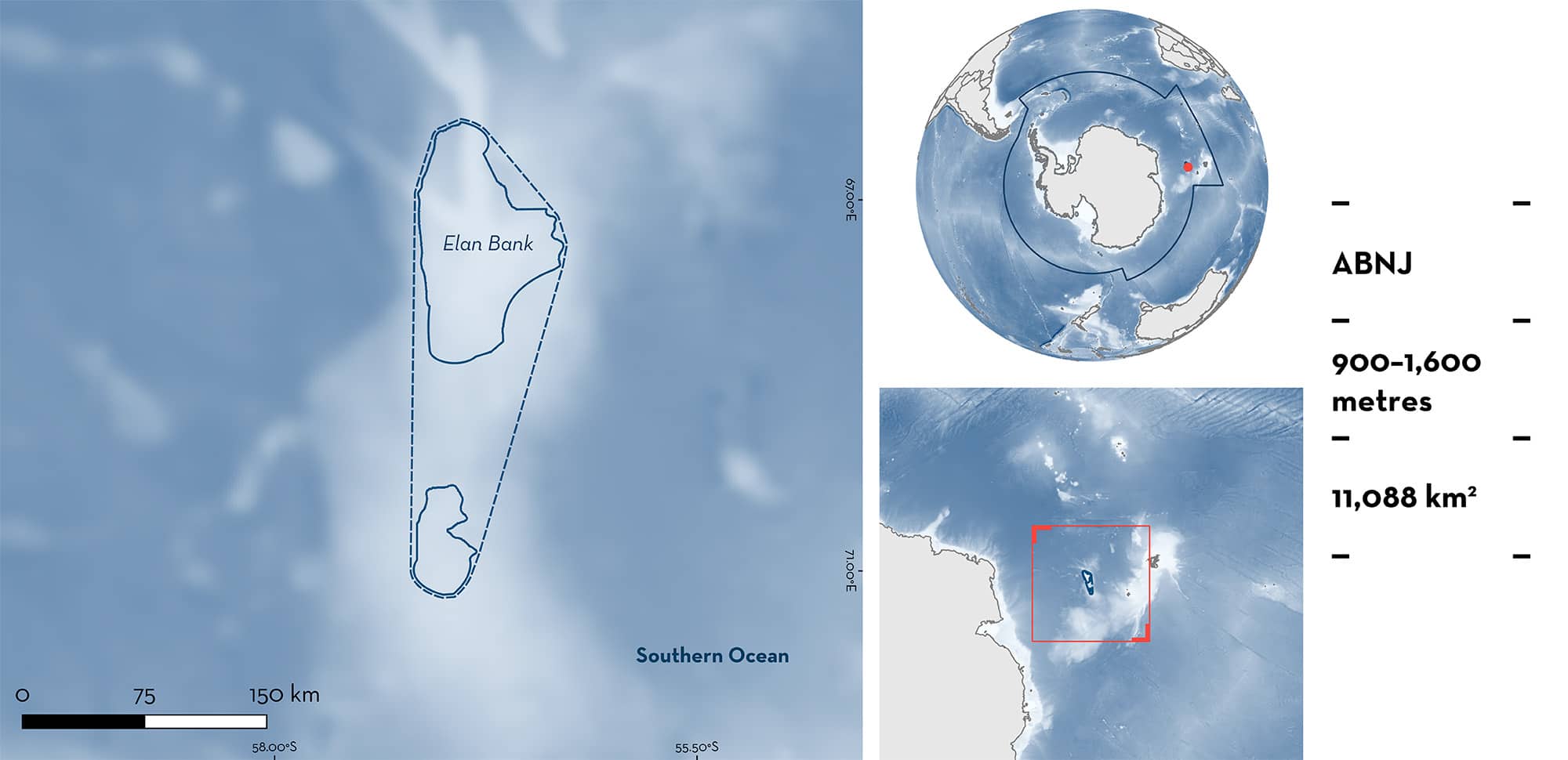
Elan Bank is located in the Southern Ocean ~1,200 km north of Mac Robertson Land in Antarctica and ~800 km south of Kerguelen Islands. The area sits within areas beyond national jurisdiction (ABNJ). This plateau rising to ~900 m depth is influenced by the Antarctic Circumpolar Current. Within this area there are: range-restricted species (Whiteleg Skate Amblyraja taaf).
Download factsheet
Elan Bank
DESCRIPTION OF HABITAT
Elan Bank is located in the Southern Ocean ~1,200 km north of Mac Robertson Land in Antarctica and ~800 km south of Kerguelen Islands. The area sits within areas beyond national jurisdiction (ABNJ). It is part of a microcontinental plateau that rises to ~900 m depth and has a steep slope in the south and a gentle slope in the north (Borissova et al. 2003; Majumdar & Bhattacharyya 2022).
The area lies just outside the maximum sea ice extent and is influenced by the eastward-flowing Antarctic Circumpolar Current (Mori et al. 2022).
This Important Shark and Ray Area is benthic and subsurface and is delineated from 900 to 1,600 m based on the bathymetry of the area and the depth range of Qualifying Species in the area.
CRITERION B
RANGE RESTRICTED
Elan Bank holds the regular presence of the Whiteleg Skate as a resident range-restricted species.
Whiteleg Skate bycatch was recorded in a research longline fishery for Patagonian Toothfish Dissostichus eleginoides operating in this area from 2008–2018 (no fishing in 2010 and 2016) that made a total of 421 hauls at ~5,000 hooks each, with an even ratio between auto-lines and trotlines as the capture method (Péron et al. 2019). Recorded data included numbers of individuals caught, catch-per-unit-effort (CPUE) expressed as biomass (kg) per 1,000 hooks, and biomass estimates based on average weight from a subsample in each haul (Captain’s data) or average weight of the species (observer data) (Péron et al. 2019). Data were analysed in 10 x 10 km cells (0.25° longitude x 0.125° latitude) and effort was not evenly distributed in the wider region.
In total, 22,700 Whiteleg Skates were caught according to the Captain’s data, with most (95%) captured on auto-lines. The species had a main peak in captures on the top of Elan Bank (~900–1,000 m deep) where most auto-lines were deployed and a second, smaller peak at ~1,400 m caught with trotlines. CPUE is high throughout the area but reached a maximum of 270 kg/1,000 hooks at relatively shallower depths in the east of the bank (Péron et al. 2019). This is higher than in any other area where the Whiteleg Skate is found, indicating that this is a main hotspot in the distribution of this species. Whiteleg Skates are only found around sub-Antarctic islands and banks south of the Indian Ocean, including Elan Bank, Crozet Islands, Ob and Lena Banks, southern Kerguelen Plateau, Marione Dufresne Bank, and Marion and Prince Edwards Islands (Pollom et al. 2020). However, the species is rarely captured in most sites outside Elan Banks and the Crozet Islands exclusive economic zone (des Clers & Deleau 2021; Faure et al. 2023), highlighting the importance of this area for this range-restricted species.
Download factsheet
SUBMIT A REQUEST
ISRA SPATIAL LAYER REQUEST
To make a request to download the ISRA Layer in either a GIS compatible Shapefile (.shp) or Google Earth compatible Keyhole Markup Language Zipped file (.kmz) please complete the following form. We will review your request and send the download details to you. We will endeavor to send you the requested files as soon as we can. However, please note that this is not an automated process, and before requests are responded to, they undergo internal review and authorization. As such, requests normally take 5–10 working days to process.
Should you have questions about the data or process, please do not hesitate to contact us.


