ISRA FACTSHEETS
ISRA FACTSHEETS
ASIA REGION
Fakfak
Summary
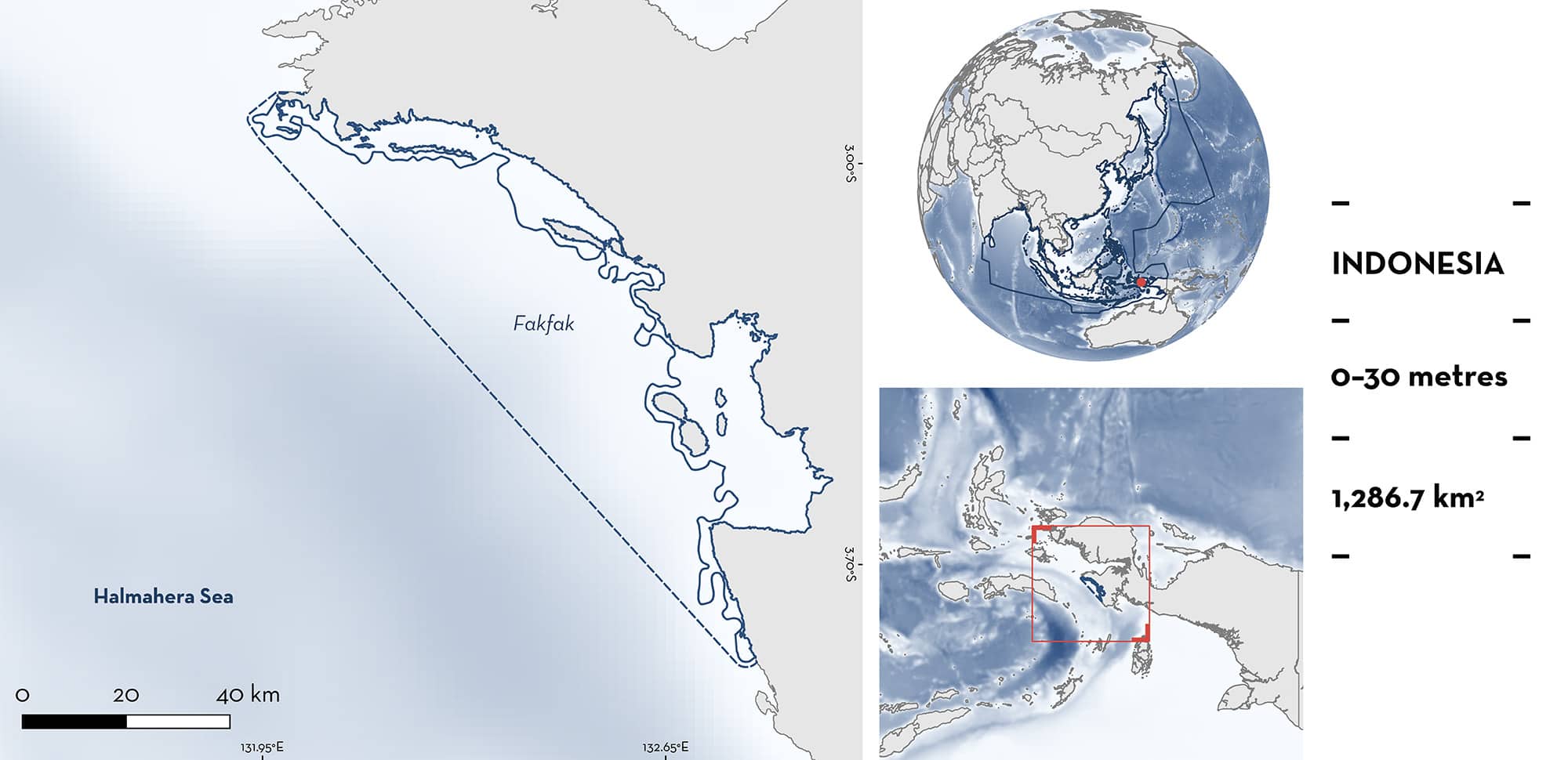
Fakfak is located in West Papua, eastern Indonesia. The area includes numerous small islands and is characterised by fringing coral reefs, seagrass beds, mangrove-lined bays, and offshore patch reefs. The area overlaps with three marine protected areas: KKPD Teluk Berau, KKPD Nusalasi, and Teluk Van Den Bosch. Within the area there are: threatened species and range-restricted species (Henry’s Epaulette Shark Hemiscyllium henryi).
Download factsheet
Fakfak
DESCRIPTION OF HABITAT
Fakfak is located in West Papua province, eastern Indonesia. This area sits within the Coral Triangle and the Bird’s Head Seascape which are known to have exceptionally high marine biodiversity (Veron et al. 2009; Mangubhai et al. 2012). The area includes a rugged coastline with numerous small islands, fringing coral reefs, seagrass beds, mangrove-lined bays, and offshore patch reefs (Allen & Erdmann 2008).
The area is mainly influenced by monsoon seasons. The northwest monsoon occurring from November to April is characterised by warm sea surface temperatures. In contrast, the southeast monsoon (May–October) is characterised by cooler temperatures and strong and continuous southeast winds that produce upwelling, resulting in an increase of primary productivity in coastal areas (Mangubhai et al. 2012).
The area overlaps with three marine protected areas: KKPD Teluk Berau, KKPD Nusalasi, and Teluk Van Den Bosch marine protected areas.
This Important Shark and Ray Area is benthic and is delineated from inshore and surface waters (0 m) to 30 m based on the depth range of the Qualifying Species in the area.
CRITERION A
VULNERABILITY
One Qualifying Species considered threatened with extinction according to the IUCN Red List of Threatened Species regularly occur in the area. This is the Vulnerable Henry’s Epaulette Shark (VanderWright et al. 2021).
CRITERION B
RANGE RESTRICTED
This area holds the regular presence of Henry’s Epaulette Shark as a resident range-restricted species. This species occurs year-round in the area and is regularly encountered during diving activities, notably dive liveaboards visiting the area. It has been recorded year-round from 17 dive sites in the area since 2008 and from individuals sampled for taxonomic studies and during underwater visual census (Allen et al. 2016; Dudgeon et al. 2020; MV Erdmann unpubl. data. 2023). This species is endemic to the Kaimana and Fakfak coasts of West Papua (Allen et al. 2016, Dudgeon et al. 2020) with both sites being where the largest number of individuals have been recorded. Henry’s Epaulette Shark has an extremely limited Area of Occupancy (AOO) of <1,500 km2, most of which is distributed in the area (Vanderwright et al. 2021).
Download factsheet
SUBMIT A REQUEST
ISRA SPATIAL LAYER REQUEST
To make a request to download the ISRA Layer in either a GIS compatible Shapefile (.shp) or Google Earth compatible Keyhole Markup Language Zipped file (.kmz) please complete the following form. We will review your request and send the download details to you. We will endeavor to send you the requested files as soon as we can. However, please note that this is not an automated process, and before requests are responded to, they undergo internal review and authorization. As such, requests normally take 5–10 working days to process.
Should you have questions about the data or process, please do not hesitate to contact us.


