ISRA FACTSHEETS
ISRA FACTSHEETS
WESTERN INDIAN OCEAN REGION
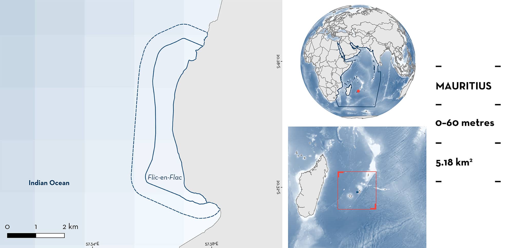
Flic-en-Flac
Summary
Flic-en-Flac is located on the western coast of Mauritius. The area is characterised by a long white sandy beach with seven narrow passes and a coral reef barrier. It is under the influence of the northwest and southeast monsoon seasons. Within this area, there are: threatened species and undefined aggregations (Spotted Eagle Ray Aetobatus ocellatus).
Download factsheet
Flic-en-Flac
DESCRIPTION OF HABITAT
Flic-en-Flac is located on the western coast of Mauritius. It has one of the longest white sandy beaches of the island. The lagoon of Flic-en-Flac measures ~2 km2 with seven narrow passes and is protected by a coral reef barrier (Doorga et al. 2021). This region experiences two major seasons, namely the southeast monsoon (April to November) characterised by strong persistent southeasterly winds, lower rainfall and lower temperatures, and the northwest monsoon (December to March) dominated by light northwesterly winds, higher rainfall, and warmer temperatures.
Flic-en-Flac is sheltered from the prevailing southeast trade winds (Doorga et al. 2018). The sediments that make up the lagoon and its beach are of carbonate origin and made up of coral fragments, crustaceans, and molluscan shells among others.
This Important Shark and Ray Area is benthopelagic and is delineated from surface waters (0 m) to 60 m based on the global depth range of the Qualifying Species.
CRITERION A
VULNERABILITY
The one Qualifying Species within the area is considered threatened with extinction according to the IUCN Red List of Threatened SpeciesTM. The Spotted Eagle Ray is assessed as Endangered (Finucci et al. submitted).
CRITERION C
SUB-CRITERION C5 – UNDEFINED AGGREGATIONS
Flic-en-Flac is an important area for undefined aggregations of one ray species.
Spotted Eagle Ray aggregations of up to 43 individuals are observed predictably every year during the northwest monsoon (from October to February). Based on data collected on 45 dives from October 2021 to August 2023, these aggregations were observed every year, on seven occasions in total. The number of individuals in the first six aggregations were 5, 6, 10, 20, 30, and 40 (Mascarane Archipelago Elasmobranch Observatory unpubl. data 2023). In September 2023, an aggregation of 43 eagle rays was observed in the area (E Crochelet pers. obs. 2023). Most of these individuals were observed in mid-water, at a coral reef site named Big Rock. The individuals were relatively stationary, lying in the current. Further information is required to understand the nature and function of these aggregations.
Download factsheet
SUBMIT A REQUEST
ISRA SPATIAL LAYER REQUEST
To make a request to download the ISRA Layer in either a GIS compatible Shapefile (.shp) or Google Earth compatible Keyhole Markup Language Zipped file (.kmz) please complete the following form. We will review your request and send the download details to you. We will endeavor to send you the requested files as soon as we can. However, please note that this is not an automated process, and before requests are responded to, they undergo internal review and authorization. As such, requests normally take 5–10 working days to process.
Should you have questions about the data or process, please do not hesitate to contact us.


