ISRA FACTSHEETS
ISRA FACTSHEETS
WESTERN INDIAN OCEAN REGION
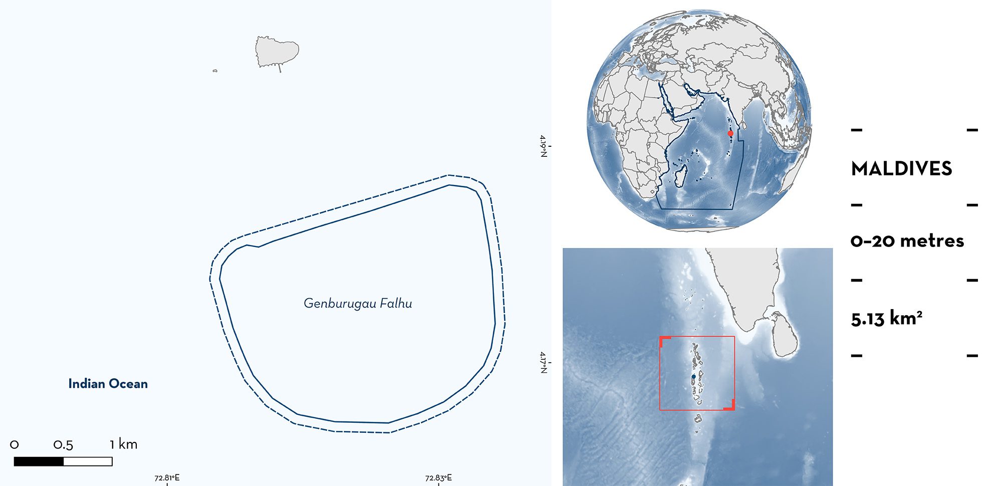
Genburugau Falhu
Summary
Genburugau Falhu is located in northern Ari Atoll, Maldives. This large lagoon area has an inner basin that reaches a depth of ~15 m. It is characterised by a benthic cover of fine sands and scattered coral blocks, enclosed by a shallow barrier reef 2–10 m deep. Within the area there are: threatened species, reproductive areas, and feeding areas (Reef Manta Ray Mobula alfredi).
Download factsheet
Genburugau Falhu
DESCRIPTION OF HABITAT
Genburugau Falhu is a large lagoon situated in northern Ari Atoll, Maldives. This area is ~2.6 km in length and ~2 km wide. The inner basin reaches a depth of ~15 m with a benthic cover of fine sands and scattered coral blocks and is enclosed by a shallow barrier reef 2–10 m deep. The sea surface temperatures fluctuate between 28–30°C. The area is positioned within the northernmost sector of Ari Atoll which is exposed along the northeastern atoll boundary where a barrier reef is either lacking or less pronounced. Daily tidal currents bring zooplankton into the atoll lagoons across the reef flats and via openings along the outer rim of the atoll. The location and geomorphology of this shallow lagoon, coupled with the tidal movements and Langmuir Circulation, acts to entrain and concentrate the zooplankton, especially during the southwest monsoon (May–November) (Hedley et al. 2018; Moloney et al. 2019; Harris et al. 2020; Harris & Stevens 2021).
This Important Shark and Ray Area is benthopelagic and is delineated from the inshore surface waters (0 m) to 20 m based on the bathymetry of the area.
CRITERION A
VULNERABILITY
One Qualifying Species within the area is considered threatened with extinction according to the IUCN Red List of Threatened SpeciesTM. The Reef Manta Ray is assessed as Vulnerable (Marshall et al. 2022).
CRITERION C
SUB-CRITERION C1 – REPRODUCTIVE AREAS
Genburugau Falhu is an important reproductive area for one ray species.
Neonate, young-of-the-year (YOY), and juvenile Reef Manta Rays spend time during early life-stages in this area. There were 147 snorkelling surveys conducted in this area between 2007–2022 (this equates to 3% of all surveys conducted in Ari Atoll; IDtheManta unpubl. data 2022). Overall, 74 YOY were identified in Ari Atoll, and 26% of these individuals were first recorded in Genburugau Falhu. Maturity estimates for neonates and YOY are based on an estimated size between 150–190 cm disc width (DW); length of tail; light ventral/spot pattern pigmentation; creases along pectorals; and often a light pink skin pigmentation on first sighting (Kashiwagi 2014; Stevens 2016; IDtheManta unpubl. data 2022). Size-at-birth for this species is 130–150 cm DW (Last et al. 2016). Aggregations occur regularly and predictably, peaking during the months of June and December. Moreover, theories propose that sheltered, shallow reef lagoons, like Genburuagau Falhu, are typically used as nursery sites by mobulid rays, as they provide calm conditions, safety from large predators, reliable food sources, and opportunities for interaction with conspecifics (McCauley et al. 2014; Heupel et al. 2019; Setyawan et al. 2022).
This area meets the criteria of a nursery area for Reef Manta Rays (as per Heupel et al. 2007), in that (1) the majority of sightings are of immature individuals (65% of the Genburugau Falhu population), (2) immature individuals revisit the area (53% of immature individuals have been sighted more than once in the area), and (3) sightings of these individuals occur across multiple years (89% of YOY first sighted at here returned to the area in subsequent years as juveniles or adults) (IDtheManta unpubl.
data 2022). There is limited monitoring of this area (only 3% of surveys from across Ari Atoll), however, 10% of the Reef Manta Rays recorded throughout North and South Ari Atoll were observed at Gengurugau Falhu.
CRITERION C
SUB-CRITERION C2 – FEEDING AREAS
Genburugau Falhu is an important feeding area for one ray species.
Reef Manta Rays aggregate regularly and predictably in the area when zooplankton is concentrated in the shallow lagoon (IDtheManta unpubl. data 2022), providing an ideal environment for planktivorous megafauna in the area (Harris et al. 2020; Harris et al. 2021). There were 147 snorkelling surveys conducted in this area between 2007–2022, and Reef Manta Rays were observed feeding during 136 of these surveys (92% of surveys). An average of four actively feeding Reef Manta Rays were observed during each aggregation (standard deviation = 2.3; maximum = 11 individuals), either individually or in organised feeding chains (IDtheManta unpubl. data 2022). Foraging in this area is most pronounced during the southwest monsoon (May–December) when aggregations are more abundant due to the accumulation of zooplankton in the area resulting from the combination of monsoonal conditions, tidal movements, and Langmuir Circulation (Harris et al. 2020).
Download factsheet
SUBMIT A REQUEST
ISRA SPATIAL LAYER REQUEST
To make a request to download the ISRA Layer in either a GIS compatible Shapefile (.shp) or Google Earth compatible Keyhole Markup Language Zipped file (.kmz) please complete the following form. We will review your request and send the download details to you. We will endeavor to send you the requested files as soon as we can. However, please note that this is not an automated process, and before requests are responded to, they undergo internal review and authorization. As such, requests normally take 5–10 working days to process.
Should you have questions about the data or process, please do not hesitate to contact us.


