ISRA FACTSHEETS
ISRA FACTSHEETS
NEW ZEALAND & PACIFIC ISLANDS REGION
Henderson Island
Summary
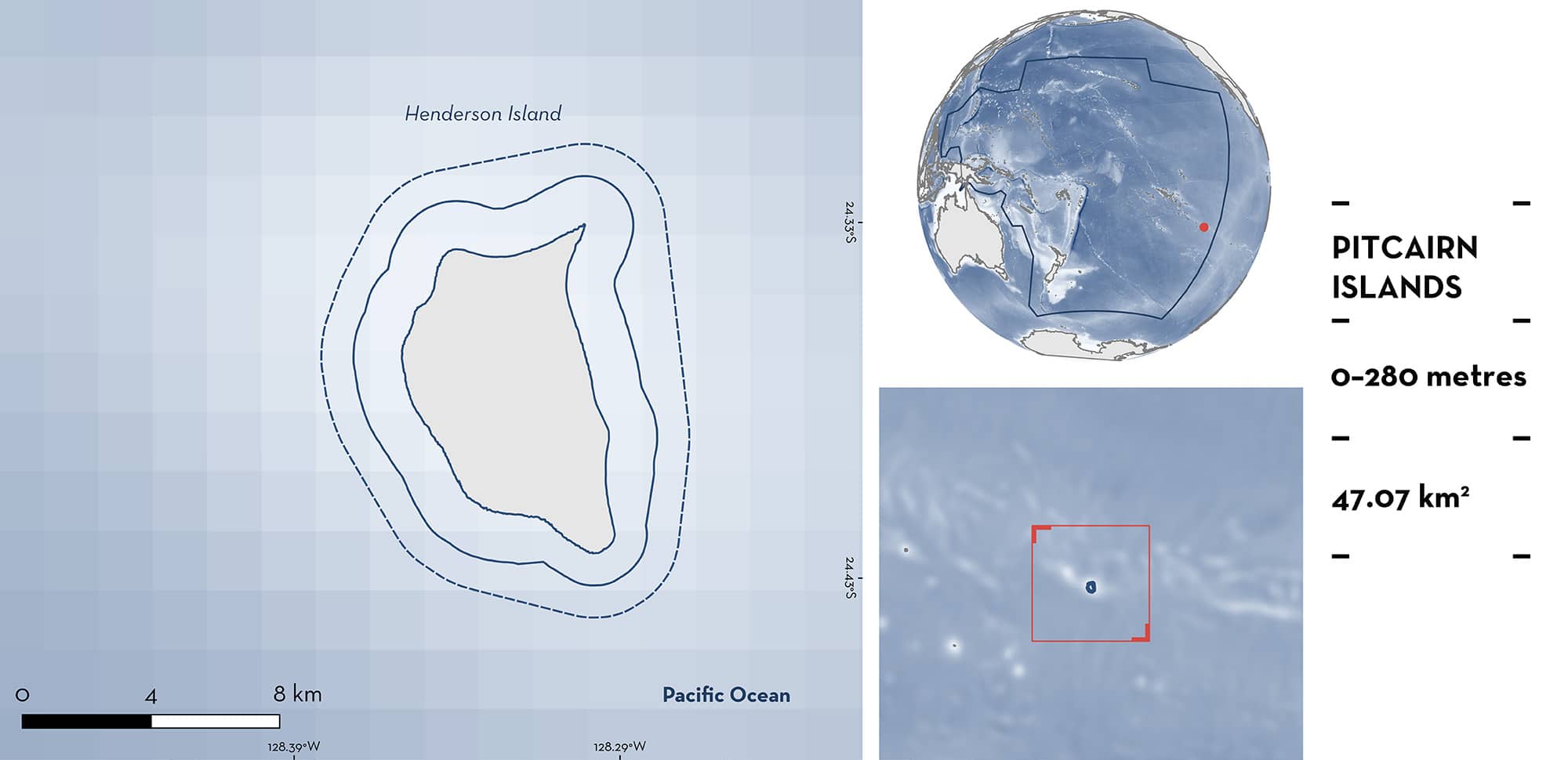
Henderson Island is part of the Pitcairn Islands, a British Overseas Territory in the South Pacific Ocean. This uninhabited and remote area is characterised by a forereef that averages 50–100 m in width. It has a gentle slope, gradually descending to depths of 30–40 m, followed by a steeper drop-off. The area overlaps with the Pitcairn Islands Marine Protected Area. Within this area there are: threatened species and undefined aggregations (Grey Reef Shark Carcharhinus amblyrhynchos).
Download factsheet
Henderson Island
DESCRIPTION OF HABITAT
Henderson Island is part of the Pitcairn Islands, a British Overseas Territory located in the South Pacific. This area is a remote uninhabited island, located ~ 2,000 km southeast of Tahiti and 1,900 km west of Easter Island. The Pitcairn Islands (i.e. Pitcairn, Henderson, Ducie, and Oeno Islands) are the only emergent parts of ancient volcanoes that rose from the seafloor between 16–0.9 million years ago (Ozal & Cazenave 1985). Geologically, they are an extension of the Tuamotu and Gambier Islands (Woodhead & Devey 1993).
Henderson Island was formerly an atoll, but when the new volcanic island of Pitcairn arose 0.8–0.9 million years ago, it caused an uplift of the crust which elevated Henderson Island 33 m above sea level (Blake 1995). The island is surrounded by 30 m high vertical cliffs, which continue underwater to depths between 10–20 m. On the north, east, and northwest sides the cliffs are footed by sandy beaches. There is a fringing reef averaging 50–100 m in width around most of the island except in the south and west (Irving & Dawson 2012). In three places (North Beach, North-West Beach, and East Beach), the reef extends up to 200 m offshore (Irving & Dawson 2012). The forereef at Henderson Island has a gentle slope, gradually descending to depths of 30–40 m, followed by a steeper drop-off. The reef is formed by a spur-and-groove system, with extensive reef platforms, occasionally interspersed by sandy patches. This area has a coral cover of 23% with minimal algae growth (Sala et al. 2012). Corals of the genus Pocillopora are the most common corals beyond 10 m depths (Irving & Dawson 2012). The drop-off below 40 m is characterised by coral rubble (Irving 1995; Sala et al. 2012). Prevailing winds and currents are dominantly from the east (Irving & Dawson 2012).
This area lies within the Pitcairn Islands Marine Reserve.
This Important Shark and Ray Area is benthopelagic and is delineated from inshore and surface waters (0 m) to 280 m based on the global depth range of the Qualifying Species.
CRITERION A
VULNERABILITY
One Qualifying Species is considered threatened with extinction according to the IUCN Red List of Threatened Species regularly occurs in the area. This is the Endangered Grey Reef Shark (Simpfendorfer et al. 2020).
CRITERION C
SUB-CRITERION C5 – UNDEFINED AGGREGATIONS
Henderson Island is an important area for undefined aggregations of one shark species.
Grey Reef Shark aggregations are regularly observed in this area; documented by underwater visual censuses and baited remote underwater video station (BRUVS) surveys (Sala et al. 2012; Friedlander et al. 2014; Pitcairn Government unpubl. data 2021, 2023).
In March–April 2012, 26 underwater visual censuses were carried out at 10 and 20 m depths, at 13 sites in the area (Sala et al. 2012). During each survey, divers counted all sharks encountered along three fixed-length (25 m) corridor transects. In September 2021, 21 BRUVS were deployed in this area at depths between 8–50 m on the seabed, and in February 2023, 21 BRUVS were deployed in this area (Pitcairn Government unpubl. data 2021, 2023). The maximum number of each taxon in a single video frame (MaxN) was recorded.
Top predators accounted for 44% of the total biomass at Henderson Island with Grey Reef Sharks comprising more than 76% of top predator biomass (Sala et al. 2012). Sharks were observed at 16 of 27 (59%) survey locations (Sala et al. 2012). In 2012, underwater visual censuses recorded an average of 7.7 (SD = ± 50) Grey Reef Sharks per 0.01 km2. In two surveys, 200 and 400 individuals per 0.01 km2 were recorded (Sala et al. 2012).
In 2021, Grey Reef Sharks were observed in 29% of BRUVS surveys, with a MaxN of two individuals and an average of 0.3 per survey (SD = ± 0.6) (Pitcairn Government unpubl. data 2021). Grey Reef Sharks (n = 6) measured an average of 147 cm (SD = ± 10 cm) total length (TL), with 100% adults (133–157 cm TL) (Pitcairn Government unpubl. data 2021; Ebert et al. 2021). In 2023, Grey Reef Sharks were observed in 43% of BRUVS surveys, with a maximum MaxN of six individuals and an average of 0.8 per survey (SD = ± 1.4) (Pitcairn Government unpubl. data 2023). Grey Reef Sharks (n = 5) measured an average of 146 cm (SD = ± 27 cm) TL, with 80% adults (146–166 cm TL) and 20% juveniles (94 cm TL) (Ebert et al. 2021; Pitcairn Government unpubl. data 2023).
Download factsheet
SUBMIT A REQUEST
ISRA SPATIAL LAYER REQUEST
To make a request to download the ISRA Layer in either a GIS compatible Shapefile (.shp) or Google Earth compatible Keyhole Markup Language Zipped file (.kmz) please complete the following form. We will review your request and send the download details to you. We will endeavor to send you the requested files as soon as we can. However, please note that this is not an automated process, and before requests are responded to, they undergo internal review and authorization. As such, requests normally take 5–10 working days to process.
Should you have questions about the data or process, please do not hesitate to contact us.


