ISRA FACTSHEETS
ISRA FACTSHEETS
ASIA REGION
Hin Muang & Hin Daeng
Summary
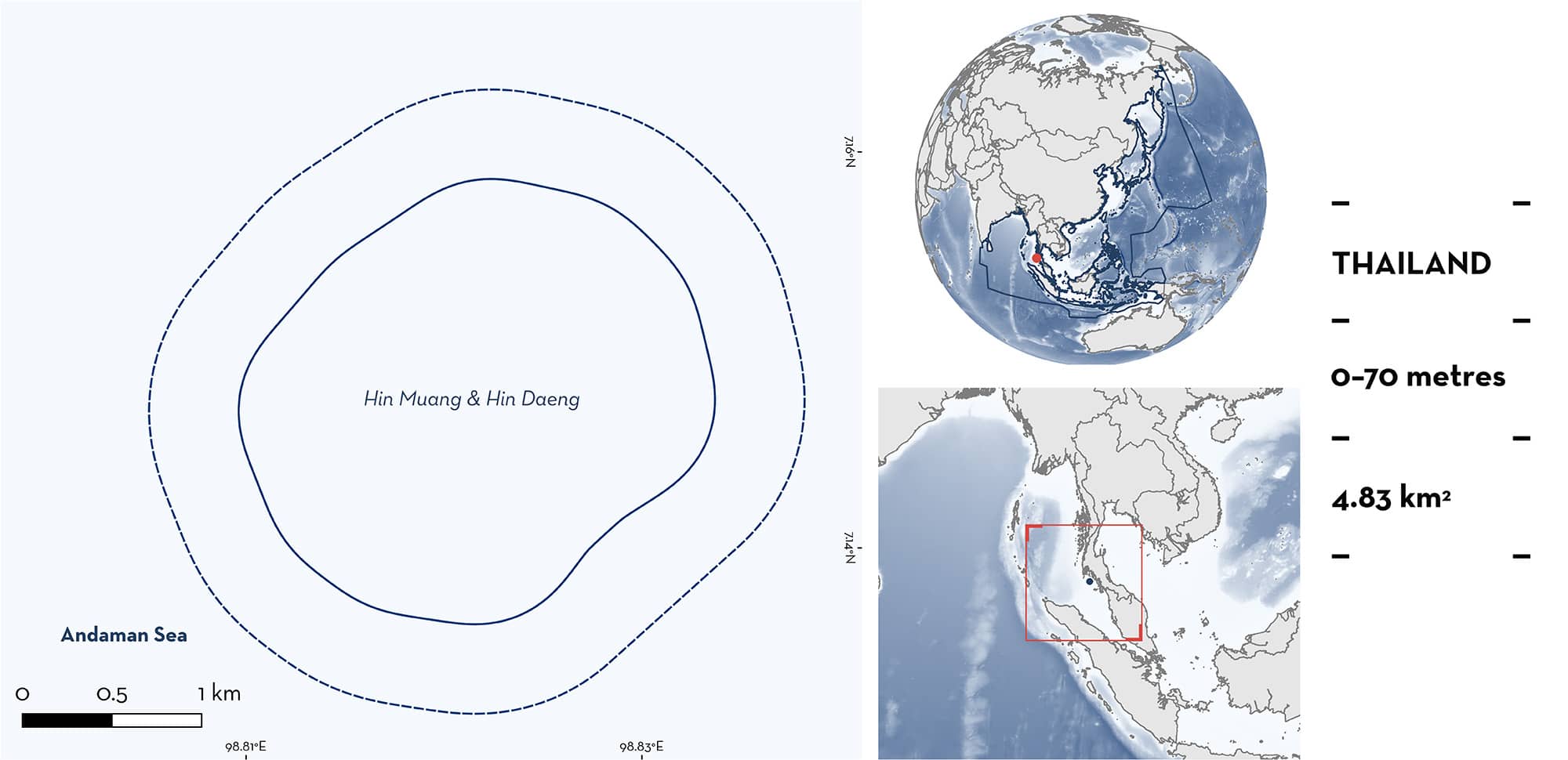
Hin Muang & Hin Daeng is located on the southern Andaman coast of Thailand, in the Bay of Bengal. It comprises two limestone seamounts located ~200 m from one another. The seamounts are characterised by soft coral communities of the genus Dendronephthya. The area is part of the Mu Koh Lanta National Park and the Lower Western Coastal Sea Ecologically or Biologically Significant Marine Area. Within this area there are: threatened species and undefined aggregations (Oceanic Manta Ray Mobula birostris).
Download factsheet
Hin Muang & Hin Daeng
DESCRIPTION OF HABITAT
Hin Muang & Hin Daeng is located on the southern Andaman coast of Thailand, in the Bay of Bengal. The area includes the adjacent limestone seamounts of Hin Muang and Hin Daeng. In Thai, Hin Muang means ‘purple rock’ and Hin Daeng means ‘red rock’, corresponding to the predominant soft coral communities on the respective seamounts. The seamounts extend to a depth of 70 m. Hin Muang comes within 8 m of the water’s surface and is ~20 m wide by 200 m long. Hin Daeng is circular, slightly breaks the surface of the water, and is ~200 m east of Hin Muang. The area is subject to the large amplitude internal waves of the Andaman Sea, which facilitate mixing of nutrient-rich deeper waters and plankton blooms (Alpers & Vlasenko 2018).
In the Andaman Sea, the circulation near the coasts and islands is mainly driven by equatorial forces. These significantly induce changes in water circulation during the monsoon-transition periods (April to May and October to November) and can result in upwelling events (Chatterjee et al. 2017).
The area is part of the Mu Koh Lanta National Park (WPAD 2023) and sits within the Lower Western Coastal Sea Ecologically or Biologically Significant Marine Area (EBSA; CBD 2024).
This Important Shark and Ray Area is benthopelagic and is delineated from inshore and surface waters (0 m) to 70 m based on the bathymetry of the area.
CRITERION A
VULNERABILITY
One Qualifying Species within the area is considered threatened with extinction according to the IUCN Red List of Threatened Species. The Oceanic Manta Ray is assessed as Endangered (Marshall et al. 2022).
CRITERION C
SUB-CRITERION C5 – UNDEFINED AGGREGATIONS
Hin Muang & Hin Daeng is an important area for undefined aggregations of one ray species.
Since 2006, 141 encounters with 118 individual Oceanic Manta Rays have been recorded through citizen science submissions (MantaMatcher.org 2023). This accounts for 25% of Oceanic Manta Ray sightings in Thailand. As part of the Mu Koh Lanta National Park, these sites are only accessible to divers from October through May. Oceanic Manta Rays are seen in all these months, but sightings peak between February and April, with this period accounting for 68% of sighting records (MantaMatcher.org 2023). Oceanic Manta Rays have been observed in the area every year from 2013–2019 (MantaMatcher.org 2023).
This area is likely an important socialisation hub, with a mean group size of four individuals, and up to 19 individuals identified in a single day together. Of the 35% of Oceanic Manta Ray encounters with a recorded age class, 88% were mature based on clasper development, mating scars, or visible pregnancy (as defined by Marshall & Bennett 2010; MantaMatcher.org 2023). Pregnant Oceanic Manta Rays have been observed twice in the area (MantaMatcher.org 2023). Hin Muang & Hin Daeng has several cleaning stations where small cleaner fish remove dead tissue and parasites from other fish. Oceanic Manta Rays have been observed cleaning in this area, but only on occasions when there are few divers (A Flam pers. obs. 2023; M Larsson pers. comm. 2023).
In addition, between 2006 and 2020, there were 111 observations of Oceanic Manta Rays from the Department of Marine and Coastal Resources (DMCR) database within the Hin Muang & Hin Daeng area. Thirty of these observations (27%) were of more than one individual, with up to eight individuals on a single day (DMCR unpubl. data 2024). A heatmap of Oceanic Manta Ray sightings produced by DMCR also supports Hin Muang & Hin Daeng as one of the areas of highest Oceanic Manta Ray sightings in Thailand (MCRRDI 2021). Further information is needed to understand the nature and function of these aggregations.
Download factsheet
SUBMIT A REQUEST
ISRA SPATIAL LAYER REQUEST
To make a request to download the ISRA Layer in either a GIS compatible Shapefile (.shp) or Google Earth compatible Keyhole Markup Language Zipped file (.kmz) please complete the following form. We will review your request and send the download details to you. We will endeavor to send you the requested files as soon as we can. However, please note that this is not an automated process, and before requests are responded to, they undergo internal review and authorization. As such, requests normally take 5–10 working days to process.
Should you have questions about the data or process, please do not hesitate to contact us.


