ISRA FACTSHEETS
ISRA FACTSHEETS
MEDITERRANEAN AND BLACK SEAS REGION
Izmir Bay
Summary
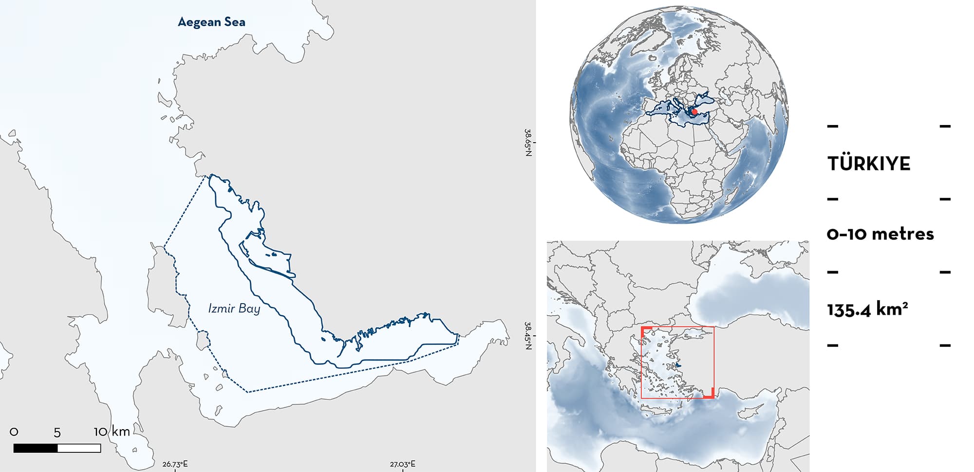
Izmir Bay is located in the eastern Aegean Sea in Türkiye. It is characterised by muddy and sandy substrates and includes four lagoons (Kırdeniz, Homa, Cilazmak, and Tas) that are located near the Gediz River delta. The area overlaps with a Wildlife Protected Area, the Central Aegean Sea Ecologically or Biologically Significant Marine Area, four Key Biodiversity Areas, and one Ramsar site. Within the area there are: threatened species; reproductive areas; and feeding areas (Blackchin Guitarfish Glaucostegus cemiculus).
Download factsheet
Izmir Bay
DESCRIPTION OF HABITAT
Izmir Bay is located on the western coast of the Anatolian peninsula, Türkiye and is connected to the eastern Aegean Sea. The mouth of the bay is ~20 km wide and 40 km long, while the inner bay is ~5–7 km wide and 24 km long. Sea surface temperature and salinity are influenced by the discharges of the Gediz River, the inputs of the Aegean Sea, and the strong evaporation during the boreal summer (Sayin 2003). This area is characterised by sandy and muddy substrates. Maximum sea surface temperatures occur in the boreal summer (~24°C) while minimum temperatures occur in winter (~16°C; Pulat & Özel 2003; Sayin 2023). Within the bay, there are four lagoons that are important habitats: Homa (the largest), Kırdeniz, Cilazmak, and Tas (WWF 2008). Homa Lagoon has two water entrances. The depth of this lagoon is 0.2–1.5 m (Yurur 2008). These lagoons are not characterised by drastic seasonal changes in sea surface temperature and salinity as seen in other parts of the area and constant conditions are observed year-round (Sayin 2003).
Izmir Bay overlaps with the Central Aegean Sea Ecologically or Biologically Significant Marine Area (CBD 2023). It also overlaps with four Key Biodiversity Areas: Gediz Delta, Çiçek Islands, Karaburun and İldir Strait Islands, and Kizildag Izmir (KBA 2023a, 2023b, 2023c, 2023d). In addition, the lagoons overlap with a Ramsar Site, Gediz Delta (Ramsar 2023). These lagoons are also a Wildlife Protected Area and a National Bird Protection Area (WWF 2008).
This Important Shark and Ray Area is delineated from surface waters (0 m) to a depth of 10 m, based on the bathymetry of the area.
CRITERION A
VULNERABILITY
The one Qualifying Species within the area is considered threatened with extinction according to the IUCN Red List of Threatened SpeciesTM. The Blackchin Guitarfish is assessed as Critically Endangered (Kyne & Jabado 2019).
CRITERION C
SUB-CRITERION C1 – REPRODUCTIVE AREAS
Izmir Bay is an important reproductive area for one ray species.
Within the bay, the lagoon systems provide a suitable habitat for neonate and juvenile Blackchin Guitarfish. Monthly sampling conducted between 2015–2016 recorded 122 individuals (Bengil 2018; Bengil et al. 2018, 2020). From those individuals, 10 had sizes (30–40 cm total length [TL]) close to the reported size-at-birth (∼34 cm TL; Last et al. 2016). In addition, most individuals (∼97) were young-of-the-year (<70 cm TL). The smallest individuals were reported in the summer and early fall and an increase in total length was observed throughout the months. Neonates and juveniles have been reported up to 2018, confirming the regular presence of these life-stages (Bengil 2020). This area also supports Blackchin Guitarfish at other life stages, including large, mature males and females in central parts of the bay (Akyol & Capapé 2014).
CRITERION C
SUB-CRITERION C2 – FEEDING AREAS
Izmir Bay is an important feeding area for Blackchin Guitarfish. Stomach content analysis from 122 individuals, with 69% characterised as full (32 females and 52 males) showed that the dominant prey are crustaceans (Index of Relative Importance [IRI] = 99.5%), from which the most important prey is the Mediterranean Green Crab Carcinus aestuarii (Bengil et al. 2020). This crab is the dominant crustacean in the lagoon system that forms around the Gediz River mouth (Acarli 2007), indicating that young guitarfishes take advantage of these habitats for feeding.
Download factsheet
SUBMIT A REQUEST
ISRA SPATIAL LAYER REQUEST
To make a request to download the ISRA Layer in either a GIS compatible Shapefile (.shp) or Google Earth compatible Keyhole Markup Language Zipped file (.kmz) please complete the following form. We will review your request and send the download details to you. We will endeavor to send you the requested files as soon as we can. However, please note that this is not an automated process, and before requests are responded to, they undergo internal review and authorization. As such, requests normally take 5–10 working days to process.
Should you have questions about the data or process, please do not hesitate to contact us.


