ISRA FACTSHEETS
ISRA FACTSHEETS
ASIA REGION
Kamorta-Katchal Islands
Summary
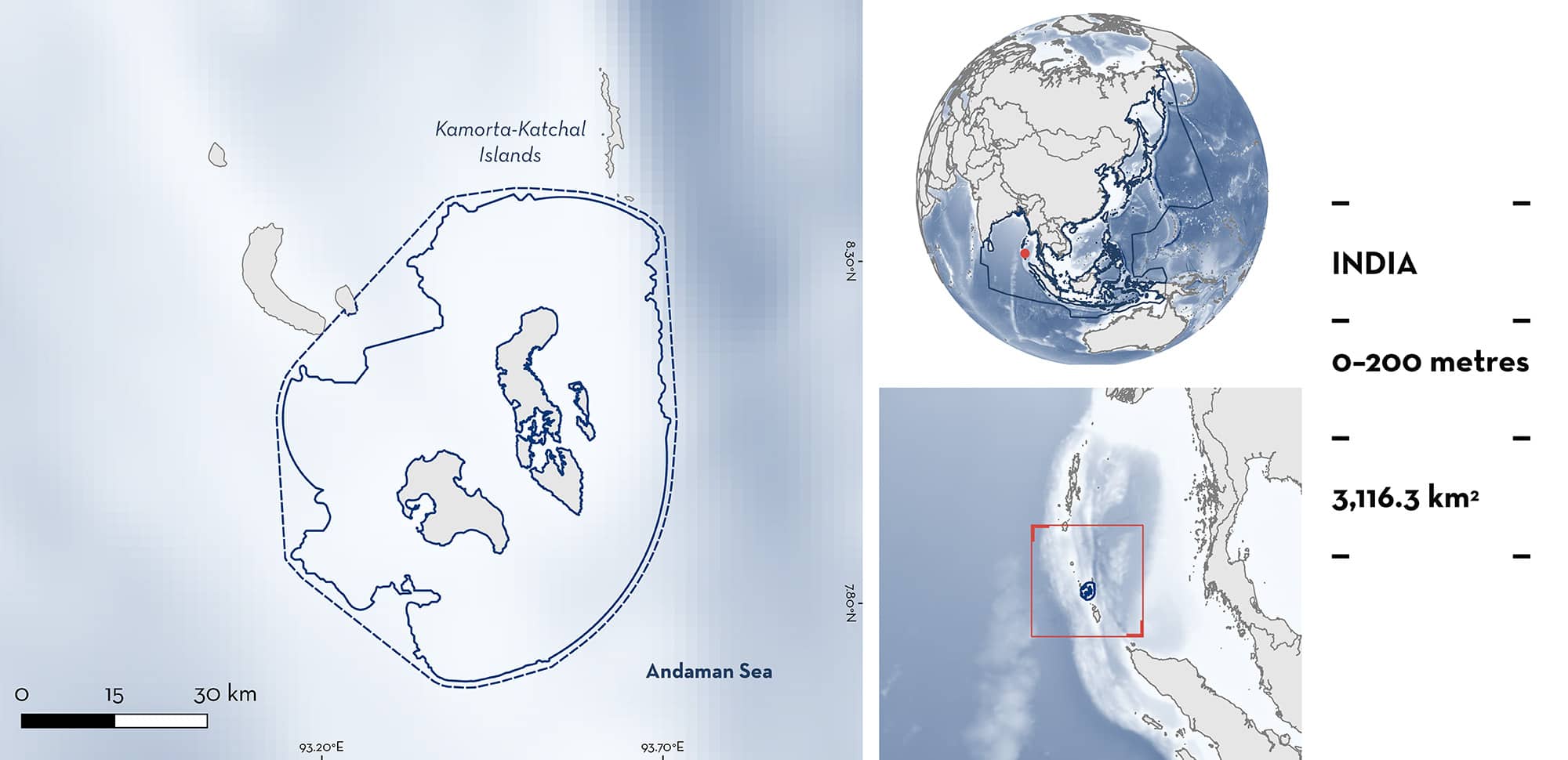
Kamorta-Katchal Islands is located within the Nicobar archipelago of India. These oceanic islands are located between the Bay of Bengal and the Andaman Sea along a roughly latitudinal gradient. The area is characterised by a variety of habitats including seagrass beds, coral reefs, and pelagic waters. The Nicobar Islands have been declared an Aboriginal Tribal Reserve Area by the Government of India. Within this area, there are: threatened species and reproductive areas (Silvertip Shark Carcharhinus albimarginatus).
Download factsheet
Kamorta-Katchal Islands
DESCRIPTION OF HABITAT
Kamorta-Katchal Islands is located within the Nicobar archipelago of India. These oceanic islands are located between the Bay of Bengal and the Andaman Sea along a roughly latitudinal gradient and are the continuation of the Mentawai Islands off Sumatra, Indonesia (Andrews et al. 2006).
The Nicobar Islands harbour a variety of marine habitats including seagrass beds, pelagic waters, and coral reefs which are characteristic of Southeast Asia and are among the most diverse of all the reef areas of India (Santhanakumar et al. 2010; Ragavan et al. 2016; Marimuthu et al. 2017; Nehru & Balasubramanian 2018). In Kamorta and Katchal Islands, coral colonies are located at depths of 3– 200 m (Mondal et al. 2012; Chaturvedi 2015).
The islands experience heavy monsoonal weather from the end of May to September when the southwest monsoon sets in, as well as intermittent or light to heavy rainfall when the northeast monsoon begins in November (Tyabji et al. 2020).
The Nicobar Islands have been declared an Aboriginal Tribal Reserve Area by the Government of India. Nicobarese manage the reef areas with complex set of traditional rules, with some reef areas maintained as no-take or no-go areas (Patankar et al. 2016).
This Important Shark and Ray Area is benthopelagic and is delineated from inshore and surface waters (0 m) to 200 m based on the bathymetry of the area.
CRITERION A
VULNERABILITY
The one Qualifying Species within the area is considered threatened with extinction according to the IUCN Red List of Threatened Species. The Silvertip Shark is assessed as Vulnerable (Espinoza et al. 2021).
CRITERION C
SUB-CRITERION C1 – REPRODUCTIVE AREAS
Karmorta-Katchal Islands is an important reproductive area for one shark species.
During fish landing surveys carried out in the Andaman and Nicobar Islands between January 2017 and May 2018, and through local ecological knowledge surveys of fishers and traders between January 2017 and February 2019, catches of neonate and pregnant female Silvertip Shark were documented in the area (Tyabji et al. 2020, 2022). During the fish landing surveys, one pregnant female was landed in February 2017 measuring 199.5 cm total length (TL); one aborted embryo of 21.5 cm TL was recorded in December 2017; 25 neonates ranging in size 61–94 cm TL were sampled in March and April 2017, and in January, February, and April 2018; and >150 neonates with open umbilical scars were observed landed in April 2017 (a subsample of n = 24 of these measured 62–78 cm TL). Fishers indicated that the neonates and pregnant females were caught around Kamorta-Katchal Islands, primarily by pelagic longline, and that this was a regular and recurring event across years (Tyabji et al. 2020, 2022). Neonates were classed as being around the published size-at-birth of the species (63–81 cm TL; Ebert et al. 2021) and/or having visible umbilical scars.
Silvertip Sharks are a known reef-associated species with high residency to coral reefs (e.g., Barnett et al. 2012; Espinoza et al. 2015). Details of reproduction is limited globally but early life-stages have been recorded on coral reef environments elsewhere in the Indian Ocean (e.g., Stevens 1984). The reefs of Karmorta-Katchal Islands provide suitable habitat for the species, with the observations of pregnant females and neonates, combined with known residency patterns, supporting the importance of the area for reproduction.
Download factsheet
SUBMIT A REQUEST
ISRA SPATIAL LAYER REQUEST
To make a request to download the ISRA Layer in either a GIS compatible Shapefile (.shp) or Google Earth compatible Keyhole Markup Language Zipped file (.kmz) please complete the following form. We will review your request and send the download details to you. We will endeavor to send you the requested files as soon as we can. However, please note that this is not an automated process, and before requests are responded to, they undergo internal review and authorization. As such, requests normally take 5–10 working days to process.
Should you have questions about the data or process, please do not hesitate to contact us.


