ISRA FACTSHEETS
ISRA FACTSHEETS
POLAR WATERS REGION
Kerguelen Islands Shelf
Summary
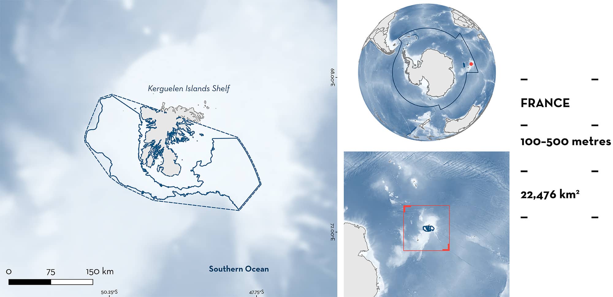
Kerguelen Islands Shelf is located in the French exclusive economic zone around the Kerguelen Islands in the Southern Ocean. The northern part of the split Antarctic Circumpolar Current flows eastward through the area. The area overlaps with the National Natural Reserve of the Terres australes françaises. Within this area there are: range-restricted species (Murray’s Skate Bathyraja murrayi); and reproductive areas (Eaton’s Skate Bathyraja eatonii).
Download factsheet
Kerguelen Islands Shelf
DESCRIPTION OF HABITAT
Kerguelen Islands Shelf is located on the shelf of Kerguelen Islands, ~2,000 km north of Mac Robertson Land, Antarctica, in the Southern Ocean. The area is located in the French exclusive economic zone (EEZ) of the Kerguelen Plateau (Terres australes et antarctiques françaises/French Southern and Antarctic Lands; TAAF).
The main oceanographic influence on the area is the Antarctic Circumpolar Current flowing eastward. It splits at the Kerguelen Plateau, with most of the flow deflected around the northern side, through the area (Park et al. 2008). This makes the Kerguelen Islands shelf more productive than surrounding areas and particularly important for ecosystem functioning.
The area overlaps with the National Natural Reserve of the Terres australes françaises.
This Important Shark and Ray Area is benthopelagic and subsurface and is delineated from 100 m to 500 m based on the depth range of Qualifying Species in the area.
CRITERION B
RANGE RESTRICTED
This area holds the regular presence of Murray’s Skate as a resident range-restricted species. Murray’s Skates were captured during scientific surveys which took place in 2006, 2010, 2013, and 2017 on the Kerguelen Islands Shelf at depths from 100 to 1,000 m (Duhamel et al. 2019). Few survey years are available because waters <500 m deep are not fished in commercial fisheries in the French EEZ of the Kerguelen Islands. Across these four survey years and across the entire French shelf of the Kerguelen Plateau, the highest densities (reaching 200 kg/km2) were recorded within this area (to the northeast of Kerguelen Islands in 2013 and to the east in 2017, which represent the two most contemporary surveys) (Duhamel et al. 2019). Further, although the species is present to a depth of 800 m, major hotspots occur on the shelf of Kerguelen Islands at depths shallower than 500 m, indicating that it is an important area for Murray’s Skates in this region. The species is endemic to, and therefore range restricted to, the wider Kerguelen Plateau and occurs nowhere else in the Southern Ocean or globally (Last et al. 2016).
CRITERION C
SUB-CRITERION C1 – REPRODUCTIVE AREAS
Kerguelen Islands Shelf is an important reproductive area for one ray species.
Eaton’s Skate is one of the most common skate bycatch species recorded by observers monitoring 25% of fishing effort of the benthic longline fishery targeting Patagonian Toothfish Dissostichus eleginoides in the French Kerguelen EEZ (des Clers & Deleau 2021). This species represents an annual average of 25% of the observed skate catches in the Kerguelen toothfish fishery which have captured >50,000 individuals per year since 2015 (Faure 2023). The fishery operates between 500–2,000 m depth, and while Eaton’s Skate is frequently caught between 500 and 1,200 m, they are also caught outside the commercial fishing grounds (<500 m) which was highlighted by the scientific surveys that occurred on the shelf area at depths of 100–1,000 m in 2006, 2010, 2013, and 2017 (Duhamel et al. 2019). In particular, the scientific survey caught predominantly immature individuals from 100 m to 500 m deep (representing the delineated area), whereas mainly mature individuals are recorded in the commercial fishery (500–2,000 m).
The size-at-maturity is estimated to be 77.2 cm total length (TL) for females and 82.6 cm TL for males (Faure 2023). Of 2,018 individuals measured on scientific surveys, 1,158 ranged between 18.1–80.0 cm TL (57.4%), including 194 individuals <35 cm TL (9.6%). This can be considered the maximum size for young-of-the-year (Wong et al. 2022), with a size-at-birth estimated at 17.8 cm TL (Duhamel et al. 2005). For comparison, in the commercial fishery, of 25,212 measurements, 4,448 were <80 cm TL (17.6%) (Faure 2023). Similarly, the spatial distribution by size between 100 m and 1,400 m using scientific and commercial data revealed that skate size increases with depth (Faure 2023), highlighting that the Kerguelen Islands Shelf at depths of 100–500 m is a regionally important reproductive area for early life history stages of this species.
Download factsheet
SUBMIT A REQUEST
ISRA SPATIAL LAYER REQUEST
To make a request to download the ISRA Layer in either a GIS compatible Shapefile (.shp) or Google Earth compatible Keyhole Markup Language Zipped file (.kmz) please complete the following form. We will review your request and send the download details to you. We will endeavor to send you the requested files as soon as we can. However, please note that this is not an automated process, and before requests are responded to, they undergo internal review and authorization. As such, requests normally take 5–10 working days to process.
Should you have questions about the data or process, please do not hesitate to contact us.


