ISRA FACTSHEETS
ISRA FACTSHEETS
ASIA REGION
Koh Talang & Koh Talu
Summary
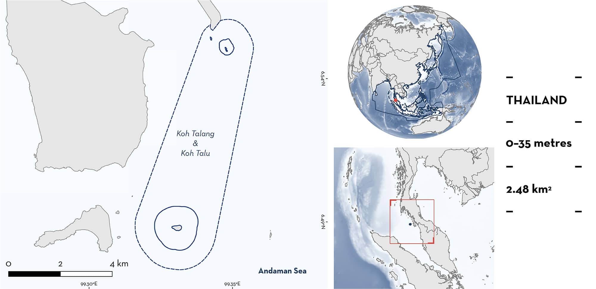
Koh Talang & Koh Talu is situated in the Andaman Sea off Thailand. The area comprises two islands characterised by caves, crevices, and coral reefs. Koh Talang includes the dive site ‘Talang Step’ where the underwater seascape features a staircase like formation in the benthos as it descends. The area is influenced by seasonal changes in sea circulation associated with the monsoon transition periods. It sits within the Tarutao National Park and the Lower Western Coastal Sea Ecologically or Biologically Significant Marine Area. Within this area there are resting areas (Coral Catshark Atelomycterus marmoratus).
Download factsheet
Koh Talang & Koh Talu
DESCRIPTION OF HABITAT
Koh Talang & Koh Talu includes the islands of Koh Talang and Koh Talu in the Andaman Sea off Thailand. The substrate around both islands is characterised by small caves and crevices (M Chuangcharoendee pers. obs. 2024). The underwater seascape of Koh Talang features a sequence of rocky formations sculpted by the tides, creating a distinctive staircase structure (Talang Step dive site) that gently descends to a maximum depth of 30 m and is characterised by barrel sponges and gorgonian fans (PADI 2024). Koh Talu features an array of hard and soft corals, including green cup corals and barrel sponges.
The area is influenced by seasonal changes in sea circulation in the Andaman Sea, particularly during the monsoon-transition periods (April to May and October to November) (Chatterjee et al. 2017).
The area falls within the Lower Western Coastal Sea Ecologically or Biologically Significant Marine Area (EBSA; CBD 2024) and the Tarutao National Park (Protected Planet 2024).
This Important Shark and Ray Area is benthopelagic and subsurface and is delineated from 0 m to 35 m based on the depth range of Qualifying Species in the area.
CRITERION C
SUB-CRITERION C3 – RESTING AREAS
Koh Talang & Koh Talu is an important resting area for one shark species.
Since 2017, Coral Catsharks have been observed resting in groups by local dive leaders in the area (S Worachananant; T Banpotjit; M Srinapa; P Soontornsuk; K Waipaka; E Hemra pers. comm. 2024). Animals are observed on every dive in the area, with an average of 3–4 individuals per dive at Koh Talu and 6–7 individuals per dive at Koh Talang (max. group size = 10). There are generally 1–4 boat trips per day between January and September to the area (with seasonal closures between October to December), amounting to over 330 surveys per year. Sightings of Coral Catsharks are so reliable that their presence contributes to local livelihoods via the promotion in the local dive tourism industry (Adang Sea Divers 2024; The Smiling Seahorse 2024). This species is known to be more active in the evening as a crepuscular or nocturnal forager (Hövel et al. 2010), and the habitat in this area, characterised by small caves and crevices, likely provides a daytime refuge for this species. Coral Catsharks are also seen in other areas of the Tarutao National Park, such as Eight Mile Rock, however not in the same numbers. The regular and predictable nature of the observations of Coral Catsharks (always seen resting in rock caves or on the substrate) in this area highlights its importance for resting.
Download factsheet
SUBMIT A REQUEST
ISRA SPATIAL LAYER REQUEST
To make a request to download the ISRA Layer in either a GIS compatible Shapefile (.shp) or Google Earth compatible Keyhole Markup Language Zipped file (.kmz) please complete the following form. We will review your request and send the download details to you. We will endeavor to send you the requested files as soon as we can. However, please note that this is not an automated process, and before requests are responded to, they undergo internal review and authorization. As such, requests normally take 5–10 working days to process.
Should you have questions about the data or process, please do not hesitate to contact us.


