ISRA FACTSHEETS
ISRA FACTSHEETS
POLAR WATERS REGION
Kongsfjorden
Summary
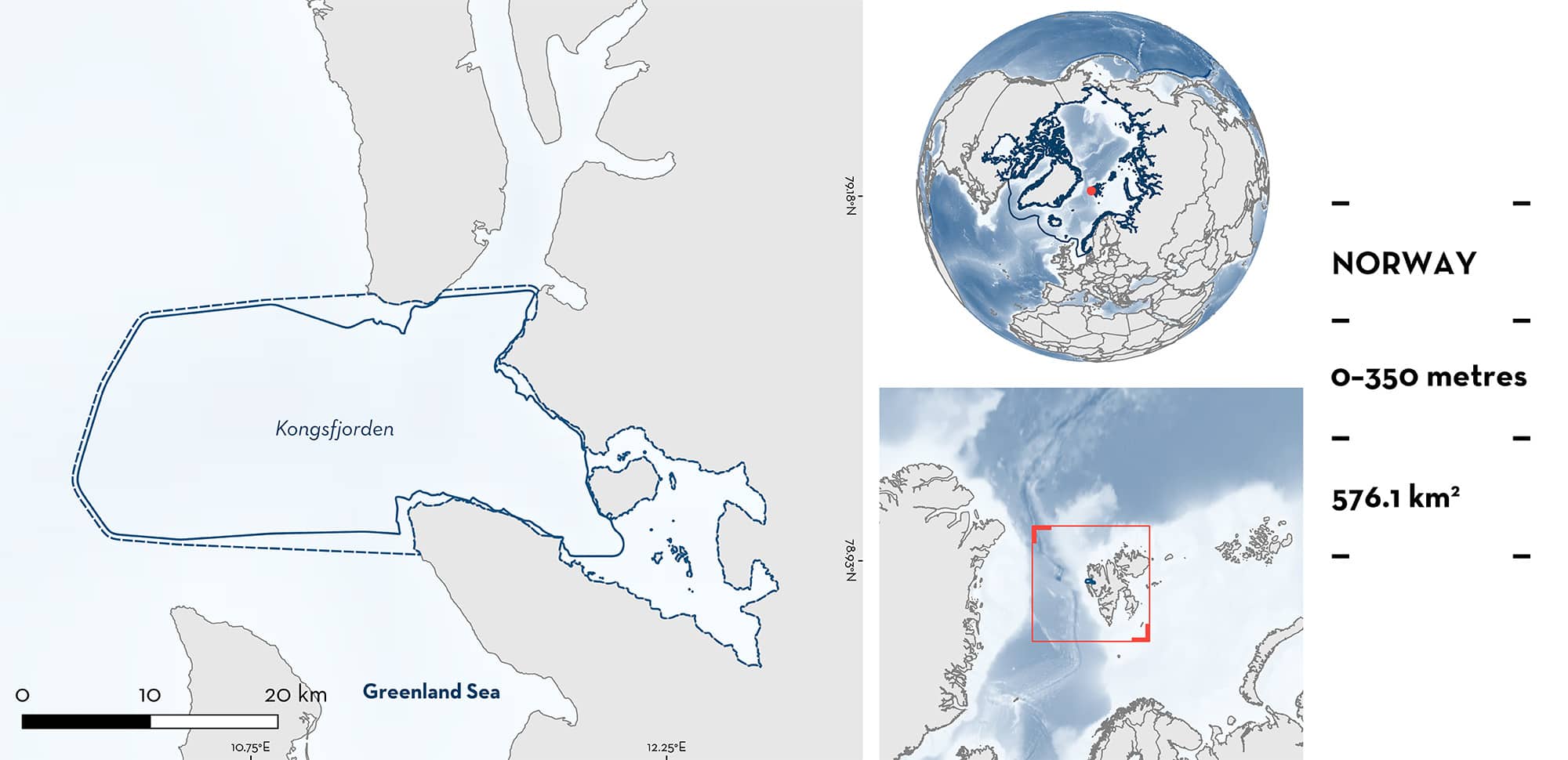
Kongsfjorden is located on the west coast of Spitsbergen, in the Svalbard Archipelago, Norway. It is a glacial fjord characterised by numerous bays and a deep central channel ~350 m deep. It is a High Arctic fjord that has increasingly been influenced by Atlantic water. The area is characterised by high phytoplankton productivity due to circulation patterns induced by the glacier termini, and regular mixing of Arctic and Atlantic water. Within this area there are: threatened species and feeding areas (Greenland Shark Somniosus microcephalus).
Download factsheet
Kongsfjorden
DESCRIPTION OF HABITAT
Kongsfjorden is located on the west coast of Spitsbergen, in the Svalbard Archipelago, Norway. It is a glacial fjord influenced by four surging glaciers (Svendsen et al. 2002), characterised by numerous bays and a deep central channel ~350 m deep.
The area is influenced by an Atlantic-type regime (Piwosz et al. 2009), through Atlantic water from the West Spitsbergen Current and Arctic-type waters from the Sørkapp Current (Swerpel 1985; Svendsen et al. 2002; Cottier et al. 2005). It has high phytoplankton productivity in part due to circulation patterns induced by the glacier termini, but also because of regular mixing of Arctic and Atlantic water types (Hop et al. 2006; Piwosz et al. 2009).
This Important Shark and Ray Area is benthopelagic and delineated from inshore and surface waters (0 m) to 350 m based on the bathymetry of the area.
CRITERION A
VULNERABILITY
One Qualifying Species considered threatened with extinction according to the IUCN Red List of Threatened Species regularly occurs in the area. This is the Vulnerable Greenland Shark (Kulka et al. 2020).
CRITERION C
SUB-CRITERION C2 – FEEDING AREAS
Kongsfjorden is an important feeding area for one shark species.
Greenland Sharks are regular, seasonal, and annual visitors to the area. Between 2008–2009, 76 individuals were caught during longline research surveys in the area, mostly during the boreal summer (June–August) (Lydersen et al. 2016). This area had the largest known contemporary cluster of Greenland Shark records in Norway. Individuals measured between 229–381 cm fork length, weighed up to 700 kg, and were all sexually immature. Greenland Sharks were historically heavily exploited in this area: local ecological knowledge indicates that high numbers were caught in shrimp trawling activities, even after targeted commercial fishing stopped. Shrimp trawling vessels now utilise deflectors to reduce Greenland Shark bycatch (KM Kovacs pers. obs. 2024).
The presence of Greenland Shark in this area is presumably driven by a high density of prey species. Stomach content analysis of Greenland Shark from the area shows that they feed on prey which have overlapping seasonality within the area (Lydersen et al. 2016). This includes resident marine mammals such as seals (Lydersen et al. 2016) which are a regular part of their diet in the area. Harbour Seals Phoca vitulina are known to be concentrated in this area, and in the past Ringed Seals Pusa hispida and Bearded Seals Erignathus barbatus also occurred in high densities (KM Kovacs pers. obs. 2024). Greenland Sharks taken in Kongsfjorden had a high proportion of seals in their diet (~50%), and a low proportion of Greenland Halibut Reinhardtius hippoglossoides (their common prey elsewhere) comxpared to other parts of the region (Lydersen et al. 2016). Further, the stomach content analysis showed that Greenland Sharks feed on Atlantic Cod Gadus morhua, which now occur in the fjord year-round. This area is a thermal niche for Atlantic Cod, whose presence is driven by a northward shift in distribution due to climate change (Brand et al. 2023). Greenland Sharks also feed on haddock Melanogrammus aeglefinus which is present at least in the summer months (Buscaino et al. 2020). This area is important in providing regular and predictable nutrition for immature Greenland Sharks, driving their seasonal abundance in the area, and providing a diet which is different from other areas in the region.
Download factsheet
SUBMIT A REQUEST
ISRA SPATIAL LAYER REQUEST
To make a request to download the ISRA Layer in either a GIS compatible Shapefile (.shp) or Google Earth compatible Keyhole Markup Language Zipped file (.kmz) please complete the following form. We will review your request and send the download details to you. We will endeavor to send you the requested files as soon as we can. However, please note that this is not an automated process, and before requests are responded to, they undergo internal review and authorization. As such, requests normally take 5–10 working days to process.
Should you have questions about the data or process, please do not hesitate to contact us.


