ISRA FACTSHEETS
ISRA FACTSHEETS
WESTERN INDIAN OCEAN REGION
La Passe
Summary
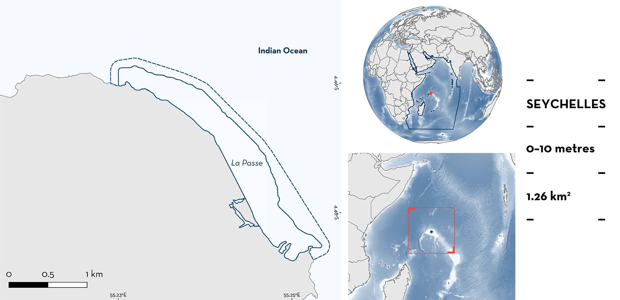
La Passe is located in Silhouette Island in the Republic of Seychelles. The area encompasses a wetland, sandy beaches, and coral reef systems. The area sits within a marine national park and the Mahé, Alphonse and Amirantes Plateau Ecologically or Biologically Significant Marine Area. It also partly overlaps with a Key Biodiversity Area. Within this area there are: threatened species (e.g., Sharptooth Lemon Shark Negaprion acutidens); reproductive areas (Sharptooth Lemon Shark); and undefined aggregations (Mangrove Whipray Urogymnus granulatus).
Download factsheet
La Passe
DESCRIPTION OF HABITAT
La Passe comprises the wetland and coastal areas of Eastern Silhouette Island, inner Islands of the Republic of Seychelles. Silhouette Island is the third largest granitic island in the Seychelles, with an area of 20.1 km2. Much of Silhouette Island is made up of syenite rock dated from 63 million years ago.
A reef system is present in the area, comprising fringing reef, reef-flat, and lagoon (Gerlach 2010). The reefs are shallow in this area and exposed to distant-source storms. This area also has a sandy channel that reaches to the reef crest (Gerlach 2010). On land (the western part of La Passe), there is a relatively well-preserved wetland that runs through the island’s main settlement. It includes small marshy areas, a small lake, and small streams (IUCN 2011). This wetland has mostly brackish water, but salinity varies greatly during the year with rainfall events and sea-water intrusion. Connections with the sea are made mostly once or twice a year during high king tides or with intensive rain events that make the wetland spill-over into the sea.
The area sits within a marine national park and the Mahé, Alphonse, and Amirantes Plateau Ecologically or Biologically Significant Marine Area (CBD 2023) and partially overlaps with the Silhouette Marine National Park Key Biodiversity Area (KBA 2023).
This Important Shark and Ray Area is benthopelagic and is delineated from inshore and surface waters (0 m) to 10 m based on the bathymetry of the area.
CRITERION A
VULNERABILITY
Two Qualifying Species considered threatened with extinction according to the IUCN Red List of Threatened SpeciesTM regularly occur in the area. These are the Endangered Sharptooth Lemon Shark (Simpfendorfer et al. 2021) and Mangrove Whipray (Sherman et al. Submitted).
CRITERION C
SUB-CRITERION C1 – REPRODUCTIVE AREAS
La Passe is an important reproductive area for one shark species.
Opportunistic observations recorded by Island Conservation Society (ICS) staff during island visits indicate that neonate Sharptooth Lemon Sharks, measuring 40–60 cm total length (TL) are regularly sighted. Animals are observed several times each week while swimming in the shallows of the reef flats and while wading or walking along the beach. Animals are either solitary or in small groups of up to five individuals on the tidal reef flats but they can also enter the wetland during high tides (G Berke & E Mederic pers. obs. 2010-2022). The size-at-birth for this species is 60 cm TL (Ebert et al. 2021). From April onwards, neonates are usually not seen anymore (G Berke & E Mederic pers. obs. 2010-2022). Staff also report larger animals observed around the jetty or seen while snorkelling during June to August. However, there are few records of individuals of the sizes corresponding to mature adults within the area. This suggests that Sharptooth Lemon Shark move to other areas for the rest of their life-cycle before returning to the area to reproduce.
CRITERION C
SUB-CRITERION C5 – UNDEFINED AGGREGATIONS
La Passe is an important area for undefined aggregations of one ray species.
Opportunistic observations recorded by ICS staff during island visits indicate that Mangrove Whiprays are regularly and predictably sighted year-round in the wetland area. Animals are reported two to three times a week (mainly at night) and are often seen in aggregations of up to five sub-adult individuals (>55 cm disc width [DW]). Size-at-maturity for males is ~90 cm DW, and females mature at ~100 cm DW (Last et al. 2016). This species is generally known to be solitary rather than forming aggregations like other stingrays (Sherman et al. Submitted). While the species is known to have preferences for mangrove habitats, the time that these individuals stay in the wetland is exceptional because the wetland can become almost fully freshwater following high rainfall events. Further information is required to determine the function of these aggregations.
Download factsheet
SUBMIT A REQUEST
ISRA SPATIAL LAYER REQUEST
To make a request to download the ISRA Layer in either a GIS compatible Shapefile (.shp) or Google Earth compatible Keyhole Markup Language Zipped file (.kmz) please complete the following form. We will review your request and send the download details to you. We will endeavor to send you the requested files as soon as we can. However, please note that this is not an automated process, and before requests are responded to, they undergo internal review and authorization. As such, requests normally take 5–10 working days to process.
Should you have questions about the data or process, please do not hesitate to contact us.


