ISRA FACTSHEETS
ISRA FACTSHEETS
MEDITERRANEAN AND BLACK SEAS REGION
Lagoon of Bizerte
Summary
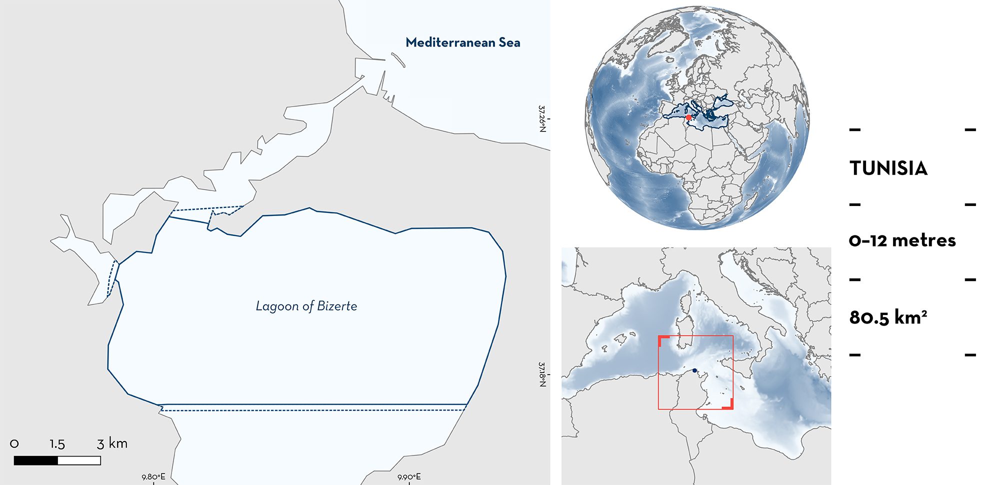
Lagoon of Bizerte is a brackish shallow water body located in northeastern Tunisia in the southwestern Mediterranean Sea. This area is situated in the north and central region of the Lagoon of Bizerte (the overall lagoon is 11 km width and 13 km long). It is connected to the Mediterranean Sea by an artificial navigation channel (6 km long, 12 m depth) and receives freshwater from eight streams depending on rainfall. This area is characterised by sandy, muddy, or detrital substrates, along with seagrass meadows. Within this area there are: threatened species and reproductive areas (Ocellate Torpedo Torpedo torpedo).
Download factsheet
Lagoon of Bizerte
DESCRIPTION OF HABITAT
Lagoon of Bizerte is a brackish water body located in northeastern Tunisia. This area is located in the north and central region of the Lagoon of Bizerte (11 km width and 13 km long, covering 150 km2). The lagoon is semi-enclosed as it connects with the Mediterranean Sea only by an artificial narrow navigation channel (6 km long, 12 m depth maximum). In the south, it connects with Ichkeul Lake via the Tinja stream. Eight streams flow into the lagoon which are non-permanent watercourses with flow dependent on rainfall that feeds the lagoon with freshwater (Zaouali 1974).
The average and maximum depth of the Lagoon of Bizerte are 7 m and 12 m, respectively. It reaches its maximum depth near the navigation channel, with sandy, muddy, or detrital substrates, and seagrass meadows in some places (Zaouali 1974). The lagoon is characterised by extreme salinity and temperatures and with a strong fluctuation of nutrients (Afli et al. 2008). The seasonal gradient of water salinity is relatively large, ranging on average from 20 ppt in winter to 40 ppt in summer (Afli et al. 2008). The rainy period coincides with the boreal winter, from November to April, and the rest of the year is dry, without any freshwater input from neighboring streams, and stronger seawater influence (Sakka et al. 2003; Garali et al. 2011).
This Important Shark and Ray Area is benthic and is delineated from inshore and surface waters (0 m) to 12 m based on the shape of the lagoon, the distribution of the species in this area, and the outflow of rivers that decrease salinity.
CRITERION A
VULNERABILITY
The one Qualifying Species within the area is considered threatened with extinction according to the IUCN Red List of Threatened SpeciesTM. The Ocellate Torpedo is assessed as Vulnerable (Jabado et al. 2021).
CRITERION C
SUB-CRITERION C1 – REPRODUCTIVE AREAS
Lagoon of Bizerte is an important reproductive area for one ray species. The Ocellate Torpedo is the most abundant species of shark in the area and is commonly captured in fisheries (El Kamel-Moutalibi et al. 2009, 2013).
From January 2006 to November 2008, 443 individuals (13–43 cm total length [TL]) were sampled in this area (El Kamel-Moutalibi et al. 2009). Smaller sized individuals were close to the known size-at-birth (8–10 cm TL; Serena 2005) highlighting that neonates and young-of-the-year were present. Adult females significantly outnumbered adult males. Of the 148 adult females sampled, 69 were pregnant and neonates were recorded (n = 9) (El Kamel-Moutalibi et al. 2009).
Between May 2010 and April 2011, 565 individuals (10–45 cm TL) were sampled in this area (El Kamel-Moutalibi et al. 2013). Of the 136 adult females examined, 34 were pregnant carrying embryos, including fully developed ones. In this area, ovulation takes place in April and May, mating probably occurs between the end of the boreal winter and the early spring, the first pregnant females appear in May and June, and near-term pregnant females are captured in July (El Kamel-Moutalibi et al. 2013). This pattern suggests that gestation lasts four months in this area. The size-at-birth was estimated at 9.5–9.9 cm TL (El Kamel-Moutalibi et al. 2013).
Download factsheet
SUBMIT A REQUEST
ISRA SPATIAL LAYER REQUEST
To make a request to download the ISRA Layer in either a GIS compatible Shapefile (.shp) or Google Earth compatible Keyhole Markup Language Zipped file (.kmz) please complete the following form. We will review your request and send the download details to you. We will endeavor to send you the requested files as soon as we can. However, please note that this is not an automated process, and before requests are responded to, they undergo internal review and authorization. As such, requests normally take 5–10 working days to process.
Should you have questions about the data or process, please do not hesitate to contact us.


