ISRA FACTSHEETS
ISRA FACTSHEETS
MEDITERRANEAN AND BLACK SEAS REGION
Ligurian Sea
Summary
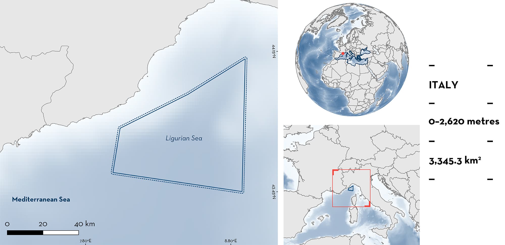
Ligurian Sea is located in the northwestern Mediterranean Sea, in the Italian region of Liguria. The area is characterised by the presence of a cyclonic circulation of water masses, mesoscale eddies, and areas of significant upwelling. It also includes seamounts, underwater canyons, and deepwater coral banks. Within this area there are: threatened species (e.g., Spinetail Devil Ray Mobula mobular); reproductive areas (Little Sleeper Shark Somniosus rostratus); and feeding areas (e.g., Basking Shark Cetorhinus maximus).
Download factsheet
Ligurian Sea
DESCRIPTION OF HABITAT
Ligurian Sea is located in the northwestern Mediterranean Sea, along the Italian coastline of Liguria. The area sits on continental shelf, slope, and bathyal habitats. One of the most important geomorphological features is the presence of several deep underwater canyons, carving the sea floor perpendicularly to the coast. Offshore seamounts are also present in the area.
Cyclonic water circulations and vorticity in the area are caused by southerly wind stress that cause a coastal counter current in the Gulf of Genova leading to high productivity (Esposito & Manzella 1982). The oceanographic circulation is induced by the density gradients of three different water masses (Prieur et al. 2020). First, surface waters (0–200/300 m depth) are from the Modified Atlantic Water. The reunion of this water mass with waters raising along the eastern coast of Corsica, right in front of Genoa, creates the Ligurian-Provençal Current, which flows westward along the continental slope. It is present throughout the year and, more importantly, creates between coastal and offshore waters, a geostrophic permanent frontal zone, which is fundamental in terms of biological productivity. Second, intermediate waters (200/300–1,000 m), are from the Levantine Intermediate Water, and are denser, saltier, richer in nutrients and relatively warmer, than surface waters as they originate from the Eastern Mediterranean Basin. Third, the Mediterranean Deep Water (from 1,000 m to the bottom), is more homogenous, with an annual near-constant temperature around 12.5–13°C. Productivity of these waters is due to winter mixing, frontal zones, local ‘upwelling’ phenomena coupled with meso-scale vortices and the presence of complex structures of divergences/convergences. These phenomena, coupled with wind-induced water exchanges, makes the offshore area present a primary productivity higher than the coastal zone, especially within the frontal zone. This productivity is relatively high throughout the year, constituting a mesotrophic zone, opposite to the general oligotrophy of the Mediterranean Sea.
This Important Shark and Ray Area is benthopelagic and is delineated from inshore and surface waters (0 m) to 2,620 m based on the bathymetry of the area.
CRITERION A
VULNERABILITY
Two Qualifying Species considered threatened with extinction according to the IUCN Red List of Threatened SpeciesTM regularly occur in the area. These are the Endangered Basking Shark (Rigby et al. 2021) and Spinetail Devil Ray (Marshall et al. 2022).
CRITERION C
SUB-CRITERION C1 – REPRODUCTIVE AREAS
Ligurian Sea is an important reproductive area for one shark species.
Pregnant female Little Sleeper Shark (n = 7; Garibaldi et al. 2012) and individuals at all stages of maturity are regularly recorded, with embryos ranging from a few cm to 15 cm total length (TL) (n = 55; Garibaldi et al. 2012; F Garibaldi unpubl. data 2008–2022). Size-at-birth for this species is 21–28 cm TL (Ebert et al. 2021). Limited reproductive information is available for the species with only one other side identified in the Mediterranean Sea which highlights that the area is important for the gestation of this species.
CRITERION C
SUB-CRITERION C2 – FEEDING AREAS
Ligurian Sea is an important feeding area for one shark and one ray species.
Ligurian Sea shows a high abundance and density of zooplankton compared with other areas in the Mediterranean Sea, particularly in spring, but also well into summer, favoured by upwelling and frontal zones (Frangou et al. 2010; Bozzano et al. 2014). Basking Shark and Spinetail Devil Ray feed on meso- and macro-zooplankton including copepods and euphausiid shrimps, mostly Northern Krill Meganyctiphanes norvegica (Celona 2004; Couturier et al. 2012; Notarbartolo di Sciara et al. 2015). Peaks of zooplankton abundances coincide with the presence of large filter-feeding animals in the area, including Basking Shark (Serena et al. 1999) and Spinetail Devil Ray (Orsi Relini & Cappello 1992; Serena et al. 1999; Notarbartolo di Sciara et al. 2015).
Download factsheet
SUBMIT A REQUEST
ISRA SPATIAL LAYER REQUEST
To make a request to download the ISRA Layer in either a GIS compatible Shapefile (.shp) or Google Earth compatible Keyhole Markup Language Zipped file (.kmz) please complete the following form. We will review your request and send the download details to you. We will endeavor to send you the requested files as soon as we can. However, please note that this is not an automated process, and before requests are responded to, they undergo internal review and authorization. As such, requests normally take 5–10 working days to process.
Should you have questions about the data or process, please do not hesitate to contact us.


