ISRA FACTSHEETS
ISRA FACTSHEETS
ASIA REGION
Lombok Strait
Summary
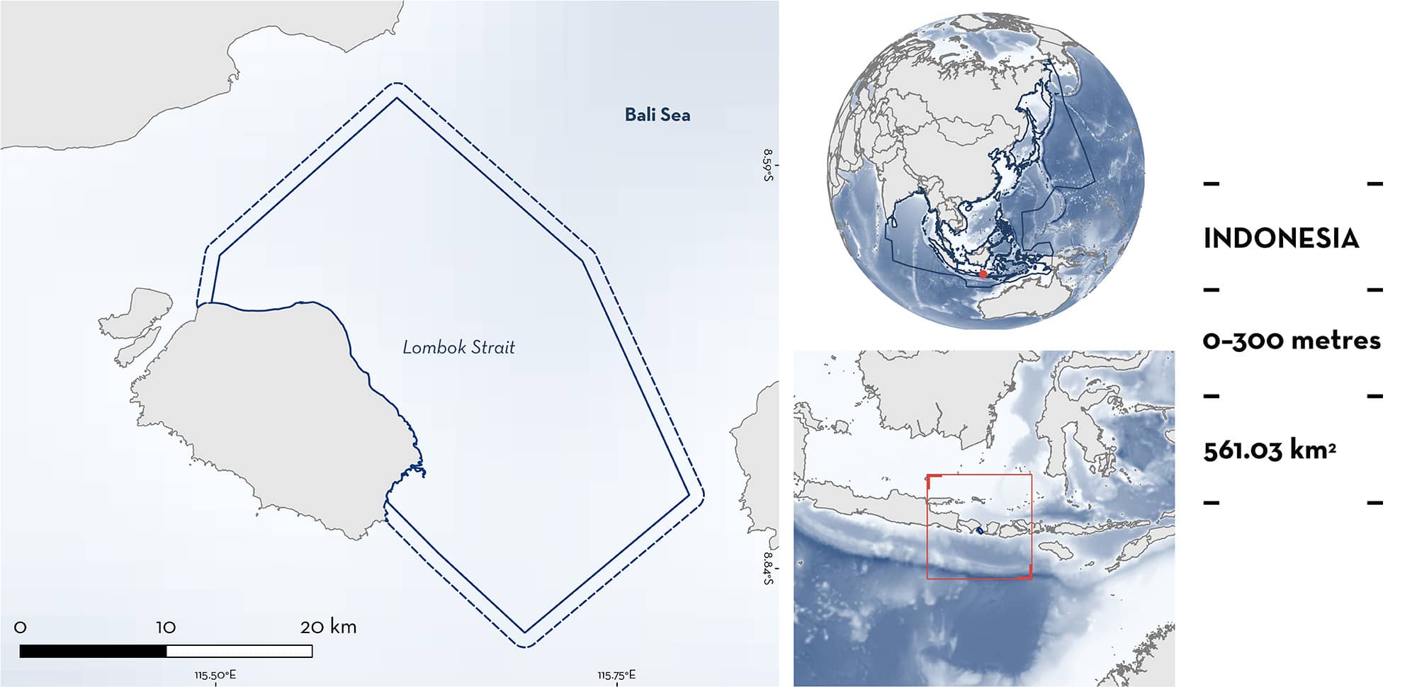
Lombok Strait is located off Nusa Penida between Bali and Lombok, Indonesia. The area is characterised by two large submarine platforms surrounded by pelagic waters. The area overlaps with the Nusa Penida marine protected area. Within this area there are: threatened species, reproductive areas, and feeding areas (Pelagic Thresher Alopias pelagicus).
Download factsheet
Lombok Strait
DESCRIPTION OF HABITAT
Lombok Strait is located off Nusa Penida between Bali and Lombok, Indonesia. The area connects the Bali Sea with the Indian Ocean. Lombok Strait is one of Indonesia’s main throughflow routes where water is exchanged between the Indian and Pacific Ocean. The area includes two large submarine platforms (~300–350 m tall) with steep slopes, a permanent thermocline, and strong barotropic tidal currents (Syamsudin et al. 2019). Lombok Strait is also part of the Wallace Line, a channel which separates the distribution of fauna in western Indonesia and eastern Indonesia. The coastal habitat in the area is characterised by mangroves, seagrasses, and a high diversity of corals, while the area covers predominantly pelagic waters (Bachtiar 2001).
The area is influenced by the North Pacific Thermocline (Siswanto 2008) and is warmed by the Indonesian throughflow (Kida & Wijffels 2012). In January, Lombok Strait is influenced by contra flow current created by cyclonal vortexes. This leads to seasonal upwelling which creates high productivity due to seasonal upwelling (Siswanto 2008).
Lombok Strait partially overlaps with the Nusa Penida marine protected area (Sanjaya 2019).
This Important Shark and Ray Area is pelagic and is delineated from surface waters (0 m) to 300 m based on the depth range of the Qualifying Species in the area.
CRITERION A
VULNERABILITY
One Qualifying Species in this area is considered threatened with extinction according to the IUCN Red List of Threatened Species. The Pelagic Thresher is assessed as Endangered (Rigby et al. 2019).
CRITERION C
SUB-CRITERION C1 – REPRODUCTIVE AREAS
Lombok Strait is an important reproductive area for one shark species.
Pelagic Threshers use this area during pregnancy. Between July–November 2020 and 2021, 1,521 individuals were observed caught within the area and landed in Karangasem, Bali. Pelagic Threshers are caught with surface longlines 250–1,000 m in length, with 10–30 hooks, set to a depth of 50 m with a 2-hour soak time (WWF-ID unpubl. data 2020). In 2020, 1,138 were observed caught in the area and landed, with 153 being classed as neonate/young-of-the-year (YOY) measuring 150–180 cm total length (TL). The size-at-birth of the species is 130–160 cm TL (Ebert et al. 2021). In 2021, 383 were observed caught in the area and landed, with 105 being classed as neonate/YOY (WWF-ID unpubl. data 2020). The seasonality of neonate/YOY catches is July–October. In addition, 137 pregnant female Pelagic Threshers were observed caught in the area between August–September 2020 (n = 82) and July–September 2021 (n = 55) (Alghozali et al. 2023). Of the individuals landed, ∼88% were female, of which 11% were pregnant as determined by dissection (WWF-ID unpubl. data 2020). In the same surveys, an additional 263 embryos (taken from dissected females), neonates, and YOY Pelagic Threshers were recorded (although separate data for each class are not available). Within this area, Pelagic Threshers give birth around two large submarine platforms (~300–550 m tall) (WWF-ID unpubl. data 2020).
CRITERION C
SUB-CRITERION C2 – FEEDING AREAS
Lombok Strait is an important feeding area for one shark species.
The presence of Pelagic Threshers in influenced by the seasonal abundance of Frigate Tuna Auxis thazard. Frigate Tuna were the dominant prey (85.9% Index of Relative Importance) in a diet study of 149 stomachs between August-September 2020 and July-September 2021 (Alghozali et al. 2023). Pelagic Threshers were caught within the area by surface longline, with 9–13 hooks per gear, and landed nearby at Pengalon Beach, Bali. When Frigate Tuna abundance declines towards the end of October (as observed in 2020 and 2021), Pelagic Threshers move away from the area. This is supported by local ecological knowledge (LEK) from fishers who indicate that the shark abundance declines at the same time, as they move towards West Lombok. Frigate Tuna catches also decrease significantly by November (WWF unpubl. data 2020). Further, during landing data collection in 2020 and 2021, some fishers switched fishing gear (from the aforementioned surface longline to catch sharks, to target Frigate Tuna with surface gillnets). LEK also indicates that Frigate Tuna return to Lombok Strait, which highlights the regularity of the use of this area for feeding purposes.
Download factsheet
SUBMIT A REQUEST
ISRA SPATIAL LAYER REQUEST
To make a request to download the ISRA Layer in either a GIS compatible Shapefile (.shp) or Google Earth compatible Keyhole Markup Language Zipped file (.kmz) please complete the following form. We will review your request and send the download details to you. We will endeavor to send you the requested files as soon as we can. However, please note that this is not an automated process, and before requests are responded to, they undergo internal review and authorization. As such, requests normally take 5–10 working days to process.
Should you have questions about the data or process, please do not hesitate to contact us.


