ISRA FACTSHEETS
ISRA FACTSHEETS
NEW ZEALAND & PACIFIC ISLANDS REGION
Maravagi
Summary
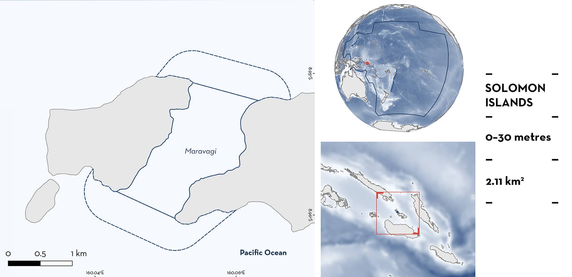
Maravagi is located in the Solomon Islands in the southwestern Pacific Ocean. It is situated in the Florida Islands in the province of Central Islands. This area is a channel between two land masses that connect east Mangalonga Island and northwestern Mbokonimbeti Island. The northern side is characterised by coral reefs with a narrow sandy channel in between the reef. This channel funnels water to form strong currents. Within this area there are: threatened species and feeding areas (Reef Manta Ray Mobula alfredi).
Download factsheet
Maravagi
DESCRIPTION OF HABITAT
Maravagi is located in the Solomon Islands in the southwestern Pacific Ocean. It is situated in the Florida Islands, also known as Nggela Islands, in the province of Central Islands. The Solomon Islands occupies a complex geologic juncture between the Indo-Australasian and Pacific Plates creating high marine biodiversity due to the diversity of habitats (Jupiter et al. 2019). Most of the Solomon Islands is located within the West Pacific Warm Pool and is influenced by the South Pacific Convergence Zone, Intertropical Convergence Zone, and the West Pacific Monsoon (Jupiter et al. 2019). Its oceanographic setting is dominated by prevailing southeasterly trade winds that drive major ocean currents to the northwest along the southern part of the chain and to the west in the northern part of the archipelago during austral winter months (June–August) (Salinger et al. 1995). During summer months (December–March), the directionality of ocean currents is more variable (Jupiter et al. 2019).
This area is a channel between two land masses that connects east Mangalonga Island and northwestern Mbokonimbeti Island. The northern side of the channel has a maximum depth of 25 m, and the southern side reaches a maximum depth of 200 m. The northern side is characterised by coral reefs with a narrow sandy channel (~160 m wide) in between the reef. This channel funnels water to form strong currents (Bilikiki 2018) and may act to concentrate productivity.
This Important Shark and Ray Area is benthopelagic and is delineated from inshore and surface waters (0 m) to 30 m based on the bathymetry of the area.
CRITERION A
VULNERABILITY
One Qualifying Species considered threatened with extinction according to the IUCN Red List of Threatened Species regularly occurs in the area. This is the Vulnerable Reef Manta Ray (Marshall et al. 2022).
CRITERION C
SUB-CRITERION C2 – FEEDING AREAS
Maravagi is an important feeding area for one ray species.
This area is a well-known dive site for recreational divers in the Solomon Islands, recognised for regular and predictable interactions with Reef Manta Rays in aggregations of up to 12 individuals, and usually observed feeding in strong currents (Bilikiki 2018; Underwater Photography Guide 2018; Professional Association of Diving Instructors 2024; Scuba Diver Magazine 2024). Maravagi is also locally known as ‘Devil’s Highway’ because of the regular sightings of Reef Manta Rays, commonly observed feeding near or at the surface. Between 2008–2024, aggregations of between 1–12 individuals were recorded monthly (at least once a month) by recreational divers (S Leeson pers. comm. 2008–2024). On various social media channels, divers or snorkellers have posted photos and videos (n = 14) of Reef Manta Ray aggregations in the area (between 3–8 individuals observed, with an average of 4.4 individuals) showcasing feeding behaviour at the surface.
Download factsheet
SUBMIT A REQUEST
ISRA SPATIAL LAYER REQUEST
To make a request to download the ISRA Layer in either a GIS compatible Shapefile (.shp) or Google Earth compatible Keyhole Markup Language Zipped file (.kmz) please complete the following form. We will review your request and send the download details to you. We will endeavor to send you the requested files as soon as we can. However, please note that this is not an automated process, and before requests are responded to, they undergo internal review and authorization. As such, requests normally take 5–10 working days to process.
Should you have questions about the data or process, please do not hesitate to contact us.


