ISRA FACTSHEETS
ISRA FACTSHEETS
NEW ZEALAND & PACIFIC ISLANDS REGION
Maro Reef
Summary
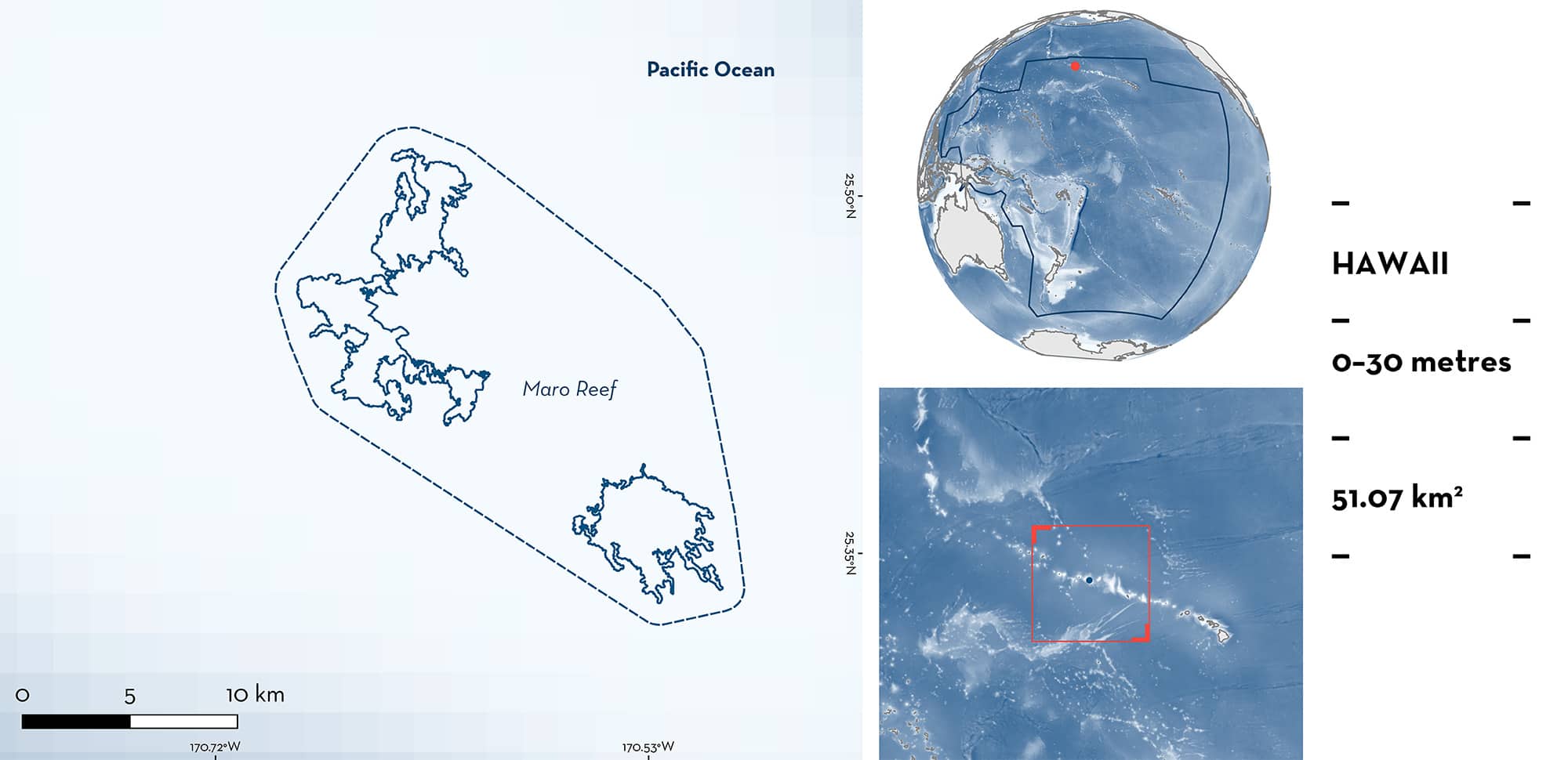
Maro Reef is located in the middle part of the Northwestern Hawaiian Islands of the United States of America. It is a submerged atoll with the largest coral reef in that Hawaiian region and is formed by linear and reticulate reef complexes radiating from the centre. The area overlaps with the Northwestern Hawaiian Islands Key Biodiversity Area and with the Papahānaumokuākea Marine National Monument. Within this area there are: undefined aggregations (Galapagos Shark Carcharhinus galapagensis).
Download factsheet
Maro Reef
DESCRIPTION OF HABITAT
Maro Reef is located in the middle part of the Northwestern Hawaiian Islands of the United States of America. Maro is a submerged open atoll and is the largest coral reef in this region of Hawaii. It is formed by linear and reticulate reef complexes radiating from the centre (Kenyon et al. 2008). It is characterised by sandy lagoons to steep reef slopes, large coral heads, ocean pinnacles, and patch reefs (Papahānaumokuākea Marine National Monument 2024). Fronts bring an increase in productivity to the area and are present between December–April, with a peak in March (Desch et al. 2009). Sea surface temperatures range from ~23°C in the boreal winter to ~27°C in the boreal summer (Desch et al. 2009).
The area overlaps with the Northwestern Hawaiian Islands Key Biodiversity Area (KBA 2024) and with the Papahānaumokuākea Marine National Monument (UNEP-WCMC & IUCN 2024).
This Important Shark and Ray Area is pelagic and is delineated from inshore and surface waters (0 m) to 30 m based on the bathymetry of the area.
CRITERION C
SUB-CRITERION C5 – UNDEFINED AGGREGATIONS
Maro Reef is an important area for undefined aggregations of one shark species.
Stationary point count surveys (25 m transect lines during a timed five minutes with four replicates) conducted during the month of September between 2000–2015 (n = 47), and towed dive surveys (undertaken up to 30 m depth and covering ~2.5 linear km in ten five-minute segments) conducted in September between 2000–2006 (n = 75), recorded the regular presence of Galapagos Shark aggregations (average = 5.6 individuals) in the area (Holzwarth et al. 2006; CREP-PIFSC 2017; ESD-PIFSC 2018, 2019).
Between 2000–2003, towed dive surveys were conducted at ten different sites across the Northwestern Hawaiian Islands and Maro Reef had the highest densities for sharks in all the banks from the Northwestern Hawaiian Islands and ranked fourth among all the sampled sites with Galapagos Shark being the most abundant shark species in the area (Holzwarth et al. 2006). Galapagos Sharks between 88–225 cm total length were observed in 17 of 59 towed dive surveys conducted in the area between 2001–2006. Aggregations were recorded in all years except for 2002 and ranged from three to 15 individuals (CREP-PIFSC 2017; ESD-PIFSC 2019). In 2016, aggregations of >20 Galapagos Sharks were reported anecdotally in a documentary (Ocean Futures Society 2016) and from Baited Remote Underwater Video Stations (BRUVS) surveys (Zill 2016). Galapagos Sharks were exclusively observed in exposed reef habitats in all the surveys conducted in the area (Holzwarth et al. 2006; CREP-PIFSC 2017; ESD-PIFSC 2018, 2019).
Historical records since the 1960s and 1970s indicate that Galapagos Shark was the most abundant shark species in the area (Papastamatiou et al. 2006). In stationary point count surveys conducted between 2000–2004, Galapagos Shark (n = 66) were observed in 16 of the 40 surveys (40%) with three aggregations of four individuals observed only in 2000 (ESD-PIFSC 2018). Further, in stationary point count surveys conducted in 2009, 2011 and 2015, Galapagos Sharks were observed in 24.3% of the surveys with aggregations observed in all years (National Oceanic and Atmospheric Administration [NOAA] unpubl. data 2024). These are small-scale surveys that cover small areas and where aggregations are not well captured (Brainard et al. 2019). The presence of Galapagos Sharks in these surveys confirms their contemporary presence and suggests that aggregations still occur in the area. Since 2015, no additional surveys have been conducted in the area. Additional information is required to determine the nature and function of these aggregations.
Download factsheet
SUBMIT A REQUEST
ISRA SPATIAL LAYER REQUEST
To make a request to download the ISRA Layer in either a GIS compatible Shapefile (.shp) or Google Earth compatible Keyhole Markup Language Zipped file (.kmz) please complete the following form. We will review your request and send the download details to you. We will endeavor to send you the requested files as soon as we can. However, please note that this is not an automated process, and before requests are responded to, they undergo internal review and authorization. As such, requests normally take 5–10 working days to process.
Should you have questions about the data or process, please do not hesitate to contact us.


