ISRA FACTSHEETS
ISRA FACTSHEETS
CENTRAL AND SOUTH AMERICAN PACIFIC REGION
Michoacan Coast
Summary
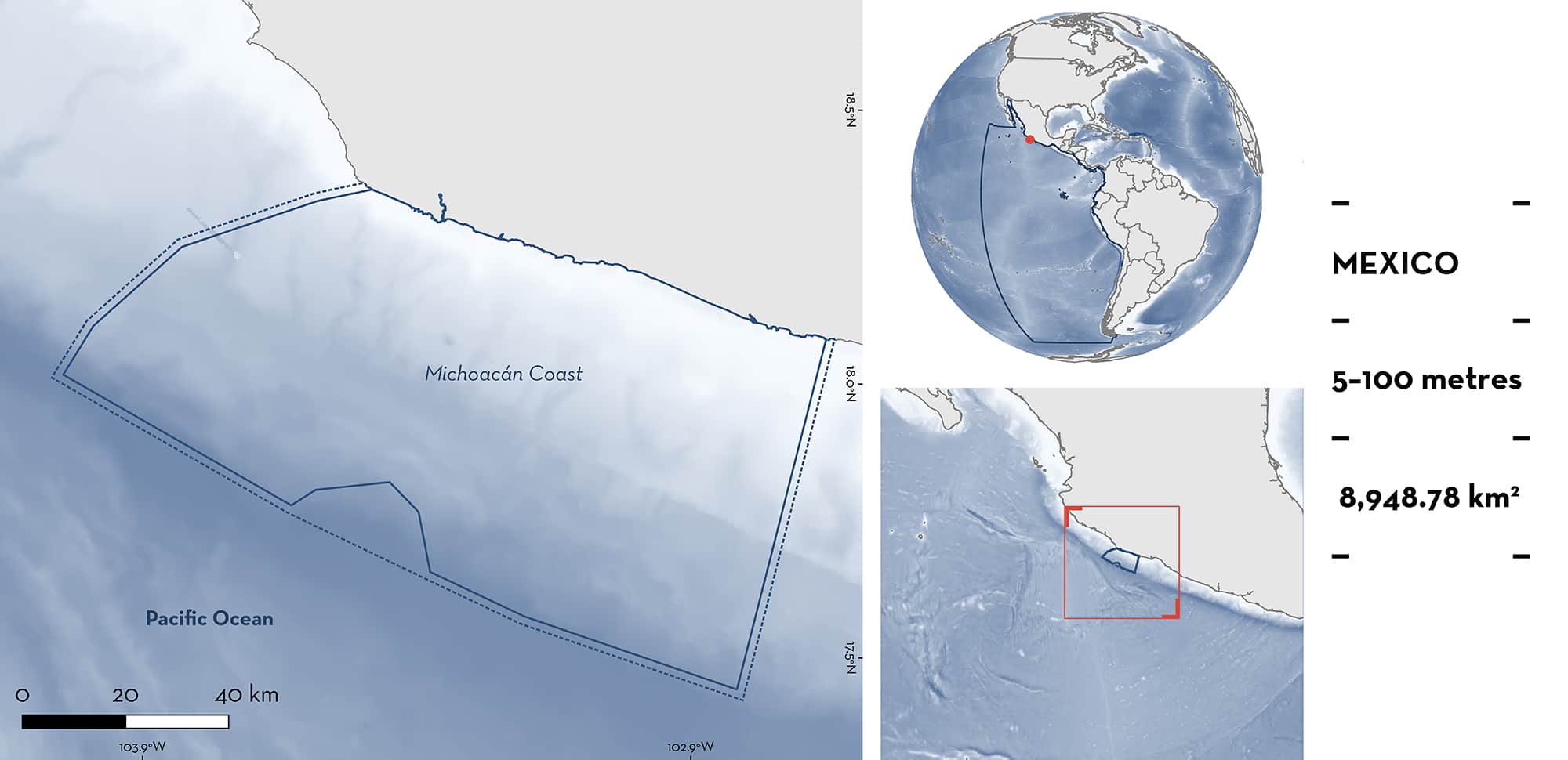
Michoacán Coast is located in the Mexican Central Pacific. It extends from the mouth of the Nexpa River in the east to the Maruata region in the west and is heavily influenced by river discharge. Combined with mixing produced by upwellings during late boreal spring (May-June), this discharge leads to an area that is highly productive. Common habitats within the area include sandy beaches, small estuaries, and rocky reefs. This area includes three Wetlands of International Importance (Ramsar sites), Playa de Maruata, Playa de Colola, and Playón Mexiquillo. Within the area, there are: threatened species, reproductive areas, and feeding areas (Scalloped Hammerhead Sphyrna lewini).
Download factsheet
Michoacan Coast
DESCRIPTION OF HABITAT
Michoacán Coast is located in the Mexican Central Pacific. It extends from the mouth of the Nexpa River in the east to the Maruata region in the west and is situated within the Pacific Central-American Coastal Large Marine Ecosystem. It is characterised by a very narrow continental shelf with sandy beaches, estuaries, and rocky reefs (Ramírez-Ortiz et al. 2011). This area is highly influenced by discharge from the Balsas, Nexpa, Mexcalhiacan, and Coahuyana rivers, that along with upwellings during late boreal spring, sustain high productivity (Toledo & Bozada 2002). Although the area is located in the tropics, it is under the influence of subtropical and temperate climatic regions. It is also subject to the influence of the Californian Current, the North-Equatorial Current, and the North-Equatorial Counter Current. Sea surface temperatures in the area range from 20°C in the winter to 32°C in the summer (Madrid et al. 1997; Anislado-Tolentino 2018). This area includes three Wetlands of International Importance (Ramsar sites), Playa de Maruata, Playa de Colola and Playón Mexiquillo (Ramsar 2022a, 2022b, 2022c).
This Important Shark and Ray Area is delineated from surface waters (0 m) to 100 m and is pelagic based on the overall vertical distribution of the Qualifying Species within the area.
CRITERION A
VULNERABILITY
One Qualifying Species considered threatened with extinction according to the IUCN Red List of Threatened SpeciesTM regularly occurs in the area. This is the Critically Endangered Scalloped Hammerhead (Rigby et al. 2019).
CRITERION C
SUB-CRITERION C1 – REPRODUCTIVE AREAS
Michoacán Coast is an important reproductive area for one shark species. The area around the mouth of the Nexpa River is reported as a nursery for Scalloped Hammerhead. Neonates with umbilical scars (44–55 cm total length [TL]) were regularly and predictably landed, mostly from May to July, between 1994 and 2004 (Anislado-Tolentino 2000, 2008). Size-at-birth is reported between 31–57 cm TL (Ebert et al. 2021), which overlaps with sizes of sharks caught in the area. Most of these neonates were captured in areas with depths of 5–50 m. Landings of neonates and juveniles represented 70% of total shark landings in the area. Additionally, pregnant females with full-term embryos are regularly recorded during the month of June. Recent studies indicate that neonates and juveniles (45–95 cm TL) of this species still dominate landings in the region (Anislado-Tolentino 2018; Arellano-Torres 2016).
In addition, mating areas have been reported within the area around the Pichilinguillo and Majagua regions based on the presence of fresh mating scars in females caught at depths between 40–90 m during August and September from 1994 to 2004. This suggests that mating occurs immediately following parturition (Anislado-Tolentino 2000, 2008, 2018).
CRITERION C
SUB-CRITERION C2 – FEEDING AREAS
Michoacán Coast is an important feeding area for one shark species. Adult male Scalloped Hammerheads who use the Mexcalhucan region, in the eastern part of the area, to feed at depths between 10–60 m. Based on stomach content analysis (n = 150 full stomachs), it was determined that these animals feed mostly on triggerfish, snappers, rays, dolphinfish, tunas, and squids. Adult females distribute in the western part of the area and feed mostly between 40–100 m on smoothhounds Mustelus spp., Humboldt Squid Dosidicus gigas, and various rays. In the Maruata area, adult Scalloped Hammerheads also feed on sea turtles, which may be related to nesting activity of Green Turtle Chelonia mydas, and sailfish (Anislado-Tolentino 2000, 2008). Neonates (5–30 m depth) feed mostly on shrimps and small rays (Dwarf Round Ray Urotrygon nana). The presence of mangrove and seagrass suggest that these smaller individuals feed in these shallow habitats. Juveniles (40–80 m depth) feed mostly on squids, small rays, and snappers between Majahuita and Caleta de Campos. These prey are abundant when these life stages are present within the area (Anislado-Tolentino 2000, 2008).
Download factsheet
SUBMIT A REQUEST
ISRA SPATIAL LAYER REQUEST
To make a request to download the ISRA Layer in either a GIS compatible Shapefile (.shp) or Google Earth compatible Keyhole Markup Language Zipped file (.kmz) please complete the following form. We will review your request and send the download details to you. We will endeavor to send you the requested files as soon as we can. However, please note that this is not an automated process, and before requests are responded to, they undergo internal review and authorization. As such, requests normally take 5–10 working days to process.
Should you have questions about the data or process, please do not hesitate to contact us.


