ISRA FACTSHEETS
ISRA FACTSHEETS
SOUTH AMERICAN ATLANTIC REGION
Montão de Trigo Island
Summary
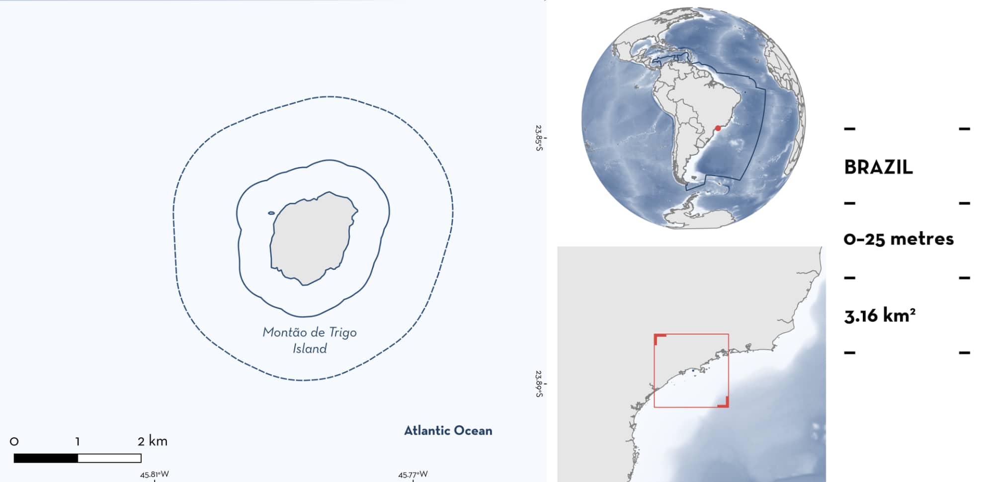
Montão de Trigo Island is located in São Paulo state, Brazil. It is situated ~13 km off the coast. The area is characterised by a rocky reef and coarse silty substrate. The area is influenced by offshore displacement of coastal and tropical water currents at the surface in austral summer months. Within this area there are: threatened species (e.g., Groovebelly Stingray Dasyatis hypostigma); reproductive areas (Spiny Butterfly Ray Gymnura altavela); and undefined aggregations (e.g., Longnose Stingray Hypanus guttatus).
Download factsheet
Montão de Trigo Island
DESCRIPTION OF HABITAT
Montão de Trigo Island is located in São Paulo state, Brazil. It is situated ~13 km off the coast. The area is characterised by a rocky reef and coarse silty substrate (Neto & Alcántara-Carrió 2024). The wind regime along the São Paulo coast varies seasonally: during austral spring and summer, winds primarily come from the east and north, whereas in autumn and winter, they shift to the southwest and west-southwest. This seasonality induces a bidirectional coastal current, flowing northeast in winter and southwest in summer, shaping the local distribution of water masses (Cerda & Castro 2014). In summer, offshore displacement of coastal and tropical water currents occurs at the surface, while South Atlantic Central Water moves onshore at deeper layers (De Castro Filho et al. 1987).
This Important Shark and Ray Area is benthic and pelagic and is delineated from surface waters (0 m) to a depth of 25 m based on the depth range of the habitat in the area.
CRITERION A
VULNERABILITY
Two Qualifying Species considered threatened with extinction according to the IUCN Red List of Threatened Species regularly occur in the area. These are the Endangered Groovebelly Stingray (Pollom et al. 2020) and Spiny Butterfly Ray (Dulvy et al. 2021).
CRITERION C
SUB-CRITERION C1 – REPRODUCTIVE AREAS
Montão de Trigo Island is an important reproductive area for one ray species.
Based on weekly recreational dives conducted year-round between 2022–2025 in the area, pregnant Spiny Butterfly Rays, sometimes occurring as assemblages with Groovebelly Stingrays and Longnose Stingrays, regularly occur within this area (RM Ferreira pers. obs. 2022–2025).
Aggregations of 5–100 Spiny Butterfly Rays were recorded during ~80% of weekly dives (RM Ferreira pers. obs. 2022–2025). Between March–August, aggregations were more frequent (100%) and larger (ranging 20–100 individuals, usually ~50). No neonates/YOY were recorded, but females with mating scars and males with swollen claspers were observed mostly during these months. Pregnant females (assumed from visual observation of extended abdomens) were also recorded predominantly between November–April and represented ~30% of aggregation size (RM Ferreira pers. obs. 2022–2025).
CRITERION C
SUB-CRITERION C5 – UNDEFINED AGGREGATIONS
Montão de Trigo Island is an important area for undefined aggregations of two ray species.
Based on weekly recreational dives conducted year-round between 2022–2025 in the area, assemblages of Groovebelly Stingrays, Spiny Butterfly Rays, and Longnose Stingrays regularly occur within this area (RM Ferreira pers. obs. 2022–2025).
Aggregations of 10–200 Groovebelly Stingrays were recorded in ~70% of weekly dives (RM Ferreira pers. obs. 2022–2025). Between March–August, aggregations were more frequent (100% of dives) and larger (range of 100–200 individuals, usually ~100). No neonates/YOY were recorded, but pregnant females (assumed from visual observation of extended abdomens) were recorded predominantly between November–April. Pregnant females represented ~20% of the aggregation size suggesting a reproductive purpose for their aggregation within this area (RM Ferreira pers. obs. 2022–2025). However, further information is needed to understand the nature and function of these aggregations.
Aggregations of 5–30 Longnose Stingrays were recorded in half of the weekly dives conducted year-round between 2022–2025 (RM Ferreira pers. obs. 2022–2025). Between March–August, aggregations were more frequent (reported from 80% of dives) and larger (ranging 20–30 individuals, usually ~20) (RM Ferreira pers. obs. 2022–2025). Further information is needed to understand the nature and function of these aggregations.
Download factsheet
SUBMIT A REQUEST
ISRA SPATIAL LAYER REQUEST
To make a request to download the ISRA Layer in either a GIS compatible Shapefile (.shp) or Google Earth compatible Keyhole Markup Language Zipped file (.kmz) please complete the following form. We will review your request and send the download details to you. We will endeavor to send you the requested files as soon as we can. However, please note that this is not an automated process, and before requests are responded to, they undergo internal review and authorization. As such, requests normally take 5–10 working days to process.
Should you have questions about the data or process, please do not hesitate to contact us.


