ISRA FACTSHEETS
ISRA FACTSHEETS
NEW ZEALAND & PACIFIC ISLANDS REGION
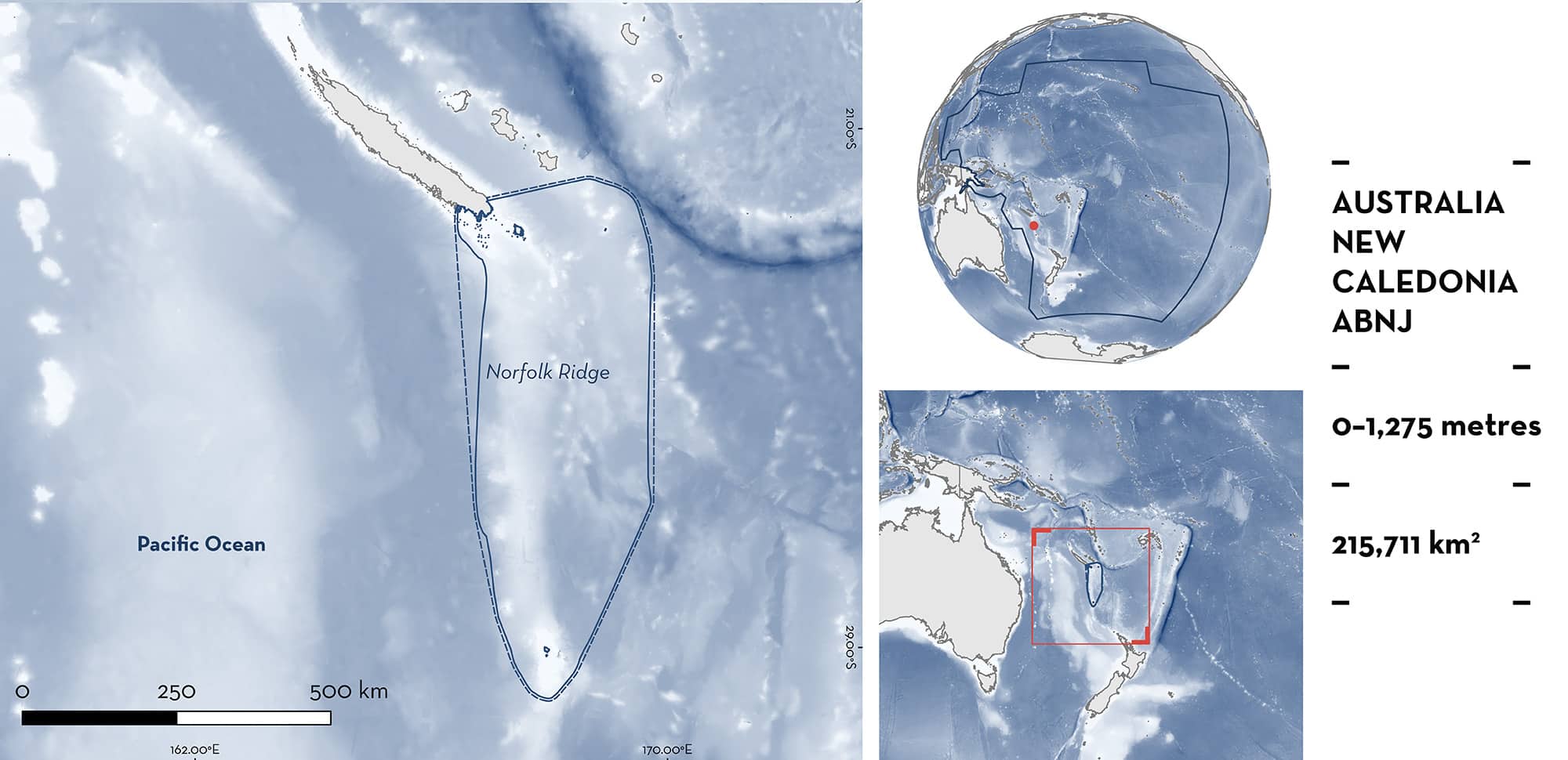
Norfolk Ridge
Summary
Norfolk Ridge is located in the western South Pacific Ocean between New Caledonia and Norfolk Island. The area follows an extensive ridge system with a depth of 1,000–1,500 m that is interspersed with seamounts and islands. It is influenced by the westward South Equatorial Current and an associated countercurrent in New Caledonia, and by the Tropical Convergence near Norfolk Island. Norfolk Ridge partly overlaps with the Norfolk Marine Park, the New Caledonian Natural Park of the Coral Sea, the Seamounts of West Norfolk Ridge Ecologically or Biologically Significant Marine Area, and the Norfolk Island/Phillip Island Key Biodiversity Area. Within this area there are areas important for movement (Tiger Shark Galeocerdo cuvier).
Download factsheet
Norfolk Ridge
DESCRIPTION OF HABITAT
Norfolk Ridge is located in the western South Pacific Ocean between New Caledonia and Norfolk Island. This area encompasses part of a larger ridge system which extends from New Zealand to New Caledonia at depths of ~1,000–1,500 m and is interspersed with islands and seamounts of volcanic origin (Francis 1993). The oceanography of the region is influenced by the East Australian Current, which flows southwards from the Coral Sea to east of Tasmania, and the South Equatorial Current, which carries tropical Pacific Ocean waters towards the Coral and Tasman Seas. Norfolk Island, at the southern end of the area, is situated at the southern limit of the Tropical Convergence, which can seasonally influence the currents (Francis 1993). When the Tropical Convergence lies south of Norfolk Island in some austral summers, warm water flows southward, while at other times the flow is eastward or northward past the island (Francis 1993). In the northern part of the area, around southern New Caledonia, the complex currents are influenced by the westward flow of the South Equatorial Current and the eastward countercurrents originating in the lee of the islands (Cravatte et al. 2015).
Norfolk Ridge partly overlaps with the Norfolk Marine Park and the New Caledonian Natural Park of the Coral Sea. It also partly overlaps with the Seamounts of West Norfolk Ridge Ecologically or Biologically Significant Marine Area (EBSA; CBD 2024) and with the Norfolk Island/Phillip Island Key Biodiversity Area (KBA 2024).
This Important Shark and Ray Area is benthopelagic and is delineated from inshore and surface waters (0 m) to 1,275 m based on the global depth range of the Qualifying Species.
CRITERION C
SUB-CRITERION C4 – MOVEMENT AREAS
Norfolk Ridge is an important movement area for one shark species.
Tiger Sharks seasonally migrate between Norfolk Island and New Caledonia. A four-year movement study (2020–2024) of 35 Tiger Sharks tagged with SPOT satellite tags off Norfolk Island (combined tracking duration: 26.7 years) has shown consistent annual migration through the area (C Huveneers et al. unpubl. data 2024). Norfolk Ridge connects the species’ seasonal feeding aggregation at Norfolk Island (December–May) with coastal areas of New Caledonia. All tracked individuals were adults or at least maturing with a total length >300 cm, and most were female (80%), reflective of the population structure at Norfolk Island (C Huveneers et al. unpubl. data 2024). Nineteen of 32 individuals with usable tracks (59%) moved from Norfolk Island directly to New Caledonia. They had a fast transit time in both directions, with a median duration of 15 days (Norfolk Island to New Caledonia) and 13 days (New Caledonia to Norfolk Island). Many of the tracks that span across multiple seasons used the area annually for their migration to and from Norfolk Island, with 88% of Tiger Sharks with a track duration >300 days (n = 16) making seasonal migrations (C Huveneers et al. unpubl. data 2024). The fast transit time and the important seasonal prey resources (mainly nesting seabirds) at Norfolk Island (L Meyer et al. unpubl. data 2024) make it likely that the Norfolk Ridge may be used as a navigational tool for Tiger Sharks to make their seasonal migration to this small offshore island ~750 km from the nearest land.
Download factsheet
SUBMIT A REQUEST
ISRA SPATIAL LAYER REQUEST
To make a request to download the ISRA Layer in either a GIS compatible Shapefile (.shp) or Google Earth compatible Keyhole Markup Language Zipped file (.kmz) please complete the following form. We will review your request and send the download details to you. We will endeavor to send you the requested files as soon as we can. However, please note that this is not an automated process, and before requests are responded to, they undergo internal review and authorization. As such, requests normally take 5–10 working days to process.
Should you have questions about the data or process, please do not hesitate to contact us.


