ISRA FACTSHEETS
ISRA FACTSHEETS
SOUTH AMERICAN ATLANTIC REGION
North Brazil Shelf
Summary
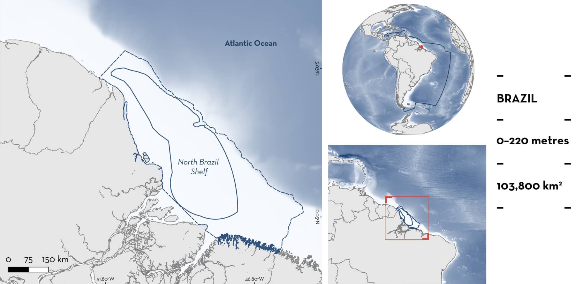
North Brazil Shelf is located off the northern coast of Brazil. It is situated off the Amazon River mouth estuary and extends offshore onto the continental shelf in the northwestern Atlantic. The area is characterised by sandy and muddy substrates, mangrove ecosystems, mesophotic coral reefs, and a prominent seamount. It is influenced by the Amazon Orinoco plume and the Great Amazon Reef System. This area overlaps with the Amazonian-Orinoco Influence Zone Ecologically or Biologically Significant Marine Area. Within this area there are: threatened species (e.g., Daggernose Shark Isogomphodon oxyrhynchus) and the area sustains a high diversity of sharks (26 species).
Download factsheet
North Brazil Shelf
DESCRIPTION OF HABITAT
North Brazil Shelf is located off the northern coast of Brazil. It is situated off the Amazon River mouth estuary and includes parts of the adjacent continental shelf. The area is characterised by rhodolith beds which are the main habitat of this portion of the continental shelf (Vale et al. 2018). It is influenced by numerous river basins, including that of the Amazon River. This increases the input of freshwater into the Atlantic Ocean and deposits sediment onto the continental shelf every day (Prestes et al. 2020). The discharge of the Amazon River, together with that of the Orinoco River, forms an Atlantic plume with low salinity and high concentrations of suspended sediments (Moura et al. 2016). In the internal zone of the continental shelf, the area is characterised by muddy substrates, whereas carbonated sediments are found on the external portion of the shelf (Allison et al. 1995).
This area overlaps with the Amazonian-Orinoco Influence Zone Ecologically or Biologically Significant Marine Area (EBSA; CBD 2025).
This Important Shark and Ray Area is benthic and pelagic and is delineated from inshore and surface waters (0 m) to 220 m based on the bathymetry of the area.
CRITERION A
VULNERABILITY
Twenty-five Qualifying Species considered threatened with extinction according to the IUCN Red List of Threatened Species regularly occur in the area. Threatened sharks comprise six Critically Endangered species, four Endangered species, and two Vulnerable species; threatened rays comprise three Critically Endangered species, four Endangered species, and six Vulnerable species (IUCN 2025).
The Shovelbill Shark is also considered Endangered according to the Red Book of Marine Fishes of Brazil (ICMBio 2018).
CRITERION D
SUB-CRITERION D2 – DIVERSITY
North Brazil Shelf sustains a high diversity of Qualifying Species (26 species). This surpasses the regional diversity threshold (25 species) for the South American Atlantic region. The regular presence of most Qualifying Species has been documented through scientific demersal trawl surveys (where the number and size of individuals were estimated) and interviews with artisanal fishers (Martins et al. 2018; Marceniuk et al. 2019; BL Sales unpubl. data 2024). Monthly estimates of capture data are available for most species. One ray species was recorded from beach trawls, longlines, and gillnets (Charvet-Almeida 2001; Marceniuk et al. 2023).
Between 2018–2023, up to 10 Oceanic Whitetip Shark, Dusky Shark, Caribbean Reef Shark, Sandbar Shark, Atlantic Nurse Shark, Daggernose Shark, Scalloped Hammerhead, Scoophead Shark, Smalleye Hammerhead individuals were caught each month, mostly during the dry season (June–November). Between 10–20 Silky Sharks (mostly in the dry season) and Great Hammerhead (year-round) were also captured each month. In the same period, ~30 Shovelbill Sharks and ~50 Smalleye Smoothhounds were captured each month, year-round (BL Sales unpubl. data 2024).
Between 2017–2024, up to 10 Whitespotted Eagle Ray, Painted Dwarf Numbfish, and Oceanic Manta Ray (although some fishers indicate up to 15 individuals could be caught) individuals were caught per month. Atlantic Pygmy Devil Ray, Bullnose Eagle Ray, Brazilian Guitarfish, American Cownose Ray, and Brazilian Cownose Ray were caught each month. Whitespotted Eagle Ray, Painted Dwarf Numbfish, and Brazilian Guitarfish are mostly caught during the rainy season (December–May). In contrast, Atlantic Pygmy Devil Ray, American Cownose Ray, and Brazilian Cownose Ray are mostly caught in the dry season. Between 2018–2023, up to 22 Wingfin Stingray (in the dry season) and Lutz’s Stingray (including observation of a pregnant female aborting three pups) were caught in this area each month. In addition, up to 35 Chola Guitarfish were caught each month during the dry season in the same period (BL Sales unpubl. data 2024). Largetooth Sawfish is regularly caught within this area, with at least three contemporary observations being video recorded in October 2021, 2022, and July 2024 (P Charvet pers. obs. 2025).
Antenna Ray is observed in this area during the rainy season, following the Amazon discharge plume (Charvet-Almeida 2001). Between 1996–1997 and 2016–2020, Antenna Rays were recorded from bottom trawl surveys in the outer region of the Amazon mouth (Marceniuk et al. 2023). Between May–December 2000, Antenna Rays were captured in this area using beach trawls, longline, and gillnets (Charvet-Almeida 2001).
Download factsheet
SUBMIT A REQUEST
ISRA SPATIAL LAYER REQUEST
To make a request to download the ISRA Layer in either a GIS compatible Shapefile (.shp) or Google Earth compatible Keyhole Markup Language Zipped file (.kmz) please complete the following form. We will review your request and send the download details to you. We will endeavor to send you the requested files as soon as we can. However, please note that this is not an automated process, and before requests are responded to, they undergo internal review and authorization. As such, requests normally take 5–10 working days to process.
Should you have questions about the data or process, please do not hesitate to contact us.


