ISRA FACTSHEETS
ISRA FACTSHEETS
WESTERN INDIAN OCEAN REGION
North Jumna Shoal
Summary
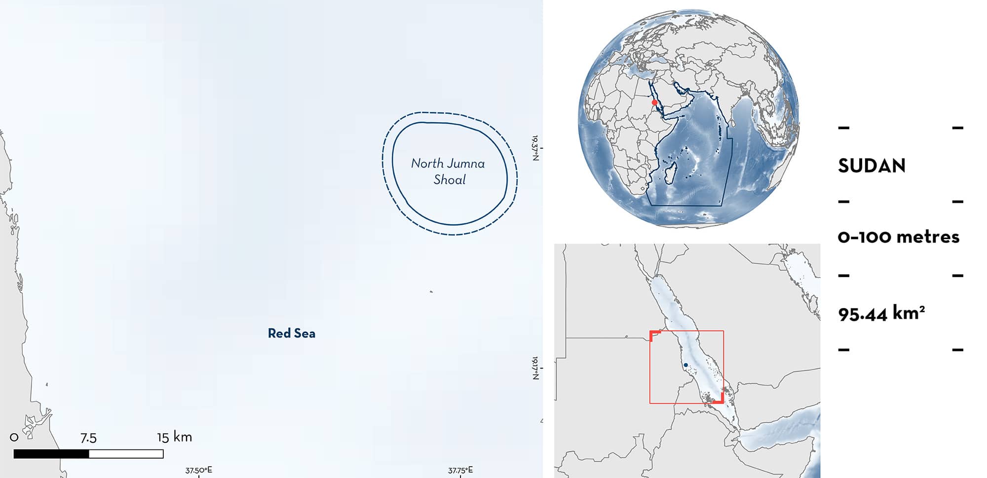
North Jumna Shoal is located in the Sudanese Red Sea, and is the northernmost reef of the Suakin Archipelago, ~48 km from Port Sudan. It is a coral platform with steep walls surrounded by deep waters. Within this area there are: threatened species and undefined aggregations (Scalloped Hammerhead Sphyrna lewini).
Download factsheet
North Jumna Shoal
DESCRIPTION OF HABITAT
North Jumna Shoal is a submerged reef platform that slopes steeply into deeper waters. The site contains reef flat, reef wall, and pelagic habitats (A Kattan pers. obs. 2023). It is the northernmost reef of the Suakin Archipelago, located ~48 km from Port Sudan (Seawolf Safari 2023).
This Important Shark and Ray Area is benthopelagic and extends from surface waters (0 m) to 100 m based on the bathymetry of the area and distribution of the Qualifying Species.
CRITERION A
VULNERABILITY
The one Qualifying Species within the area is considered threatened with extinction according to the IUCN Red List of Threatened SpeciesTM. The Scalloped Hammerhead is assessed as Critically Endangered (Rigby et al. 2019).
CRITERION C
SUB-CRITERION C5 – UNDEFINED AGGREGATIONS
North Jumna Shoal is important for undefined aggregations of one shark species.
Scalloped Hammerheads have been regularly observed in aggregations of up to 200 individuals. Surveys conducted from 2012–2017 by a single dedicated observer have recorded 72 encounters with Scalloped Hammerheads in the area. Of these encounters, there were 30 recorded aggregations of 50–200 Scalloped Hammerheads, with 10–19 encounters per year (D Coker unpubl. data 2023). This area hosts some of the largest aggregations of Scalloped Hammerheads remaining in the Red Sea (J Cochran pers. obs. 2023) along with less accessible sites in the South Suakin Archipelago (where aggregations reach up to 280 individuals) (D Coker unpubl. data 2023). More information is needed to define the nature and function of these aggregations.
Download factsheet
SUBMIT A REQUEST
ISRA SPATIAL LAYER REQUEST
To make a request to download the ISRA Layer in either a GIS compatible Shapefile (.shp) or Google Earth compatible Keyhole Markup Language Zipped file (.kmz) please complete the following form. We will review your request and send the download details to you. We will endeavor to send you the requested files as soon as we can. However, please note that this is not an automated process, and before requests are responded to, they undergo internal review and authorization. As such, requests normally take 5–10 working days to process.
Should you have questions about the data or process, please do not hesitate to contact us.


