ISRA FACTSHEETS
ISRA FACTSHEETS
ASIA REGION
Ogasawara Islands
Summary
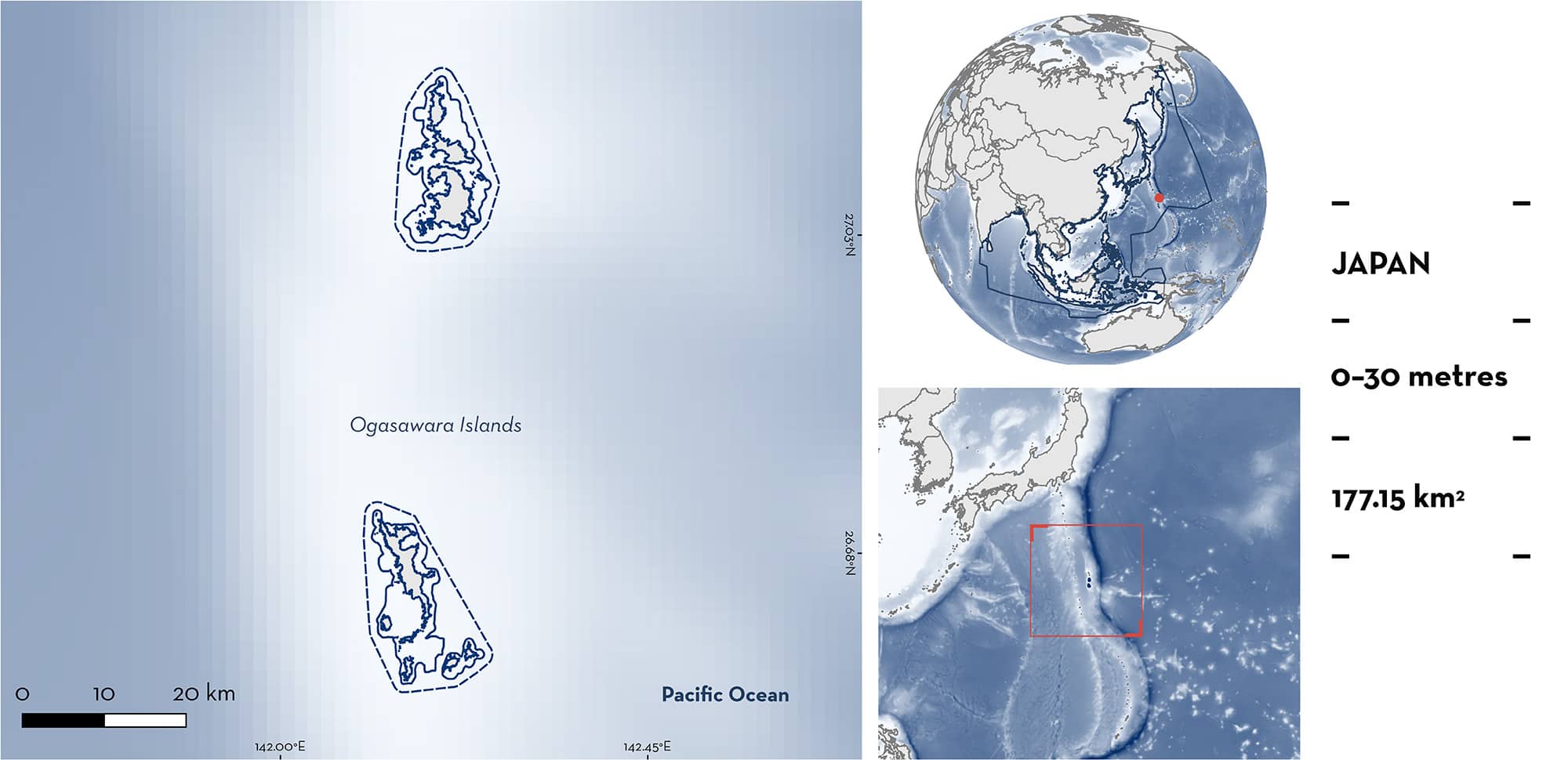
Ogasawara Islands is located in the subprefecture of Tokyo in Japan. The area is an archipelago shaped by volcanic activity and positioned away from major oceanic currents. It is characterised by caves and reefs. The area overlaps with one Ecologically or Biologically Significant Marine Area, one Key Biodiversity Area, and the Ogasawara National Park. Within this area there are: threatened species (Sand Tiger Shark Carcharias taurus) and undefined aggregations (e.g., Whitetip Reef Shark Triaenodon obesus).
Download factsheet
Ogasawara Islands
DESCRIPTION OF HABITAT
Ogasawara Islands is located in the subprefecture of Tokyo in Japan. The area is situated in the Northwest Pacific Ocean and is an archipelago shaped by volcanic activity over geological time scales (Tokyo Metropolitan Ogasawara Island Branch Office 2024). These isolated islands, positioned away from major oceanic currents, host a diverse marine habitat characterised by sandy beaches, fringing reefs, and patch reefs. The area encompasses the dive points known as North West Otouto Island and Hahajima West Pinnacle. North West Otouto Island is characterised by submerged caverns at ~22 m depth, while Hahajima West Pinnacle presents a pinnacle emerging from the surface with exposed rocks and crevasses at ~30 m depth (S Hilbourne pers. obs. 2024).
The precipitation rate is high in May and November. When the water temperature rises, typhoons occur on the ocean south of Ogasawara. Sea surface temperatures range from 19 to 28ºC (Wepfer et al. 2022).
The area overlaps with the Ogasawara Islands Ecologically or Biologically Significant Marine Area (EBSA; CBD 2024), Ogasawara Island Key Biodiversity Area (KBA 2024), and the Ogasawara National Park (Ministry of Environment, Government of Japan 2024).
This Important Shark and Ray Area is benthopelagic and is delineated from surface waters (0 m) to 30 m based on the bathymetry of the area.
CRITERION A
VULNERABILITY
Two Qualifying Species considered threatened with extinction according to the IUCN Red List of Threatened Species regularly occur in the area. These are the Critically Endangered Sand Tiger Shark (Rigby et al. 2021) and the Vulnerable Whitetip Reef Shark (Simpfendorfer et al. 2020).
CRITERION C
SUB-CRITERION C5 – UNDEFINED AGGREGATIONS
Ogasawara Islands is an important area for undefined aggregations of two shark species.
Based on local ecological knowledge (LEK), regular and predictable aggregations of Sand Tiger Sharks occur at Ogasawara Islands year-round. However, they aggregate in the shallow waters of this area during specific months, where they are regularly observed by recreational divers. Since 2019, diving activities specifically aimed at observing Sand Tiger Sharks have been organised in Chichijima and Keita islands, from November to February where group sizes of up to nine individuals can be seen (S Hilbourne pers. obs. 2024). Aggregations have also been recorded by a research diver in 2024 at 20–30 m depth in North West Otouto Island (6–7 sharks) and Hahajima West Pinnacle (3–4 sharks) (S Hilbourne pers. obs. 2024).
Sand Tiger Sharks may be aggregating in this area for reproductive purposes. Observations of individuals with fresh mating scars were reported from Ogasawara on 15th June 2018 by the Reproductive Management Committee for Sand Tiger Sharks in Japan, a monitoring program using photo-identification that began in February 2018. This suggests that the mating season for Sand Tiger Sharks might be in June in Ogasawara Islands (Nakamura et al. 2018). Another function of this aggregation may be for resting purposes. Sand Tiger Sharks have been observed resting inside caves or shipwrecks in North West Otouto Island, South Chichijima Island, and Hahajima West Pinnacle (S Hilbourne pers. obs. 2024). This is the only known aggregation site for Sand Tiger Sharks in Japan and more information is needed to understand the nature and function of these aggregations.
Between 2019–2022, Whitetip Reef Sharks were recorded aggregating in large numbers (over 20 individuals) in the shallows (1 m deep) of Wakihama-Nagisa Park in Hahajima island. Sharks are predominantly adults and mostly seen resting in groups. Aggregations occur regularly and predictably between the months of February to June (Ogasawara Kaiun 2024). Smaller groups of 3–4 Whitetip Reef Sharks have been seen in deeper waters by divers around Ogasawara Island. According to LEK, there are indications that this species might be aggregating for reproductive purposes with some females showing an extended abdomen. However, additional information is required to determine the nature and function of these aggregations.
Download factsheet
SUBMIT A REQUEST
ISRA SPATIAL LAYER REQUEST
To make a request to download the ISRA Layer in either a GIS compatible Shapefile (.shp) or Google Earth compatible Keyhole Markup Language Zipped file (.kmz) please complete the following form. We will review your request and send the download details to you. We will endeavor to send you the requested files as soon as we can. However, please note that this is not an automated process, and before requests are responded to, they undergo internal review and authorization. As such, requests normally take 5–10 working days to process.
Should you have questions about the data or process, please do not hesitate to contact us.


