ISRA FACTSHEETS
ISRA FACTSHEETS
MEDITERRANEAN AND BLACK SEAS REGION
Otranto Channel
Summary
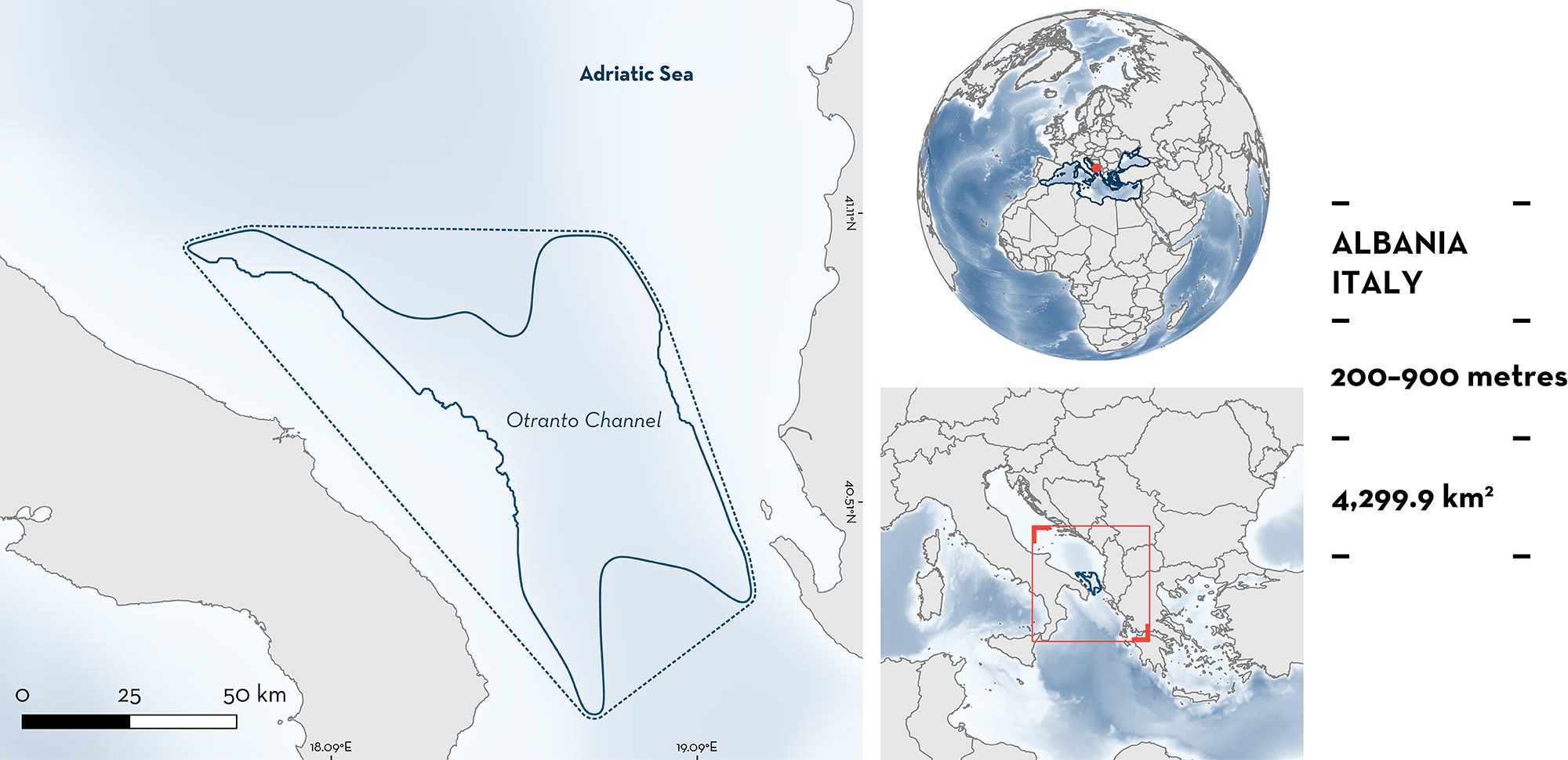
Otranto Channel is located in the southern Adriatic Sea, a sub-basin of the Mediterranean Sea in the waters of Albania and Italy. The area hosts Vulnerable Marine Ecosystems such as beds of the sessile colonial cnidarian Isidella elongata, sea pens, deepwater sponges, deepwater corals, and other colonial and solitary coral species. It overlaps with the boundary of the South Adriatic Ionian Straight Ecologically or Biologically Significant Marine Area. Within this area there are reproductive areas (Blackmouth Catshark Galeus melastomus).
Download factsheet
Otranto Channel
DESCRIPTION OF HABITAT
Otranto Channel sits in the southern Adriatic Sea, in the waters of Albania and Italy, and connects the Adriatic with the wider Mediterranean Sea. The channel is within the deep southern basin of the Adriatic and its unique physical features influence the water circulation and water exchange between the Adriatic and the wider Mediterranean Sea (UNEP/MAP-RAC/SPA 2015). Water exchange through this channel is significant, with the Adriatic Sea’s entire volume estimated to be exchanged with the Mediterranean Sea through this area every 3–4 years (Franić 2005). A sill that is 800 m deep separates the Adriatic Sea and the Ionian Sea (Fonda Umani 1996). Water masses circulating through the channel are the Adriatic surface water, Ionian surface water, Levantine intermediate water, and Adriatic deep water (McKinney 2007).
The area hosts Vulnerable Marine Ecosystems (VMEs) such as beds of the sessile colonial cnidarian Isidella elongata, sea pens, deepwater sponges, deepwater corals, and other colonial and solitary coral species. Dominant habitats and communities (‘biocoenosis’ and ‘facies’) present in the Otranto Channel, listed as priority habitats by the SPA/BD Protocol of the Barcelona Convention (UNEP/MAP-RAC/SPA 2015) comprise: Biocoenosis of shelf-edge detritic bottom (IV.2.3); Biocoenosis of bathyal mud (V.1.1); Facies of soft muds with Funiculina quadrangularis (V.1.1.3); Facies of compact muds with Isidella elongata (V.1.1.4); and Biocoenosis of deep-sea corals (V.3.1).
The habitat in the reproductive hotspots identified for the Qualifying Species was characterised by muddy substrates dominated by the bivalve Gryphus vitreus and I. elongata (Giannoulaki et al. 2013).
The area falls within the South Adriatic Ionian Straight Ecologically or Biologically Significant Marine Area (CBD 2023).
This Important Shark and Ray Area is benthic and is delineated from 200 to 900 m based on the bathymetry of the area.
CRITERION C
SUB-CRITERION C1 – REPRODUCTIVE AREAS
Otranto Channel is an important reproductive area for one species of shark.
Reproductive areas for the Blackmouth Catshark were identified in the area through the MEDISEH project using data from the Mediterranean International Trawl Survey (MEDITS) from 1994 to 2010 (Giannoulaki et al. 2013). This analysis used data from across Geographical Sub-Area (GSA 18) to identify reproductive areas at a finer scale. The identification of ‘nurseries’ and ‘spawning areas’ was based on the use of density measures to identify ‘density hot spots’ of ‘recruits’ (juveniles; <27 cm total length [TL]) and ‘spawners’ (adults; >45 cm TL) (i.e., areas where the density of these groups was significantly higher than other areas). Note that the use of the term ‘nurseries’ may not match other biological uses of the term. To evaluate the importance that each annual density hotspot played for the population, measures of temporal persistence were used (Giannoulaki et al. 2013). The stability of a density hotspot for recruits or spawners can be assumed to be an indirect measure of the importance of that area for the recruitment/spawning success of the population.
The reproductive period for Blackmouth Catshark across GSA 18 occurs in the boreal spring and summer, with recruits (juveniles) more common in late autumn (Giannoulaki et al. 2013). Across the survey years 1999–2010 and across GSA 18, the frequency of positive hauls (hauls where the species was present/all hauls) ranged 0–0.26 (mean = 0.198) and the annual sampled catch ranged 0–1,107 (mean = 526) individuals (Giannoulaki et al. 2013).
Across GSA 18, the recruit and spawner aggregations were relatively localised and generally occurred along the slope parts of Otranto Channel (Giannoulaki et al. 2013). These hotspots with higher densities of recruits and spawners were used to delineate the area (Otranto Channel). ‘Persistence’ of 40–60% was estimated for both life stages in the area indicating persistent use across survey years (i.e., regular and predictable occurrence) (Giannoulaki et al. 2013).
Download factsheet
SUBMIT A REQUEST
ISRA SPATIAL LAYER REQUEST
To make a request to download the ISRA Layer in either a GIS compatible Shapefile (.shp) or Google Earth compatible Keyhole Markup Language Zipped file (.kmz) please complete the following form. We will review your request and send the download details to you. We will endeavor to send you the requested files as soon as we can. However, please note that this is not an automated process, and before requests are responded to, they undergo internal review and authorization. As such, requests normally take 5–10 working days to process.
Should you have questions about the data or process, please do not hesitate to contact us.


