ISRA FACTSHEETS
ISRA FACTSHEETS
SOUTH AMERICAN ATLANTIC REGION
Pedra da Risca do Meio
Summary
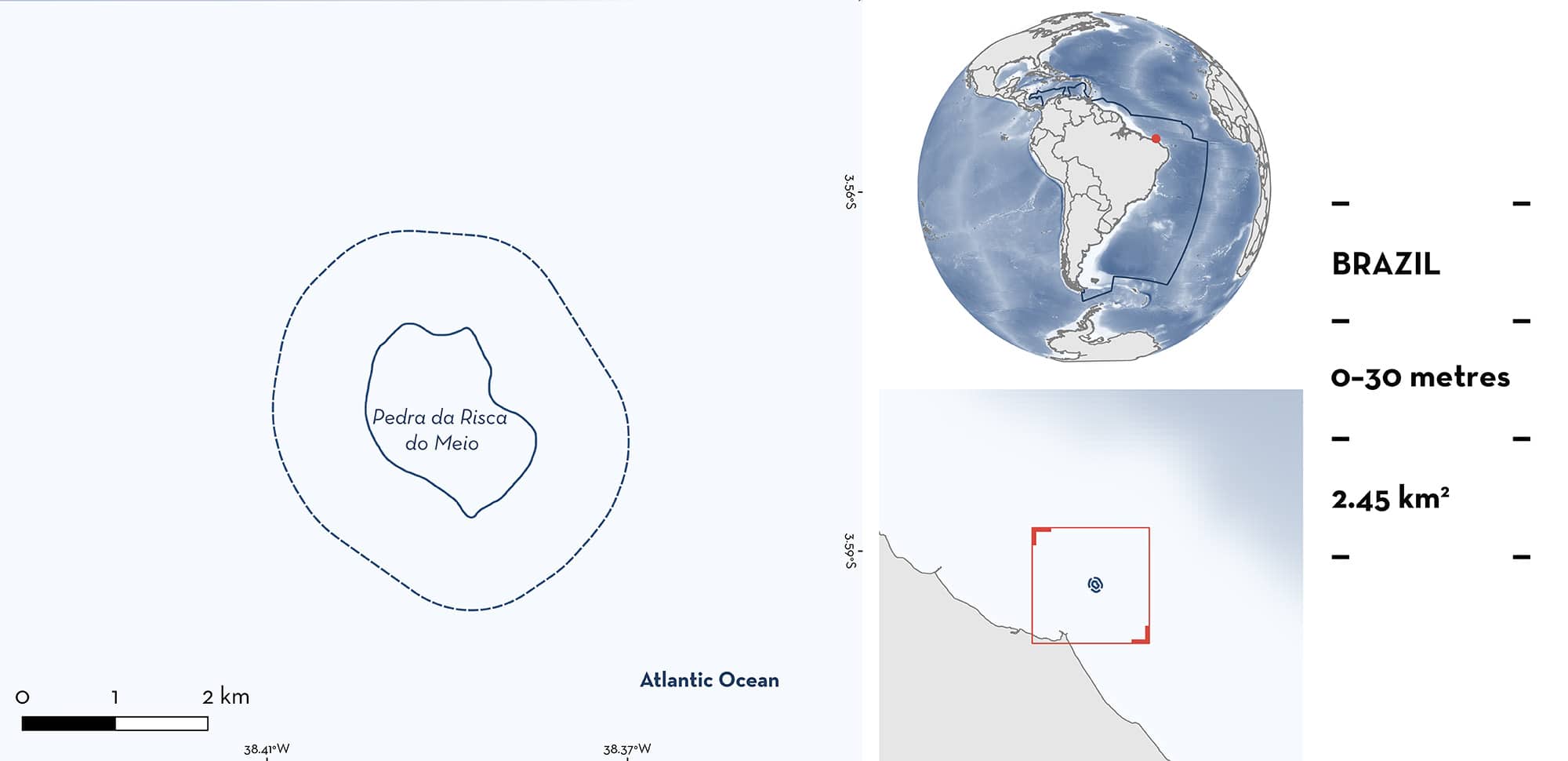
Pedra da Risca do Meio is located off Fortaleza, State of Ceará, northeastern Brazil. It is situated 18.5 km from the coastline and is characterised by sandy substrates, coral reefs, and rocky structures that produce overhangs. There is clear benthic variation with fleshy macroalgae in shallower depths and higher sponge and coral coverage at greater depths. Within this area there are: threatened species and resting areas (Atlantic Nurse Shark Ginglymostoma cirratum).
Download factsheet
Pedra da Risca do Meio
DESCRIPTION OF HABITAT
Pedra da Risca do Meio is located 18.5 km from the coastline of Fortaleza, State of Ceará, Northeastern Brazil. This area comprises part of the largest semi-continuous tropical reef system in the world, that stretches from French Guiana to the northeastern Brazilian coast. This reef complex has unusual environmental conditions for reef-building corals, such as high sedimentation inputs, periodic burials, and moderate water turbidity (Costa et al. 2024). The area is characterised by a seabed with high roughness, with reef structures inserted among patches of sand (Freitas et al. 2019). These characteristics lead to a high degree of spatial heterogeneity, with the benthic cover of fleshy macroalgae, algal turfs, sponges, crustose coralline algae, live coral, unconsolidated sediments, and a rocky substrate (Costa et al. 2024). These vary with depth; at ~17 m there is the shallow reef with macroalgae, with deeper reefs up to 27 m with high algal turf cover, corals, and sponges (Costa et al. 2024).
This Important Shark and Ray Area is benthic and pelagic and is delineated from inshore and surface waters (0 m) to 30 m based on the bathymetry of the area.
CRITERION A
VULNERABILITY
One Qualifying Species considered threatened with extinction according to the IUCN Red List of Threatened Species regularly occurs in the area. This is the Vulnerable Atlantic Nurse Shark (Carlson et al. 2021).
CRITERION C
SUB-CRITERION C3 – RESTING AREAS
Pedra da Risca do Meio is an important resting area for one shark species.
Atlantic Nurse Sharks, particularly juveniles, predictably rest at specific reefs with overhangs and caves within this area during the day (A Pantalena & J Araújo pers. obs. 2025). Animals have been observed resting in groups of up to three individuals across multiple dives at sites within this area (A Pantalena & J Araújo pers. obs. 2025). Between 2015–2025, from December–June, recreational divers undertook up to two dives per week in this area (A Pantalena & J Araújo pers. obs. 2025). They reported Atlantic Nurse Sharks resting in this area in half of the dives undertaken. Animals were observed resting in all months that dives were undertaken (A Pantalena & J Araújo pers. obs. 2025). Further information is required to determine seasonality, if any, of resting behaviour. Atlantic Nurse Sharks have been observed resting in other areas (around shipwrecks) in Brazil, but the most regular and predictable reports of resting animals are made from this area where they are also commonly seen resting alone. The area has national importance as it is the only remaining known location in Brazil where Atlantic Nurse Sharks are known to rest independently of man-made structures (VV Faria pers. obs. 2025).
Download factsheet
SUBMIT A REQUEST
ISRA SPATIAL LAYER REQUEST
To make a request to download the ISRA Layer in either a GIS compatible Shapefile (.shp) or Google Earth compatible Keyhole Markup Language Zipped file (.kmz) please complete the following form. We will review your request and send the download details to you. We will endeavor to send you the requested files as soon as we can. However, please note that this is not an automated process, and before requests are responded to, they undergo internal review and authorization. As such, requests normally take 5–10 working days to process.
Should you have questions about the data or process, please do not hesitate to contact us.


