ISRA FACTSHEETS
ISRA FACTSHEETS
MEDITERRANEAN AND BLACK SEAS REGION
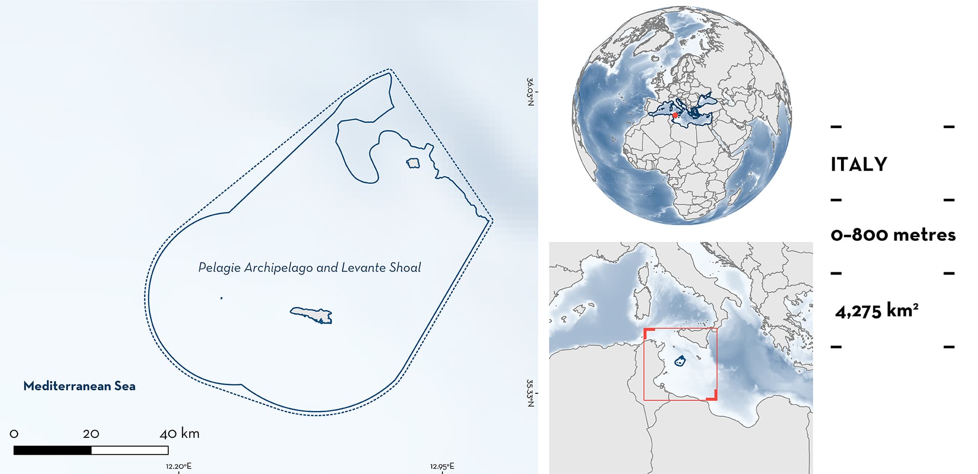
Pelagie Archipelago and Levante Shoal
Summary
Pelagie Archipelago and Levante Shoal is located on the African continental shelf of the southern Mediterranean Sea. It represents the southernmost part of Italian waters and lies within the Sicilian Channel. It includes the area around Lampedusa, Linosa, and Lampione Islands, and the channel between Lampedusa and Linosa Islands. The seafloor of this area is mostly flat and characterised by seagrass meadows, rhodolith and maërl beds, and coralligenous assemblages. The area partially overlaps with a Marine Protected Area, two Natura 2000 sites, and falls within an Ecologically or Biologically Significant Marine Area. The influence of Atlantic currents makes it a high-energy area. Within this area there are: threatened species (e.g., Shortfin Mako Isurus oxyrinchus); reproductive areas (Shortfin Mako); and undefined aggregations (Sandbar Shark Carcharhinus plumbeus).
Download factsheet
Pelagie Archipelago and Levante Shoal
DESCRIPTION OF HABITAT
Pelagie Archipelago and Levante Shoal is located in the Sicilian Channel lying on the African lithosphere, i.e., the Pelagian Block. This area is mostly characterised by sedimentary substrates corresponding to diverse marine sensitive habitats, such as underwater caves, Neptune Grass (Posidonia oceanica) meadows, coralligenous areas, and rhodolith and maërl beds (Tonielli et al. 2016; Innangi et al. 2019). These have been recognised as Vulnerable Marine Ecosystems by the European Union and other environmental commissions.
Pelagie Archipelago and Levante Shoal is a high-energy area with intense hydrodynamics caused by wave motion and influenced by a highly variable current system (the Atlantic Tunisian Current), including deepwater upwellings along the coast. A water mass (~200 m thick) of Modified Atlantic Mediterranean Water flows from the west, and after entering the Sicilian Channel, splits into the Atlantic Ionian Stream and the Atlantic Tunisian Current, the latter moving through the Pelagie Archipelago (Innangi et al. 2019).
The area partially overlaps with a Marine Protected Area (MPA), and two Natura 2000 sites, and it falls within the Sicilian Channel Ecologically or Biologically Significant Marine Area.
This Important Shark and Ray Area is delineated from surface waters (0 m) to a depth of 800 m based on the maximum depth range of the habitat used by the Qualifying Species.
CRITERION A
VULNERABILITY
Two Qualifying Species considered threatened with extinction according to the IUCN Red List of Threatened Species™ regularly occur in the area. These are the Endangered Sandbar Shark (Rigby et al. 2021), and Shortfin Mako which is assessed as Endangered globally (Rigby et al. 2019) and Critically Endangered in the Mediterranean Sea (Walls & Soldo 2016).
CRITERION C
SUB-CRITERION C1 – REPRODUCTIVE AREAS
Pelagie Archipelago and Levante Shoal is an important reproductive area for one shark species.
There is interannual evidence that young Shortfin Mako use the area between Levante shoal, Lampedusa, and Linosa Islands during the boreal summer. In July 2021 and 2022, 15 young-of-the-year (YOY) (71–81 cm total length [TL]) were incidentally captured in pelagic longlines deployed between Lampedusa, Levante Shoal, and Linosa Islands (3.4 were caught on average per 1,000 hooks, for four separate longlines; 100% of occurrence). In addition, one individual (~80 cm TL) was filmed in Levante Shoal (4.5% of occurrence in Baited Remote Underwater Video Surveys [BRUVS] [C. Cattano et al. unpubl. data 2023]). These are considered neonate or YOY as the known size-at-birth for the species is ~70 cm TL (Rigby et al. 2019) and they can grow from 16 cm TL (Cerna & Licandeo 2009) to 50 cm TL (Natanson et al. 2020) during the first year. These were caught at the end of July; parturition in the Mediterranean Sea occurs mainly in late winter to mid-spring (Mollet at al. 2000). In addition, in early June 2023, a questionnaire survey aimed at gathering information on the occurrence of Shortfin Mako YOY in the region was administered to 15 out of 17 longline fishers of Lampedusa Island. All fishers (100%) stated that incidental catches of YOY Shortfin Mako predictably occur every year from late July to September in the same area of the Archipelago (i.e., South Linosa Island and North and East Lampedusa Island). Fishers noted that is the only fishing ground in the Pelagie Archipelago where Shortfin Mako YOY are captured.
CRITERION C
SUB-CRITERION C5 – UNDEFINED AGGREGATIONS
Pelagie Archipelago and Levante Shoal is an important area for the aggregation of one shark species.
Aggregations of Sandbar Sharks in this area were first reported in 1956 (Merlo 1964). These aggregations have been recorded on BRUVS whereby five individuals were observed in a single frame in 2019, at a depth of 20–40 m (Cattano et al. 2021). Aggregations of Sandbar Sharks attract tourists to the area thus divers have made further observations. Diver-operated videos have recorded aggregations of up to 18 individuals. Sandbar Shark aggregations around Lampione have been monitored every July and September/October from 2019 to 2022 (Cattano et al. 2021; C. Cattano et al. unpubl. data 2023). This species is found in this area seasonally (from mid-July to September/October) (Cattano et al. 2021, 2023) but no other information on the purpose of these aggregations is available.
Download factsheet
SUBMIT A REQUEST
ISRA SPATIAL LAYER REQUEST
To make a request to download the ISRA Layer in either a GIS compatible Shapefile (.shp) or Google Earth compatible Keyhole Markup Language Zipped file (.kmz) please complete the following form. We will review your request and send the download details to you. We will endeavor to send you the requested files as soon as we can. However, please note that this is not an automated process, and before requests are responded to, they undergo internal review and authorization. As such, requests normally take 5–10 working days to process.
Should you have questions about the data or process, please do not hesitate to contact us.


