ISRA FACTSHEETS
ISRA FACTSHEETS
WESTERN INDIAN OCEAN REGION
Pemba Channel
Summary
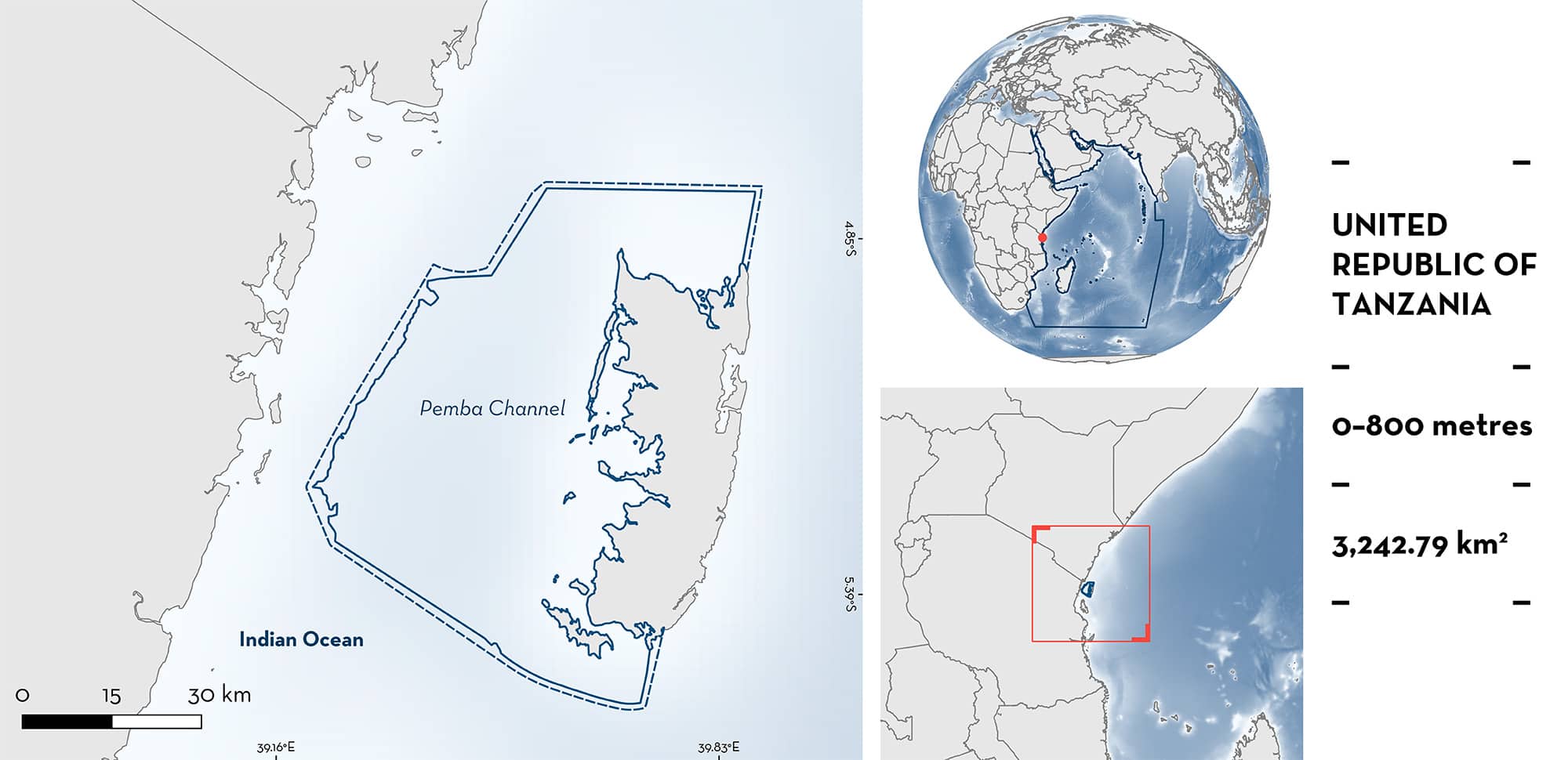
Pemba Channel is located in the Zanzibar Archipelago in Tanzania. The area includes the western side of Pemba Island and is characterised by the presence of coral reefs, mangroves, sandy substrates, and the Pemba Channel. It is mainly influenced by the East African Coastal Current and southern monsoon winds that produces upwellings and increases productivity. The area overlaps with an Ecologically or Biologically Significant Marine Area, two Key Biodiversity Areas, and one protected area. Within the area there are: threatened species (e.g., Pelagic Thresher Alopias pelagicus) and reproductive areas (e.g., Silky Shark Carcharhinus falciformis).
Download factsheet
Pemba Channel
DESCRIPTION OF HABITAT
Pemba Channel is located to the west of Pemba Island which is the main northern island in the Zanzibar Archipelago in Tanzania. The island is separated from the mainland by the Pemba Channel (~800 m depth) which brings nutrient-rich midwater to the area (Semba et al. 2019). The area is characterised by the presence of coral reefs, mangroves, and sandy substrates. The channel is directly connected to the open ocean and is characterised by a deep oceanic setting (Sekadende et al. 2020). Pemba Channel is mainly influenced by the East African Coastal Current and southern monsoon winds (May–September) that produces upwellings and increases in productivity around the island (Painter et al. 2021). Mean sea surface temperature ranges from 22°C (June–August) to 30°C (December–February). Long periods of rains occur from March–June, when the Pangani River has a higher discharge into the area (Painter 2020).
The area overlaps with the Pemba-Shimoni-Kisite Ecologically or Biologically Significant Marine Area (EBSA; CBD 2023) and two Key Biodiversity Areas (KBA), Makongwe Island and Panza Island (KBA 2023a, 2023b). In addition, it overlaps with the Pemba Channel Conservation Area.
This Important Shark and Ray Area is benthopelagic and is delineated from inshore and surface waters (0 m) to 800 m based on the bathymetry of the area and the distribution of the Qualifying Species.
CRITERION A
VULNERABILITY
Three Qualifying Species considered threatened with extinction according to the IUCN Red List of Threatened SpeciesTM regularly occur in the area. These are the Critically Endangered Bottlenose Wedgefish (Kyne et al. 2019), the Endangered Pelagic Thresher (Rigby et al. 2019), and the Vulnerable Silky Shark (Rigby et al. 2021).
CRITERION C
SUB-CRITERION C1 – REPRODUCTIVE AREAS
Pemba Channel is an important reproductive area for two shark and one ray species. These species are caught in the area mainly with gillnets and hook-and-line and were recorded regularly during artisanal fishery landing surveys on the west and south coasts of Pemba Island between 2019–2023 (Wildlife Conservation Society unpubl. data 2023).
Pelagic Threshers (n = 67) were recorded ranging from 100–360 cm total length (TL). Reported size-at-birth for this species is 158–190 cm TL (Ebert et al. 2021) and size-at-one-year is 187–204 cm TL (Drew et al. 2015). Of the individuals recorded, 39% (n = 26) were < 200 cm TL, indicating that these individuals were neonates or young-of-the-year. Furthermore, one pregnant female was landed with two near-term embryos, suggesting that this area is important not only for early life stage individuals, but also pregnant females. During the same period, no Pelagic Threshers were recorded at any of the landing sites in mainland Tanzania, and only three individuals were recorded from neighbouring Unguja Island, suggesting that the waters off Pemba Island serve as an important reproductive area and possible parturition ground in the region.
Silky Sharks (n = 576) ranging from 70–270 cm TL were recorded with 62% (n = 355) measuring 70–116 cm TL. Size-at-birth for this species is between 55–87 cm TL (Clarke et al. 2015; Ebert et al. 2021) and size-at-one-year is ~116 cm TL (Branstetter 1987). Therefore, 13% (n = 77) of individuals can be considered neonates and an additional 48% (n = 278) young-of-the-year. During the same period, only 17 Silky Sharks were recorded in similar fisheries landing site surveys in neighbouring Unguja Island, located to the south of Pemba Island, and only 17 Silky Sharks were recorded across eight landing sites on mainland Tanzania, with none recorded at Tanga landing site on mainland Tanzania which is situated directly across from Pemba Island. This evidence suggests that the waters off Pemba serve as an important reproductive area for this species compared to others in the region.
From 78 Bottlenose Wedgefishes recorded (60–300 cm TL), 12 (17%) measured 40–65 cm TL. Reported size-at-birth for the species is ~46–50 cm TL and size-at-one-year is ~65 cm TL (Iskandar et al. 2023), which confirms that these 12 individuals can be considered neonates and/or young-of-the-year. Furthermore, one pregnant female (300 cm TL) with seven near-term embryos (~40 cm TL each) was landed in May 2019. In comparison, during this same period, 112 Bottlenose Wedgefish were landed in neighbouring Unguja Island, of which only two individuals (2%) were < 65 cm TL. In the eight mainland landing sites, 55 Bottlenose Wedgefish were landed, of which only one (2%) was < 65 cm TL. This information highlights the regional importance of the waters off Pemba for reproduction.
Download factsheet
SUBMIT A REQUEST
ISRA SPATIAL LAYER REQUEST
To make a request to download the ISRA Layer in either a GIS compatible Shapefile (.shp) or Google Earth compatible Keyhole Markup Language Zipped file (.kmz) please complete the following form. We will review your request and send the download details to you. We will endeavor to send you the requested files as soon as we can. However, please note that this is not an automated process, and before requests are responded to, they undergo internal review and authorization. As such, requests normally take 5–10 working days to process.
Should you have questions about the data or process, please do not hesitate to contact us.


