ISRA FACTSHEETS
ISRA FACTSHEETS
ASIA REGION
Penghu Islands
Summary
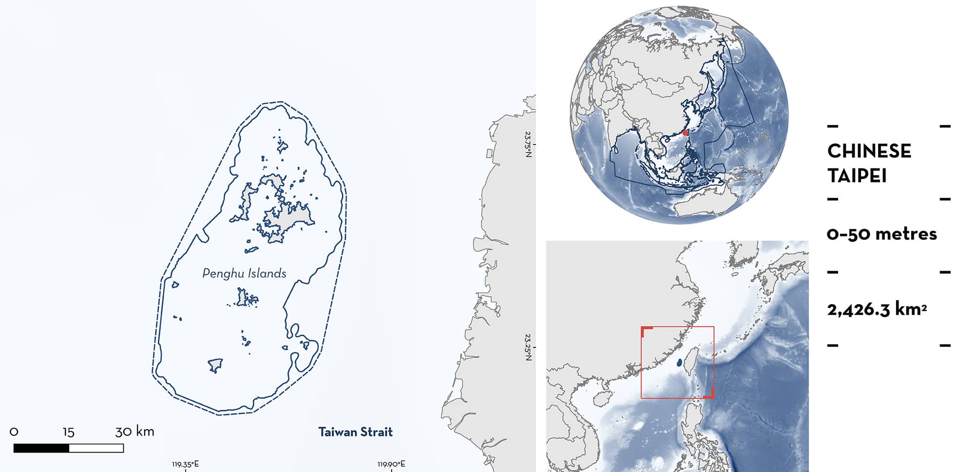
Penghu Islands is located off the west coast of the island of Taiwan. It includes 92 islands and islets and is characterised by shallower waters with coral reefs, rocky areas, and flat and sandy seabeds. The area overlaps with four Key Biodiversity Areas and three marine protected areas. Within the area there are: threatened species (Brown Guitarfish Rhinobatos schlegelii); and reproductive areas (e.g., Spottail Shark Carcharhinus sorrah).
Download factsheet
Penghu Islands
DESCRIPTION OF HABITAT
Penghu Islands is located in the Taiwan Strait, off the west coast of Chinese Taipei. The archipelago includes 92 islands and islets (Chen et al. 2020). The area is characterised by shallower waters and the inner coastlines are bordered by flat and sandy seabeds (Chen et al. 2020). The eastern coasts, battered by strong currents and monsoons, are predominantly rocky with significant coral reef formations while the western coasts are hallmarked by basalt formations (Chen et al. 2020). The northern shores display a composite of rock, decreased coral, and shell sediments and the southern parts of accumulate finer sands.
Penghu Islands is shaped significantly by the intersection of three major currents: the China Coastal Current, the Kuroshio Current branch, and the South China Sea Monsoon Current (Jan et al. 2002). The southwest monsoon from May to September produces upwellings throughout the Taiwan Strait, while from November to April, the northeast monsoon brings warm and high salinity waters from the Kuroshio Current (Hu et al. 2003). Sea surface temperature ranges from 22°C in winter to 30°C in summer (Lee et al. 2014).
The area overlaps with four Key Biodiversity Areas (KBA): Northeastern Sea Islets, Northern Sea Islets, Southern Sea Islets, and Cat Islet Seabird Refuge, Penghu County Refuge (KBA 2024a, 2024b, 2024c, 2024d). In addition, it overlaps with three marine protected areas: the Xiaomen Aquatic Organisms Propagation and Conservation Zone, the Qimei Aquatic Organisms Propagation and Conservation Zone, and the South Penghu Marine National Park.
This Important Shark and Ray Area is benthopelagic and is delineated from inshore and surface waters (0 m) to 50 m based on the depth range of the Qualifying Species in the area.
CRITERION A
VULNERABILITY
One Qualifying Species within the area is considered threatened with extinction according to the IUCN Red List of Threatened Species. The Brown Guitarfish is assessed as Endangered (Rigby et al. 2021).
CRITERION C
SUB-CRITERION C1 – REPRODUCTIVE AREAS
Penghu Islands is an important reproductive area for one shark and one ray species.
A total of 327 Spottail Sharks (171 females and 156 males) were collected from fisheries operating in the area between October 2010 to December 2011 and July 2019 to August 2021 (Hsu 2012; Joung et al. 2022). Individuals measured between 52.5–123.0 cm total length (TL) and were caught mainly with artisanal longlines operating at depths 20–60 m. A few individuals were also caught with drift nets operating between 10–50 m (Joung et al. 2022). Vertebral growth band readings revealed that individuals <80 cm TL were neonates or young-of-the-year, and these life stages represented 50% of the sampled sharks (Hsu 2012; Joung et al. 2022). Individuals between 60–70 cm TL were caught mostly between June–August, while sharks between 70–80 cm TL were caught mainly from September–November, representing 50% and 75% of the sharks caught in those months, respectively (Hsu 2012). The large number of individuals close to the reported size-at-birth (45–60 cm TL; Ebert et al. 2021) during the boreal summer indicates that pupping occurs during this season (Joung et al. 2022).
Thirteen mature female Brown Guitarfish, of which 10 were pregnant, were sampled opportunistically on 29 May 2005 and between 4 and 25 April 2006 from fisheries operating in the area (Schluessel et al. 2014). In addition, in March 2024, 66 individuals (all females) were recorded from fisheries operating in the area (H Hsu unpubl. data. 2024). Of these individuals, 25 were pregnant and 34 showed indication of recent mating due to the presence of an inflamed cloaca. Pregnant females and juveniles are commonly caught by benthic trawlers operating in Penghu Islands, with near-term embryos found during summer, indicating that pupping occurs during this season (H Hsu pers. obs. 2023). This species is regularly caught in aggregations (###g###10 individuals) in the area (H Hsu pers. obs. 2023).
Download factsheet
SUBMIT A REQUEST
ISRA SPATIAL LAYER REQUEST
To make a request to download the ISRA Layer in either a GIS compatible Shapefile (.shp) or Google Earth compatible Keyhole Markup Language Zipped file (.kmz) please complete the following form. We will review your request and send the download details to you. We will endeavor to send you the requested files as soon as we can. However, please note that this is not an automated process, and before requests are responded to, they undergo internal review and authorization. As such, requests normally take 5–10 working days to process.
Should you have questions about the data or process, please do not hesitate to contact us.


