ISRA FACTSHEETS
ISRA FACTSHEETS
MEDITERRANEAN AND BLACK SEAS REGION
Prince Islands
Summary
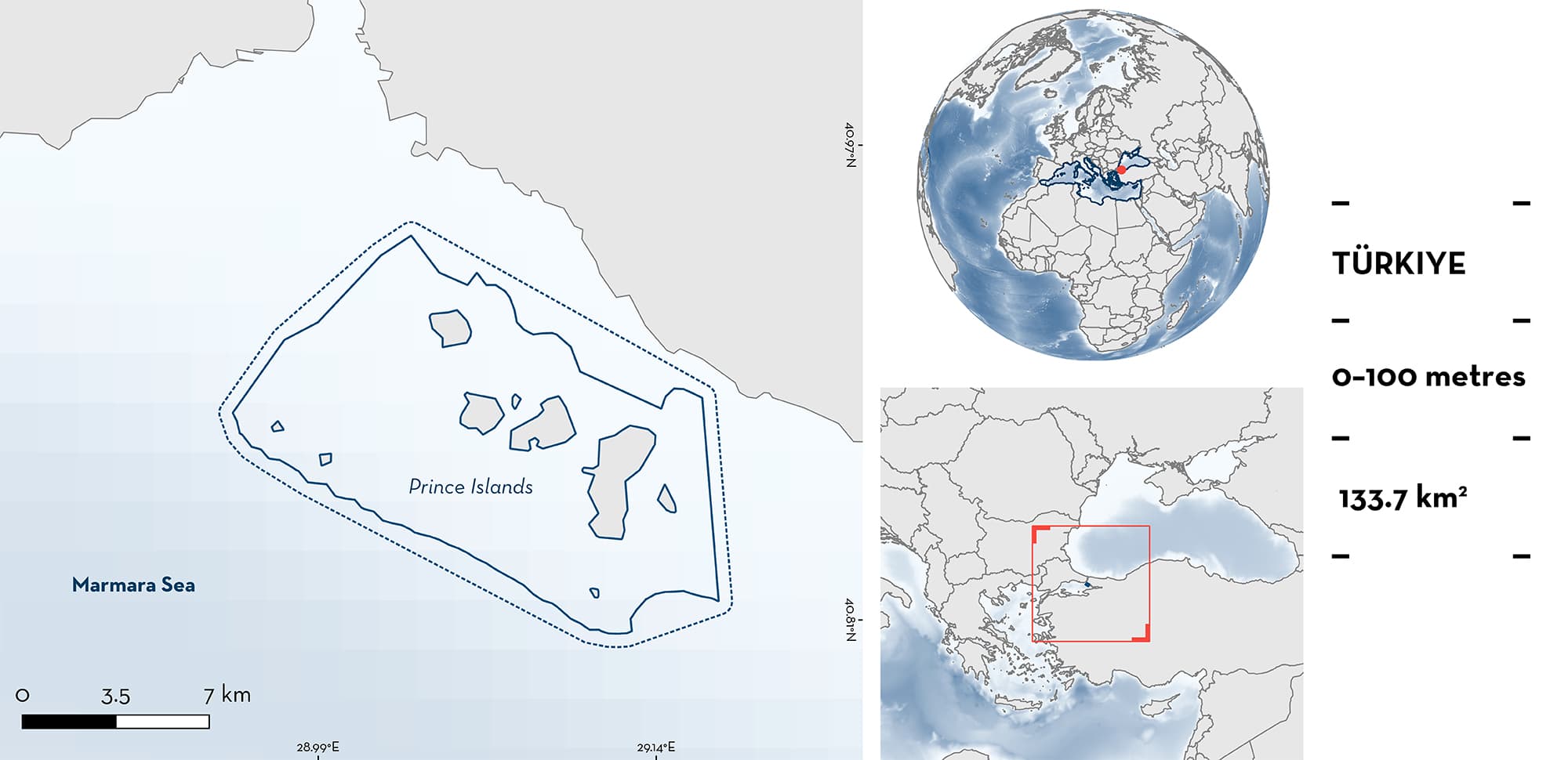
Prince Islands is an archipelago located in the northeast Marmara Sea, Türkiye. The area includes nine islands and is characterised by sandy and muddy substrates with patches of seagrass meadows and gorgonians reefs. This area overlaps with one Key Biodiversity Area and a Special Environmental Protection Area. Within the area there are: threatened species (Angular Roughshark Oxynotus centrina) and undefined aggregations (e.g., Bluntnose Sixgill Shark Hexanchus griseus).
Download factsheet
Prince Islands
DESCRIPTION OF HABITAT
Prince Islands is an archipelago located in the northeast Marmara Sea, off the Anatolian coast of Istanbul and along the coast from Bostancı to Kartal, Türkiye. The area includes nine islands: Büyükada, Heybeliada, Burgazada, Kınalıada, Sedef, Yassıada, Sivriada, Tavşan, and Kaşık (Balcıoğlu 2019). Prince Islands sits on a narrow continental shelf. In the Marmara Sea, hypoxic conditions in central trenches have forced several species to move to shallower areas on the continental shelf (Kabasakal 2022; Kabasakal et al. 2023). The area is characterised by sandy and muddy substrates with patches of Neptune Grass Posidonia oceanica meadows and gorgonian reefs (Topçu & Öztürk 2021). Average mean annual sea surface temperatures are lower in the boreal winter (~6°C) and higher in summer (~25°C). However, temperatures near the seafloor (>30 m depths) are less variable throughout the year, averaging ~14°C (Topçu & Öztürk 2021; Kayadelen et al. 2022).
The area overlaps with one Key Biodiversity Area, the İstanbul Islands (KBA 2023). In November 2021, areas around Tavşan Island were declared a Special Environmental Protection Area: the Marmara Sea and Islands Special Environmental Protection Area (Resmî Gazete 2021).
This Important Shark and Ray Area is benthopelagic and is delineated from inshore and surface waters (0 m) to 100 m based on the bathymetry of the area.
CRITERION A
VULNERABILITY
One Qualifying Species within the area is considered threatened with extinction according to the IUCN Red List of Threatened SpeciesTM. The Angular Roughshark is assessed as Endangered (Finucci et al. 2021).
CRITERION C
SUB-CRITERION C5 – UNDEFINED AGGREGATIONS
Prince Islands is an important area for undefined aggregations of two shark species. The reason(s) for these aggregations of both species is/are unknown.
Historically, the presence of Bluntnose Sixgill Sharks in areas near Prince Islands was regular, according to catches from multiple fishing gears made at depths of ~350 m (Kabasakal 2009, 2017, 2022). However, due to recent changes in species distributions driven by deoxygenation in the deeper parts of the Marmara Sea, this species is now found around Prince Islands at depths <50 m, where aggregations of two to four animals are commonly observed by commercial divers (H. Kabasakal pers. obs. 2023). Sharks caught by purse seiners in shallow waters measured between 180–250 cm total length (TL) which indicates that these are aggregations of juveniles since size-at-maturity is ~300–350 cm TL (Kabasakal 2009; Ebert et al. 2021).
The presence of Angular Roughsharks has been reported in deeper parts (below 600 m) of the Marmara Sea, in the central trenches (Kabasakal 2015, 2017). Research after 2009 demonstrated that this species also regularly occurs in the waters of the continental shelf (<200 m) (Kabasakal & Dalyan 2011; Kabasakal 2017, 2022; Kabasakal et al. 2023). One of the reasons of the regular occurrence of this deep-sea species in the shallow areas is assumed to be vertical habitat compression due to hypoxia in the deep zones (Kabasakal et al. 2023). This species has been observed aggregating regularly (usually a few individuals but groups of up to five animals have been recorded) at depths <50 m in Prince Islands since 2009, according to visual census by commercial divers (Kabasakal 2009, 2015; H. Kabasakal pers. obs. 2023). Sharks observed were <60 cm TL which indicates they are close to size-at-maturity (60–65 cm TL) (Kabasakal 2015; Ebert et al. 2021).
Download factsheet
SUBMIT A REQUEST
ISRA SPATIAL LAYER REQUEST
To make a request to download the ISRA Layer in either a GIS compatible Shapefile (.shp) or Google Earth compatible Keyhole Markup Language Zipped file (.kmz) please complete the following form. We will review your request and send the download details to you. We will endeavor to send you the requested files as soon as we can. However, please note that this is not an automated process, and before requests are responded to, they undergo internal review and authorization. As such, requests normally take 5–10 working days to process.
Should you have questions about the data or process, please do not hesitate to contact us.


