ISRA FACTSHEETS
ISRA FACTSHEETS
ASIA REGION
Probolinggo
Summary
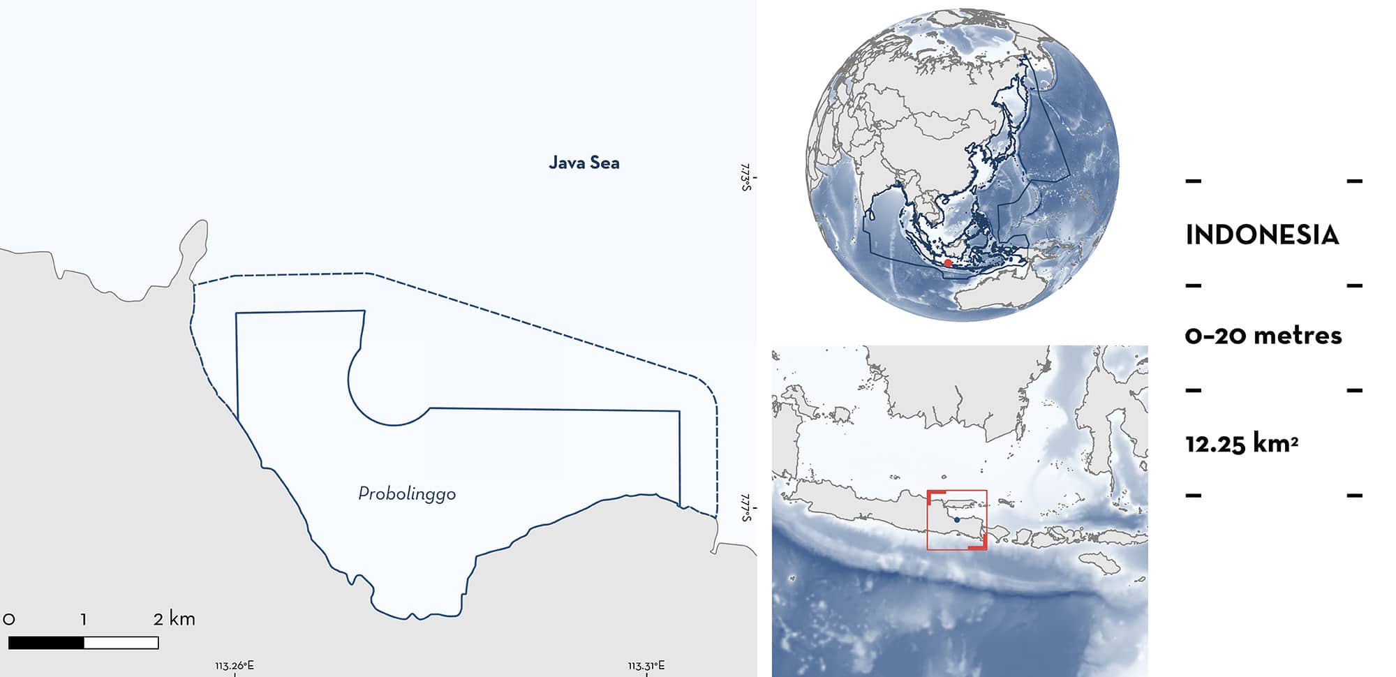
Probolinggo is situated in the Madura Strait on the north coast of Java, Indonesia. It is characterised by shallow turbid waters fringed with mangrove forests. The area overlaps with the Kawasan Konservasi Daerah Probolinggo protected area. Within the area there are: threatened species and undefined aggregations (Whale Shark Rhincodon typus).
Download factsheet
Probolinggo
DESCRIPTION OF HABITAT
Probolinggo is situated in the Madura Strait on the north coast of Java, Indonesia. It is characterised by shallow turbid waters fringed with mangrove forests. Freshwater input originates through the Banger River estuary (Putri et al. 2022). The waters of Probolinggo are characterised by oceanographic features including sea surface temperature which ranges from 28.2–31.3°C, salinity between 23–31 ppt, and high chlorophyll-a levels (0–4 mg/m3) (Wulandari et al. 2018).
This area overlaps partially with the Kawasan Konservasi Daerah (KKD) Probolinggo regional marine protected area (SIDAKO 2024).
This Important Shark and Ray Area is delineated from inshore and surface waters to a depth of 20 m based on the bathymetry of the area and observations of the Qualifying Species in the area.
CRITERION A
VULNERABILITY
The one Qualifying Species within the area is considered threatened with extinction according to the IUCN Red List of Threatened Species. The Whale Shark is assessed as Endangered (Pierce & Norman 2016).
CRITERION C
SUB-CRITERION C5 – UNDEFINED AGGREGATIONS
Probolinggo is an important area for undefined aggregations of one shark species.
Regular and predictable Whale Shark aggregations have been reported in this area based on visual census (Kamal et al. 2016; BPSPL Denpasar unpubl. data 2024). During 2021–2022, Whale Sharks were observed at the water surface from dedicated observers aboard motorboats. There were 55 observations of aggregations (i.e., two or more individuals at a time; 383 individuals in total, based on photo-identification). Of these 55 observations, 28 were of three or more animals together. The estimated mean Whale Shark aggregation size was 5.54 individuals, with a maximum of 11 individuals sighted together. Whale Sharks are present seasonally in the coastal waters of the area, from December to May (BPSPL Denpasar unpubl. data 2024) but are most frequently observed in February and move from west to east of this area from January to March (Syah et al. 2018). The highest cumulative monthly sighting of Whale Sharks was 196 individuals in February 2022 (BPSPL Denpasar unpubl. data 2024). Whale Sharks may be aggregating in this area for feeding purposes. Their presence appears to be significantly influenced by the availability of food (0.5–0.9 mg/m3 plankton), and sea surface temperature (29–30°C). The high abundance of Whale Sharks (maximum of 14 individuals observed in one day) in the area in 2016 was thought to be driven by feeding (Kamal et al. 2016). The wind-driven oceanographic conditions cause food to be in high abundance (Kamal et al. 2016) and the occurrence of this species nearby to the area is positively correlated with copepods and fish larvae (Kamal et al. 2020). Further information is required to determine the nature and function of these aggregations.
Download factsheet
SUBMIT A REQUEST
ISRA SPATIAL LAYER REQUEST
To make a request to download the ISRA Layer in either a GIS compatible Shapefile (.shp) or Google Earth compatible Keyhole Markup Language Zipped file (.kmz) please complete the following form. We will review your request and send the download details to you. We will endeavor to send you the requested files as soon as we can. However, please note that this is not an automated process, and before requests are responded to, they undergo internal review and authorization. As such, requests normally take 5–10 working days to process.
Should you have questions about the data or process, please do not hesitate to contact us.


