ISRA FACTSHEETS
ISRA FACTSHEETS
NEW ZEALAND & PACIFIC ISLANDS REGION
Pūpūkea
Summary
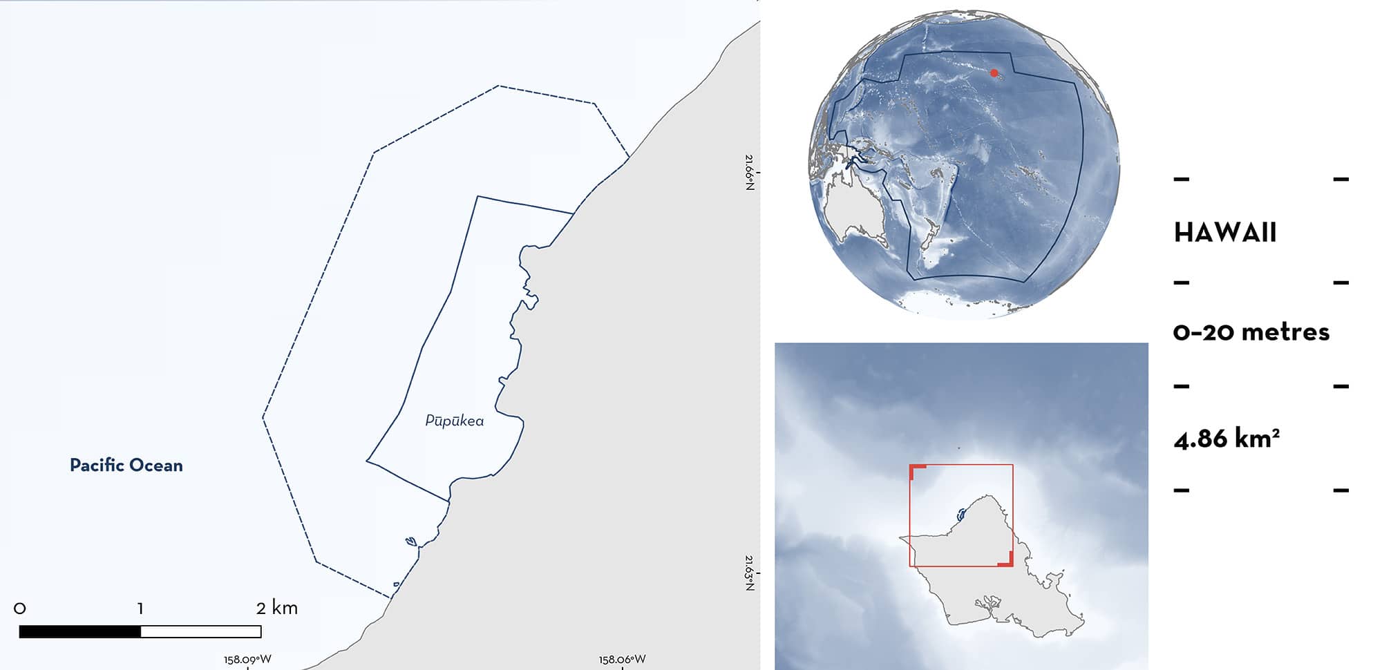
Pūpūkea is located on the North Shore of O‘ahu, in the Hawaiian Islands of the United States of America. This area is characterised by diverse marine habitats, including fringing coral reefs, rocky outcrops, and sandy substrates. The oceanographic conditions at Pūpūkea are highly seasonal. During the boreal winter months (November–April), the area is subject to strong north Pacific swells, whereas the summer months (May–October) bring calm seas. Within this area there are: threatened species and feeding areas (Reef Manta Ray Mobula alfredi).
Download factsheet
Pūpūkea
DESCRIPTION OF HABITAT
Pūpūkea is located on the North Shore of O‘ahu, in the Hawaiian Islands of the United States of America. This area is characterised by diverse marine habitats, including fringing coral reefs, rocky outcrops, and sandy substrates (Department of Land and Natural Resources [DLNR] 2024).
The oceanographic conditions at Pūpūkea are highly seasonal. During the boreal winter (November–April), the area is subject to strong north Pacific swells (Stopa et al. 2011). In contrast, the summer months (May–October) bring calm seas. The area experiences dynamic water circulation due to tidal currents and wave action, promoting nutrient mixing and supporting periodic zooplankton blooms. These blooms are crucial for sustaining the marine food web in the region. The combination of nutrient-rich waters and complex reef structures contribute to high primary productivity, which supports a diverse marine ecosystem (DLNR 2024).
This Important Shark and Ray Area is benthic and pelagic and is delineated from inshore and surface waters (0 m) to 20 m based on the bathymetry of the area.
CRITERION A
VULNERABILITY
One Qualifying Species considered threatened with extinction according to the IUCN Red List of Threatened Species regularly occurs in the area. This is the Vulnerable Reef Manta Ray (Marshall et al. 2022).
CRITERION C
SUB-CRITERION C2 – FEEDING AREAS
Pūpūkea is an important feeding area for one ray species.
Between 2021–2024, 217 sightings were confirmed in the area during summer (O‘ahu Manta Project unpubl. data 2024), comprising 59.3% of all Reef Manta Ray sightings around O‘ahu during this period (n = 366). Sea conditions prevent in-water surveys during the winter months. Reef Manta Rays were encountered on 32.1% of surveys (34/106 surveys per year). Sightings comprised between 1–4 individuals, with an average of two Reef Manta Rays observed together at a time. Reef Manta Rays were observed surface feeding or feeding along the reef ridges in 6–11 m depth during 99.5% of observations (only one sighting of a non-feeding individual). The rays are observed swimming with mouth open through visibly dense zooplankton patches (C Nevels pers. obs. 2024). They circle back to feed along specific reef ridges where zooplankton is concentrated and will often somersault feed through dense patches.
Despite dedicated survey effort and a relatively high number of resightings of Reef Manta Rays in the area, only 12 individuals have been identified in the area via photo identification (O‘ahu Manta Project unpubl. data 2024). This highlights the site fidelity of these individuals to the area and the relatively small population resident to O‘ahu. Using photographic identification on images of Reef Manta Rays, only 96 individuals have been identified around the island of O‘ahu since 2004. No records of inter-island connectivity have been documented, despite collaboration between manta ray research projects using genetics and photo identification techniques (Deakos et al. 2011, Whitney et al. 2023, C Nevels pers. obs. 2024). Of the 12 individuals identified in the area, 11 of them were confirmed as juvenile, suggesting there is some degree of habitat segregation between age classes, however, more information is needed to confirm whether this area is also important for reproduction.
Download factsheet
SUBMIT A REQUEST
ISRA SPATIAL LAYER REQUEST
To make a request to download the ISRA Layer in either a GIS compatible Shapefile (.shp) or Google Earth compatible Keyhole Markup Language Zipped file (.kmz) please complete the following form. We will review your request and send the download details to you. We will endeavor to send you the requested files as soon as we can. However, please note that this is not an automated process, and before requests are responded to, they undergo internal review and authorization. As such, requests normally take 5–10 working days to process.
Should you have questions about the data or process, please do not hesitate to contact us.


