ISRA FACTSHEETS
ISRA FACTSHEETS
NEW ZEALAND & PACIFIC ISLANDS REGION
Ros
Summary
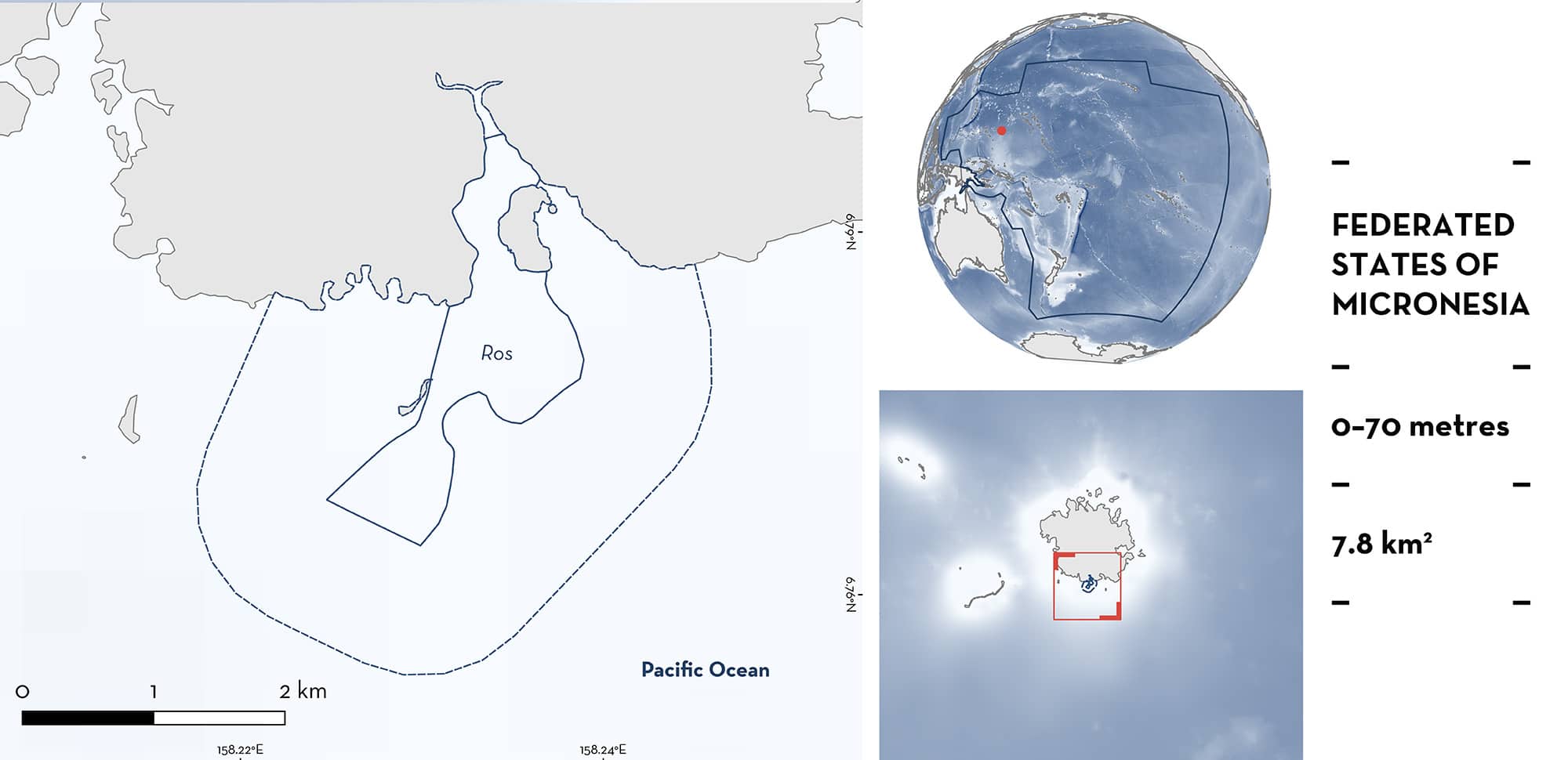
Ros is located in the south of Pohnpei in the Federated States of Micronesia. The area is characterised by coral reef features and mangrove areas where productive waters are concentrated. It is influenced by high water flows dependent on tidal movements, moon phase, and wave height. Within this area there are: threatened species, feeding areas, and undefined aggregations (Reef Manta Rays Mobula alfredi).
Download factsheet
Ros
DESCRIPTION OF HABITAT
Ros is located in the south of Pohnpei in the Federated States of Micronesia. Pohnpei is surrounded by a discontinuous barrier reef surrounding a lagoon (Rowley et al. 2019). The area is a small reef channel with the reef line on either side of the channel acting as a funnel into the small channel and the lagoon. The area is characterised by coral reef features that serve as cleaning stations, and mangrove areas where productive waters are concentrated (J Hartup pers. obs. 2024). Pohnpei is a volcanic island with high elevation and dense vegetation, resulting in high annual precipitation levels (Rowley et al. 2019), with runoff influencing the surrounding reefs and lagoon. Ros is influenced by high water flows dependent on tidal movements, moon phase, and wave heights.
This Important Shark and Ray Area is benthic and pelagic and is delineated from inshore and surface waters (0 m) to 70 m based on the bathymetry of the area.
CRITERION A
VULNERABILITY
One Qualifying Species considered threatened with extinction according to the IUCN Red List of Threatened Species regularly occurs in the area. This is the Vulnerable Reef Manta Ray (Marshall et al. 2022).
CRITERION C
SUB-CRITERION C2 – FEEDING AREAS
Ros is an important feeding area for one ray species.
Reef Manta Rays aggregate in this area to feed. Between 2013–2024, 188 scientific dive surveys were conducted around the island of Pohnpei (Micronesian Conservation Coalition [MCC] unpubl. data 2024). Of these surveys, 35 were undertaken in the area (18.6%; years 2014, 2015, 2016, 2017, 2023, and 2024). Reef Manta Rays were observed on 57% of surveys (n = 20; MCC unpubl. data 2024). In 30% of encounters (n = 6), Reef Manta Rays were observed feeding with observations of 3–5 individuals at a time. Feeding behaviours such as somersault, line, and vertical strategies have been recorded (Stevens 2016), depending on how the food is stratified through the water column (J Hartup pers. obs. 2024). Despite the low survey effort in the area, the proportion of feeding observations is similar to that of Mwand, in the northeast of Pohnpei, where survey effort is higher (n = 100) and where Reef Manta Rays are observed foraging in 30% of encounters. This demonstrates the relative importance of this area for fulfilling the foraging requirements of this species. Most observations during scientific surveys were made close to the cleaning station in the area, as this is where the scientific dive surveys are conducted (MCC unpubl. data 2024). Local ecological knowledge from fishers indicates that Reef Manta Ray aggregations have been observed in the area since the 1990’s (J Opet & K Oplet pers. comm. 2024). Fishers observe Reef Manta Rays surface feeding close to the mangroves in the area where in-water surveys are not conducted; and these aggregations coincide with periods after rainfall when productivity is suspected to be higher (J Opet & K Oplet pers. comm. 2024).
CRITERION C
SUB-CRITERION C5 – UNDEFINED AGGREGATIONS
Ros is an important area for undefined aggregations of one ray species.
Reef Manta Rays are regularly observed engaged in cleaning behaviour in the area. Between 2013–2024, 188 scientific dive surveys were conducted around the island of Pohnpei (MCC unpubl. data 2024). Of these surveys, 35 were undertaken in the area (18.6%; years 2014, 2015, 2016, 2017, 2023, and 2024). Sightings of up to five individuals engaged in cleaning behaviour in the area at one time have been recorded (mean = 2–3 individuals; MCC unpubl. data 2024). Reef Manta Rays were observed on 57% of surveys (n = 20; MCC unpubl. data 2024). From these surveys, 36 Reef Manta Ray individuals have been recorded via photo-identification. Mwand is the only other documented aggregation site for Reef Manta Rays around the island of Pohnpei, highlighting the relative importance of this area for this species. During scientific dive surveys, two pregnant females were recorded with visibly extended abdomens, and early courtship behaviour such as nudging and trailing has been observed. There is also historical information which showcases the importance of this area for aggregations of Reef Manta Rays with tourism companies undertaking dives in the area specifically to observe the Reef Manta Rays (J Hartup pers. obs. 2024). Survey effort is limited in the area due to weather and distance from the boat dock, so it is difficult to determine if the aggregation has a seasonal component.
Download factsheet
SUBMIT A REQUEST
ISRA SPATIAL LAYER REQUEST
To make a request to download the ISRA Layer in either a GIS compatible Shapefile (.shp) or Google Earth compatible Keyhole Markup Language Zipped file (.kmz) please complete the following form. We will review your request and send the download details to you. We will endeavor to send you the requested files as soon as we can. However, please note that this is not an automated process, and before requests are responded to, they undergo internal review and authorization. As such, requests normally take 5–10 working days to process.
Should you have questions about the data or process, please do not hesitate to contact us.


