ISRA FACTSHEETS
ISRA FACTSHEETS
POLAR WATERS REGION
Ross Sea Slope
Summary
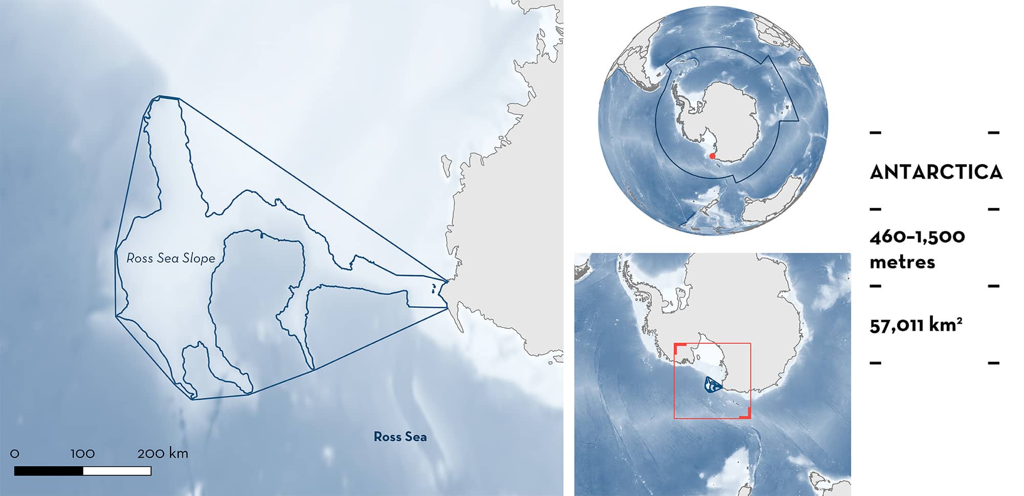
Ross Sea Slope is located in the Ross Sea of Antarctica. The area is characterised by intense seasonality, nutrient-rich waters, and extensive ice coverage most of the year. The area overlaps with the Ross Sea region Marine Protected Area. Within this area there are: reproductive areas (Antarctic Starry Skate Amblyraja georgiana).
Download factsheet
Ross Sea Slope
DESCRIPTION OF HABITAT
Ross Sea Slope is a deep bay located in Antarctica in the Southern Ocean. The Ross Sea is the southernmost sea on Earth, located about 320 km from the South Pole and is covered with ice for most of the year. Due to its remoteness, intense seasonality, and extensive ice coverage, the Ross Sea is considered amongst the least human-impacted marine environments (Halpern et al. 2008). The Ross Sea has a depth range of 200–1,200 m (average, 530 m; Smith et al. 2012).
The Ross Sea region is influenced by the coastal East-Wind Drift that sets up a circumpolar gyre accompanied by bottom-water currents that are relatively warm, high in salinity, and nutrient-rich (Bowen et al. 2021, 2023).
The area overlaps with the Ross Sea region Marine Protected Area, the world’s largest marine protected area (MFAT 2023).
This Important Shark and Ray Area is benthic and subsurface and is delineated from 460–1,500 m based on the depth range of Qualifying Species in the area.
CRITERION C
SUB-CRITERION C1 – REPRODUCTIVE AREAS
Ross Sea Slope is an important reproductive area for one ray species.
Antarctic Starry Skates are a regular incidental catch of toothfish (Dissostichus spp.) fisheries in the area (Moore et al. 2022). Skates are generally returned to the sea and are sometimes tagged before release during designated tagging years (Parker & Francis 2018; Finucci 2023). From 2005 to 2023, over 15,000 skates were tagged and released from the two primary CCAMLR small-scale research unit (SSRU) areas (88.1H and 88.1I) occurring in this area, including >12,000 Antarctic Starry Skates (Ballara et al. 2006; Parker & Francis 2018; Finucci 2023). Some Antarctic Starry Skates have been captured and recaptured at the same location within the Ross Sea Slope 10 years apart, showing that this species likely has site fidelity to Ross Sea Slope (B Finucci unpubl. data 2024).
Skate recaptures can be retained for assessment in the laboratory, and this has been conducted by New Zealand’s National Institute of Water and Atmospheric Research (NIWA) since 2002 (B Finucci unpubl. data 2024). Examined recaptures have included large mature females (n = 87) measuring 79–111 cm total length (TL; 52–77 cm pelvic length, PL) and large mature males (n = 50) measuring 72–108 cm TL (59–72 cm PL) (B Finucci unpubl. data 2024). Median size-at-maturity for both sexes for this species is 66 cm PL (Francis 2010). From 2008 to 2022, these mature individuals have been recorded every year, with the exception of the 2012 and 2013 fishing years (B Finucci unpubl. data 2024). Of these mature females, 20 individuals (23% of examined mature females) were observed carrying egg cases. These skates represent only a small proportion of the overall skate catch as most skates are alive at capture and returned to the sea immediately; only recaptured skates are retained and returned to the laboratory. These individuals are captured during the austral summer months (December–February) when the fishery has access to the region. This is the only location across the range of the species where females carrying egg cases have been observed over many years, highlighting the importance of the area for reproduction.
Download factsheet
SUBMIT A REQUEST
ISRA SPATIAL LAYER REQUEST
To make a request to download the ISRA Layer in either a GIS compatible Shapefile (.shp) or Google Earth compatible Keyhole Markup Language Zipped file (.kmz) please complete the following form. We will review your request and send the download details to you. We will endeavor to send you the requested files as soon as we can. However, please note that this is not an automated process, and before requests are responded to, they undergo internal review and authorization. As such, requests normally take 5–10 working days to process.
Should you have questions about the data or process, please do not hesitate to contact us.


