ISRA FACTSHEETS
ISRA FACTSHEETS
ASIA REGION
Saleh Bay
Summary
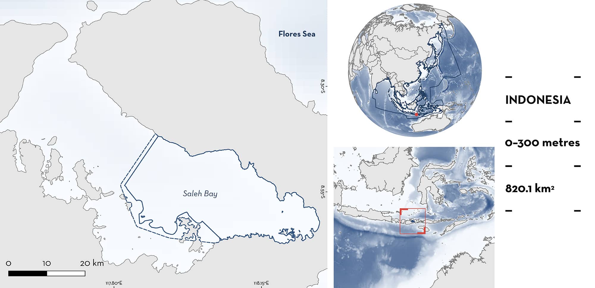
Saleh Bay is located in northeast Sumbawa Island, Indonesia. It is a semi-enclosed embayment connected to the Flores Sea and is characterised by the presence of small islands and habitats including coral reefs, seagrass, and mangroves. Saleh Bay is a high-productivity area due to inputs from several rivers year-round and seasonal upwellings. Within this area there are: threatened species and feeding areas (Whale Shark Rhincodon typus).
Download factsheet
Saleh Bay
DESCRIPTION OF HABITAT
Saleh Bay is part of the West Nusa Tenggara Province, located in northeast Sumbawa Island in Indonesia. It is a semi-enclosed embayment directly connected to the Flores Sea with limited water exchange (Farid et al. 2021). The area is characterised by several small islands and various habitats including coral reefs, seagrass, and mangroves (Herdiana et al. 2024).
Saleh Bay is a high-productivity area due to large inputs from rivers year-round and seasonal upwellings produced by monsoon winds (Yulianto et al. 2016). The northwest monsoon (December to February) brings low-speed winds and high rainfall while the southeast monsoon (June to August) brings high-speed winds and lower precipitation (Herdiana et al. 2024). Sea surface temperatures in the area range ~25–33°C (Sianipar 2022).
This Important Shark and Ray Area is benthopelagic and is delineated from inshore and surface waters (0 m) to 300 m based on the bathymetry of the area.
CRITERION A
VULNERABILITY
One Qualifying Species considered threatened with extinction according to the IUCN Red List of Threatened Species regularly occurs in the area. This is the Endangered Whale Shark (Pierce & Norman 2016).
CRITERION C
SUB-CRITERION C2 – FEEDING AREAS
Saleh Bay is an important feeding area for one shark species.
Between 2017–2022, Whale Sharks have been observed regularly in the area. Individuals are observed year-round with the largest number of observations recorded in March and April (Farid et al. 2021; Konservasi Indonesia unpubl. data 2023). The average size of sighted individuals was 512 ± 112 (mean ± SD) cm total length (TL; Konservasi Indonesia, unpubl. data 2023). Of 108 individuals identified, 99% were juveniles or sub-adults. Photo-identification revealed that 76% of individuals had been resighted across multiple years, with an average of 1.67 years between observations and a maximum of 5.12 years.
Whale Sharks commonly aggregate year-round around lift nets (bagan) targeting small pelagic fishes (atherinids and clupeids) and sergestid shrimps. Bagan fisheries use light to attract target species and Whale Sharks have been observed regularly sucking baitfish from the outside of the net. After that, Whale Sharks move to deeper areas within the bay to feed on mesopelagic prey (Farid et al. 2021; Sianipar 2022). Whale Sharks have been observed feeding on krill and small-pelagic fish in the mornings around the sites within the bay where higher biomass of these species have been reported (Yulianto et al. 2016; Farid et al. 2021) and engage in vertical migration to mesopelagic waters within the bay to presumably feed on sergestid shrimps during the afternoon (Sianipar 2022). Based on accelerometer data, vertical foraging behaviour (according to pitch angle and vertical velocity) was described for two sharks in the area (A Sianipar et al. unpub. data 2023). From 56 days of accelerometer data, vertical foraging was identified in 39% of the total tracking time. Further, local ecological knowledge indicates that Whale Sharks have been observed feeding on krill and small pelagic fishes in the area long before the bagan fishery started (since 1992), confirming the natural origin of feeding activities (Djunaidi et al. 2019).
Download factsheet
SUBMIT A REQUEST
ISRA SPATIAL LAYER REQUEST
To make a request to download the ISRA Layer in either a GIS compatible Shapefile (.shp) or Google Earth compatible Keyhole Markup Language Zipped file (.kmz) please complete the following form. We will review your request and send the download details to you. We will endeavor to send you the requested files as soon as we can. However, please note that this is not an automated process, and before requests are responded to, they undergo internal review and authorization. As such, requests normally take 5–10 working days to process.
Should you have questions about the data or process, please do not hesitate to contact us.


