ISRA FACTSHEETS
ISRA FACTSHEETS
MEDITERRANEAN AND BLACK SEAS REGION
Santa Croce Bank
Summary
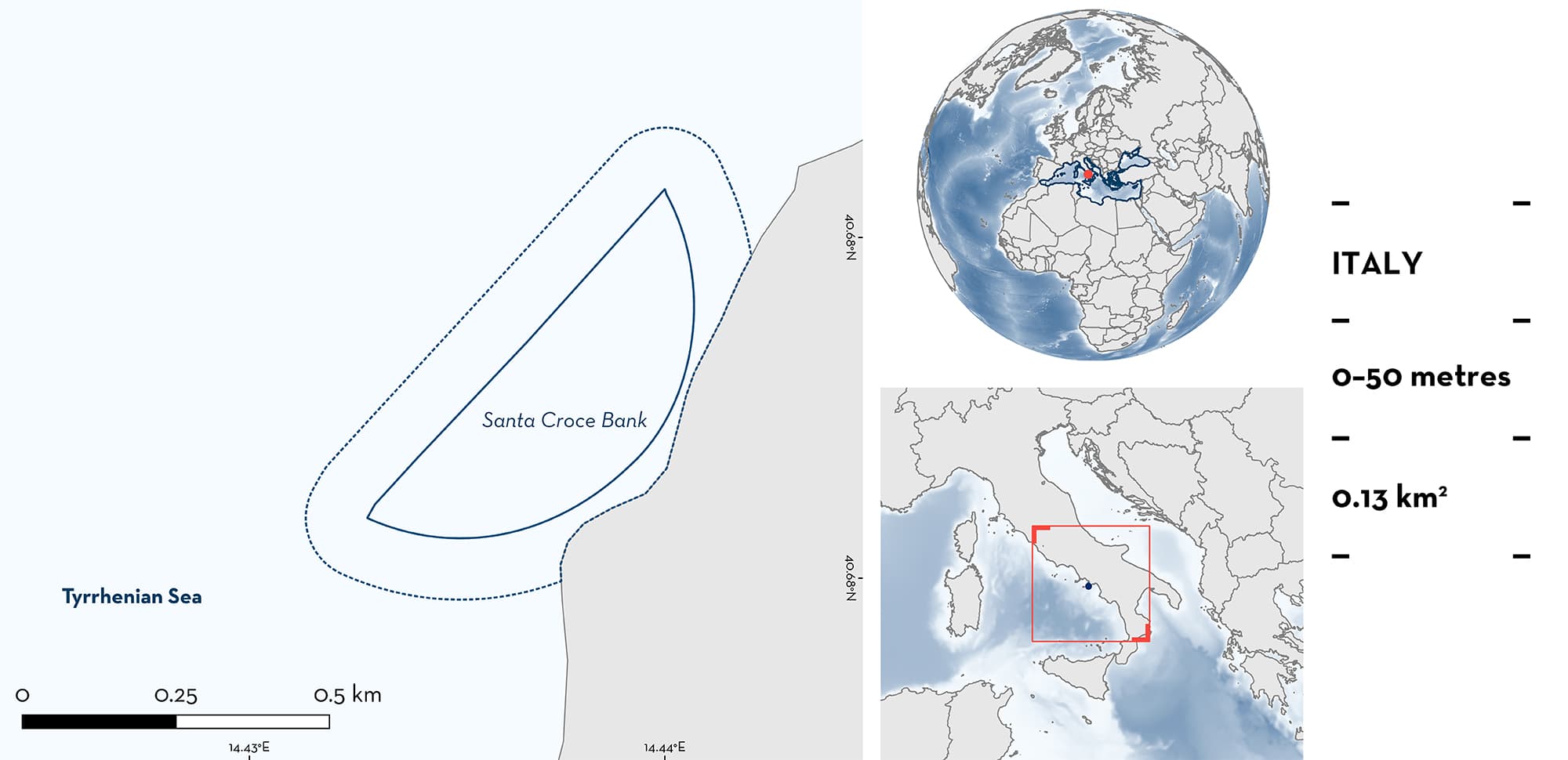
Santa Croce Bank sits in the southeastern sector of the Gulf of Naples, central Tyrrhenian Sea, Italy. Its rocky outcrops rise from seafloor depths of 9–50 m and are surrounded by sandy areas. The strong currents and suspended particulate matter, due in part to inflow from the Sarno River, support rich invertebrate and fish biodiversity. The area has been designated a ‘biologically protected area’ since 1993 and falls within a Natura 2000 site. Within this area there are: threatened species (e.g., Common Eagle Ray Myliobatis aquila); reproductive areas (Nursehound Scyliorhinus stellaris); resting areas (Nursehound); and undefined aggregations (Common Eagle Ray).
Download factsheet
Santa Croce Bank
DESCRIPTION OF HABITAT
Santa Croce Bank is located on the west coast of Italy in the Tyrrhenian Sea, central-western Mediterranean Sea. It is the main rocky bank on the southeastern side of the Gulf of Naples. It lies 600 m offshore of the Sorrento Peninsula and includes a series of rocky outcrops rising from seafloor depths of 9–50 m, surrounded by sandy habitats. The strong currents and great amount of suspended particulate matter, due to inflow from the Sarno River, support the development of rich and diversified benthic communities (Bussotti et al. 1999). Complex oceanographic processes can rapidly exchange Gulf of Naples waters between the coast and the sea or trap the outflow of the Sarno River near the coast (Cianelli et al. 2012). Seawater temperatures in the area range from a minimum of 14°C in March to a maximum of 28°C in August at 5 m depth (MedSharks unpubl. data 2023). The boreal summer is characterised by strong diurnal oscillations in the thermocline, with maximum amplitudes of several degrees Celsius and internal waves that seem to be mainly induced by the wind (de Sabata et al. 2022a, b).
This Important Shark and Ray Area is delineated from the surface (0 m) to a depth of 50 m based on the bathymetry of the area and the depth at which the Qualifying Species occur.
CRITERION A
VULNERABILITY
Two Qualifying Species considered threatened with extinction according to the IUCN Red List of Threatened SpeciesTM regularly occur in this area. These are the Vulnerable Nursehound (Finucci et al. 2021) and Critically Endangered Common Eagle Ray (Jabado et al. 2021).
CRITERION C
SUB-CRITERION C1 – REPRODUCTIVE AREAS
Santa Croce Bank is an important reproductive area for one shark species.
It is the most important egg-nursery area known in Italy for the Nursehound (de Sabata & Clò 2013, 2014). Surveys indicated that the density of eggs is higher in the area than in surrounding areas (de Sabata & Clò 2013; MedSharks unpubl. data 2023). For example, 60 egg cases were counted along an 80 m2 transect in 2013 (de Sabata & Clò 2013, 2014). In the area, eggs are attached to seafans, and in situ egg cases and adults have been photographed in the area (Lo Bianco 1909; de Sabata 2013).
CRITERION C
SUB-CRITERION C3 – RESTING AREAS
Santa Croce Bank is an important resting area for one shark species.
Nursehounds spend extended periods aggregating in ‘home’ refuges, in narrow, labyrinthine rock systems (Sims et al. 2005). MedSharks’ Stellaris Project runs a photo-identification survey collecting photographs from divers. Between 2008 and 2023, this citizen science effort produced a catalogue of around 450 sightings. Most of the sharks are sighted year-round in the Santa Croce Bank, resting in small crevices in the rocky outcrops (E. de Sabata unpubl. data 2023).
CRITERION C
SUB-CRITERION C5 – UNDEFINED AGGREGATIONS
Santa Croce Bank is an important area for undefined aggregations of one ray species.
Data from MedSharks indicates the seasonal presence of Common Eagle Rays on Santa Croce Bank since 2013 (MedSharks unpubl. data 2023). Common Eagle Rays are regularly sighted from May until September, forming aggregations of up to eight individuals (E. de Sabata pers. obs. 2023). The reason for these aggregations remains unknown but they could be a stopover area during movement.
Download factsheet
SUBMIT A REQUEST
ISRA SPATIAL LAYER REQUEST
To make a request to download the ISRA Layer in either a GIS compatible Shapefile (.shp) or Google Earth compatible Keyhole Markup Language Zipped file (.kmz) please complete the following form. We will review your request and send the download details to you. We will endeavor to send you the requested files as soon as we can. However, please note that this is not an automated process, and before requests are responded to, they undergo internal review and authorization. As such, requests normally take 5–10 working days to process.
Should you have questions about the data or process, please do not hesitate to contact us.


