ISRA FACTSHEETS
ISRA FACTSHEETS
MEDITERRANEAN AND BLACK SEAS REGION
Santa Maria di Leuca
Summary
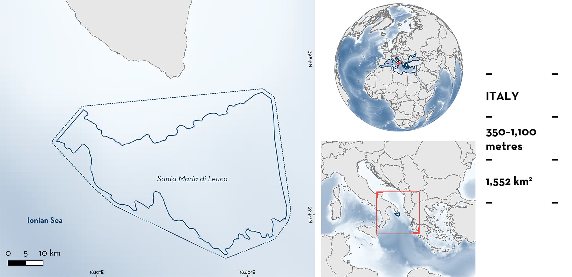
Santa Maria di Leuca is located along the Apulian continental margin between the southwest Adriatic Sea and northwest Ionian Sea. The area is included in an almost continuous belt of patchy cold-water coral banks that represents a rare example of living Lophelia–Madrepora-bearing coral mounds in the Mediterranean Sea. The area is characterised by complex and diverse coral habitat. Greater abundance of demersal fauna has often been recorded inside this area than surrounding areas, indicating refuge effects. This area overlaps with the South Adriatic Ionian Straight Ecologically or Biologically Significant Marine Area. Within this area there are: threatened species and reproductive areas (Velvet Belly Lanternshark Etmopterus spinax).
Download factsheet
Santa Maria di Leuca
DESCRIPTION OF HABITAT
Santa Maria di Leuca is located in Italian waters along the Apulian continental margin between the southwest Adriatic Sea and northwest Ionian Sea. This area has a complex seabed topography due to the presence of hard ground, fault escarpments, carbonate mounds, canyons, and other seafloor irregularities (D’Onghia et al. 2012). This area is included in an almost continuous belt of patchy cold-water coral banks that represents a rare example of living Lophelia–Madrepora-bearing coral mounds in the Mediterranean Sea (Angeletti et al. 2014).
The coral communities of Santa Maria di Leuca have the most significant growth between 500–700 m depth, which is controlled by oceanographic features, namely the influx of Adriatic Deep Water (Angeletti et al. 2014). This area has been a site of active coral growth since the late Pleistocene (Taviani et al. 2011). This area also includes deep-sea sponge aggregations that represent important biodiversity reservoirs and contribute to the trophic recycling of organic matter (Mastrototaro et al. 2010; Marín et al. 2014).
The complexity and diversity of the coral habitat are likely linked to the energetic trophic system and to hydrographic factors in the northern Ionian Sea, where an important coupling between the water column production process and the transfer of particulate matter to the bottom has been recorded (De Lazzari et al. 1999). Greater abundance of demersal fauna has often been recorded inside this area than surrounding areas, indicating refuge effects (D’Onghia et al. 2019).
This area overlaps with the South Adriatic Ionian Straight Ecologically or Biologically Significant Marine Area (CBD 2023).
This Important Shark and Ray Area is benthopelagic and is delineated at depths between 350 and 1,100 m based on the distribution of the coral banks of Santa Maria di Leuca.
CRITERION A
VULNERABILITY
The one Qualifying Species within the area is considered threatened with extinction according to the IUCN Red List of Threatened SpeciesTM. The Velvet Belly Lanternshark is assessed as Vulnerable (Finucci et al. 2021).
CRITERION C
SUB-CRITERION C1 – REPRODUCTIVE AREAS
Santa Maria di Leuca is an important reproductive area for one shark species.
The Velvet Belly Lanternshark is a common species within the cold-water coral habitat of the area (D’Onghia et al. 2010, 2012, 2016; Carluccio et al. 2021). During September–October 2005, scientific sampling was carried out with longlines and trawl nets in two types of ‘megahabitat’: inside the coral habitat (refuge area) and outside (fishing area). This revealed refuge effects in the coral habitat and fishing effects outside (D’Onghia et al. 2010, 2017). One of the most abundant bycatch species was the Velvet Belly Lanternshark (D’Onghia et al. 2010). This shark had a multi-modal body size distribution mostly made up of small individuals with sizes between 10 and 16 cm in total length (TL) (D’Onghia et al. 2010). Size-at-birth is 8–14 cm TL (Ebert et al. 2021). An average density of 430 (± 497 SD) individuals per km2 was estimated for this species inside this area from trawl nets. There was a far greater density in the refuge coral habitat, than in the fishing area (D’Onghia et al. 2010). The high density of the young-of-the-year Velvet Belly Lanternshark indicates that the coral habitat acts as a reproductive area for this species (D’Onghia et al. 2010).
During May–June and September–October 2010, scientific sampling was carried out with longlines inside the coral habitat and outside (D’Onghia et al. 2012). The results showed that Velvet Belly Lanternshark were caught with comparable numbers in the two types of megahabitat. However, highly significant differences in the body sizes between the two megahabitats were detected with a greater number of small-medium individuals captured in the coral megahabitat and a greater number of medium-large individuals in the non-coral megahabitat (D’Onghia et al. 2012). This suggests that corals provide a better refuge for the juveniles of this shark, and this area might function seasonally (September–October).
Using experimental longlining during the boreal spring–summer and autumn–winter seasons, between 2010 and 2014, the faunal assemblages of five cold-water coral sites located between the southwest Adriatic Sea and the northwest Ionian Sea (along the Apulian continental margin) were evaluated (D’Onghia et al. 2016). The results showed that the highest relative abundance (i.e., catch-per-unit-effort; CPUE) of Velvet Belly Lanternshark was in Santa Maria di Leuca, indicating the importance of the area relative to other areas.
Download factsheet
SUBMIT A REQUEST
ISRA SPATIAL LAYER REQUEST
To make a request to download the ISRA Layer in either a GIS compatible Shapefile (.shp) or Google Earth compatible Keyhole Markup Language Zipped file (.kmz) please complete the following form. We will review your request and send the download details to you. We will endeavor to send you the requested files as soon as we can. However, please note that this is not an automated process, and before requests are responded to, they undergo internal review and authorization. As such, requests normally take 5–10 working days to process.
Should you have questions about the data or process, please do not hesitate to contact us.


