ISRA FACTSHEETS
ISRA FACTSHEETS
ASIA REGION
Seram Sea
Summary
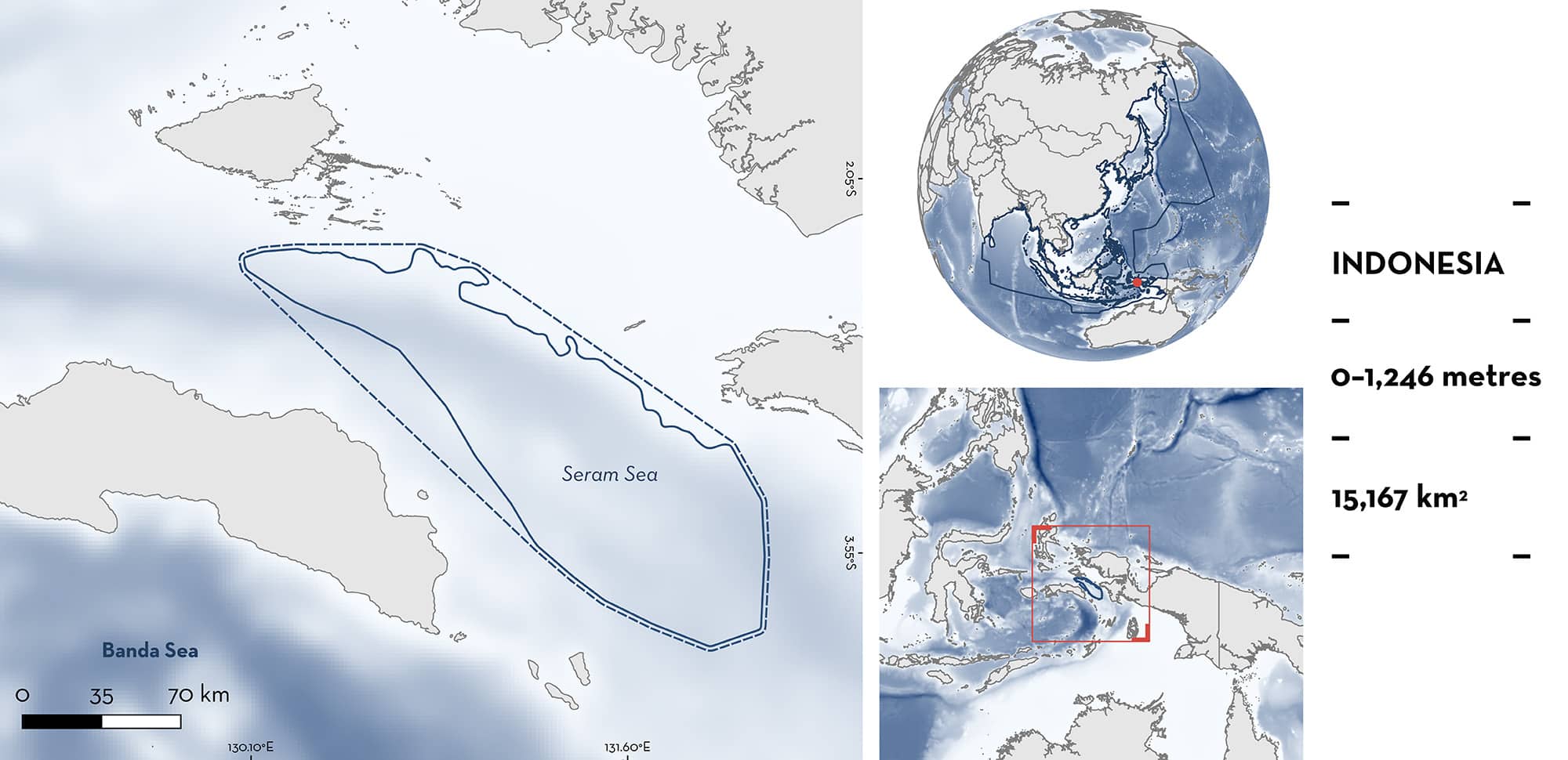
Seram Sea is located in eastern Indonesia. The area is characterised by an extended slope with deep waters and the presence of submarine canyons, troughs, and seamounts. Within this area there are: threatened species and movement areas (Oceanic Manta Ray Mobula birostris).
Download factsheet
Seram Sea
DESCRIPTION OF HABITAT
Seram Sea is located in eastern Indonesia. It is situated between Misool Island, West Papua, and Seram Island and is part of the provinces of Maluku, West Papua, and Southwest Papua. The area is characterised by an extended slope with deep waters and the presence of submarine canyons, troughs, and seamounts.
The area is highly influenced by monsoon winds (Moore et al. 2003). The southeast monsoon (June–September) produces lower sea surface temperatures and large-scale upwelling while the northwest monsoon (December–March) produces higher temperatures and a depression of the thermocline (Moore et al. 2003; Iskandar 2010).
This Important Shark and Ray Area is pelagic and is delineated from surface waters (0 m) to 1,246 m based on the global depth range of the Qualifying Species.
CRITERION A
VULNERABILITY
One Qualifying Species within the area is considered threatened with extinction according to the IUCN Red List of Threatened Species. The Oceanic Manta Ray is assessed as Endangered (Marshall et al. 2022).
CRITERION C
SUB-CRITERION C4 – MOVEMENT AREAS
Seram Sea is an important movement area for one ray species.
Between 2012–2016 and during 2022, 13 Oceanic Manta Rays were tagged with satellite transmitters at cleaning stations in southeast Misool (E Setyawan & CS Beale unpubl. data 2024). Tracking of tagged individuals lasted between 60–270 days (average, 164 days). Tagged rays moved back and forth to offshore areas in the Seram Sea, to coastal areas around Seram Island, and to coastal aggregation sites and cleaning stations in West Papua (E Setyawan & CS Beale unpubl. data 2024). No seasonality was found in these movements.
Download factsheet
SUBMIT A REQUEST
ISRA SPATIAL LAYER REQUEST
To make a request to download the ISRA Layer in either a GIS compatible Shapefile (.shp) or Google Earth compatible Keyhole Markup Language Zipped file (.kmz) please complete the following form. We will review your request and send the download details to you. We will endeavor to send you the requested files as soon as we can. However, please note that this is not an automated process, and before requests are responded to, they undergo internal review and authorization. As such, requests normally take 5–10 working days to process.
Should you have questions about the data or process, please do not hesitate to contact us.


