ISRA FACTSHEETS
ISRA FACTSHEETS
ASIA REGION
Sesayap
Summary
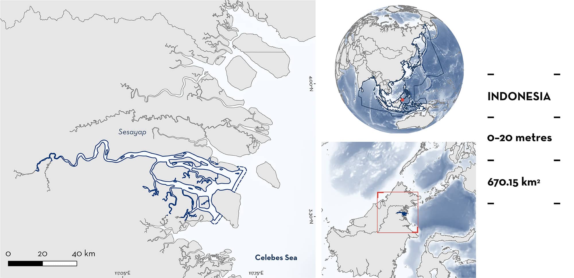
Sesayap is located in North Kalimantan, Indonesia. Sesayap River is a relatively fast flowing river, and combined with a large local tidal variation, it forms a large estuarine delta environment. The position of the estuary is dynamic across seasons (wet and dry) and tidal cycles (spring and neap). Water in the estuary is highly turbid and the substrate is silty. The banks of the river are mainly lined with mangroves. Within this area there are: threatened species and reproductive areas (Ganges Shark Glyphis gangeticus).
Download factsheet
Sesayap
DESCRIPTION OF HABITAT
Sesayap is located in North Kalimantan, Indonesia. The area is a river that drains from the Iran Mountain Range at the border of North Kalimantan (Indonesia) and Sarawak (Malaysia) east toward the Sulu-Celebes Sea. Sesayap is centrally positioned along North Kalimantan’s coastline, adjoining the Kayan and Bahau River estuaries to the south, and the Sebuku and Sembakung River estuaries to the north. The Sesayap River lacks a floodplain, as the Iran Mountain Range extends close to the coast. As a result, the Sesayap is a relatively fast flowing river, and combined with a large local tidal variation, it forms a large estuarine delta environment. The position of the estuary is dynamic across seasons (wet and dry) and tidal cycles (spring and neap). In the wetter months (October–April) the estuary is closer to the coast at the mouth of the river. In drier months (June–August) the estuary can occur as far upriver as Malinau or Tanjung Lapang (Kreb & Rukman 2010). Water in the estuary is highly turbid and the substrate is silty. The banks are lined with riparian vegetation dominated by mangroves.
This Important Shark and Ray Area is benthopelagic and is delineated from surface waters (0 m) to 20 m based on the bathymetry of the area.
CRITERION A
VULNERABILITY
One Qualifying Species within the area is considered threatened with extinction according to the IUCN Red List of Threatened Species. The Ganges Shark is assessed as Critically Endangered (Rigby et al. 2021).
CRITERION C
SUB-CRITERION C1 – REPRODUCTIVE AREAS
Sesayap is an important reproductive area for one shark species.
During surveys in July–August 2023, 17 Ganges Sharks were discovered in Sesayap through observations from small-scale fishers (Grant et al. unpubl. data 2023). Lengths of individuals ranged from ~58–108 cm total length (TL) and included neonate and young-of-the-year (YOY) individuals. The known size-at-birth for the Ganges Shark is ~58–61 cm TL (Ebert et al. 2021). In these same surveys, a further ~50 fin sets from small individuals, likely including neonates and young-of-the-year, were observed in villages within the area. Fishers reported the presence of small Ganges Sharks during their lifetimes, through local ecological knowledge (LEK) interviews that included a reference photograph of the species. Research on congeneric species in Australia shows that YOY river sharks display daily and seasonal movements to remain within a relatively narrow salinity range (Pillans et al 2009; Dwyer et al. 2020).
There is no indication that YOY move into fresh- or marine water for prolonged periods (Grant et al. 2023), and thus it can be reasonably assumed that Sesayap is a pupping area and core habitat for neonates and YOY Ganges Sharks. Contemporary records of this Critically Endangered species are extremely rare (Jabado et al. 2018), so although there is no information available on mature individuals, the relative abundance of small Ganges Sharks in the area is significant for a species that otherwise appears to be extinct from much of its former range (Jabado et al. 2018). Indeed, this area potentially represents the only known viable breeding population of Ganges Shark across its global range (Li et al. 2015).
Download factsheet
SUBMIT A REQUEST
ISRA SPATIAL LAYER REQUEST
To make a request to download the ISRA Layer in either a GIS compatible Shapefile (.shp) or Google Earth compatible Keyhole Markup Language Zipped file (.kmz) please complete the following form. We will review your request and send the download details to you. We will endeavor to send you the requested files as soon as we can. However, please note that this is not an automated process, and before requests are responded to, they undergo internal review and authorization. As such, requests normally take 5–10 working days to process.
Should you have questions about the data or process, please do not hesitate to contact us.


