ISRA FACTSHEETS
ISRA FACTSHEETS
WESTERN INDIAN OCEAN REGION
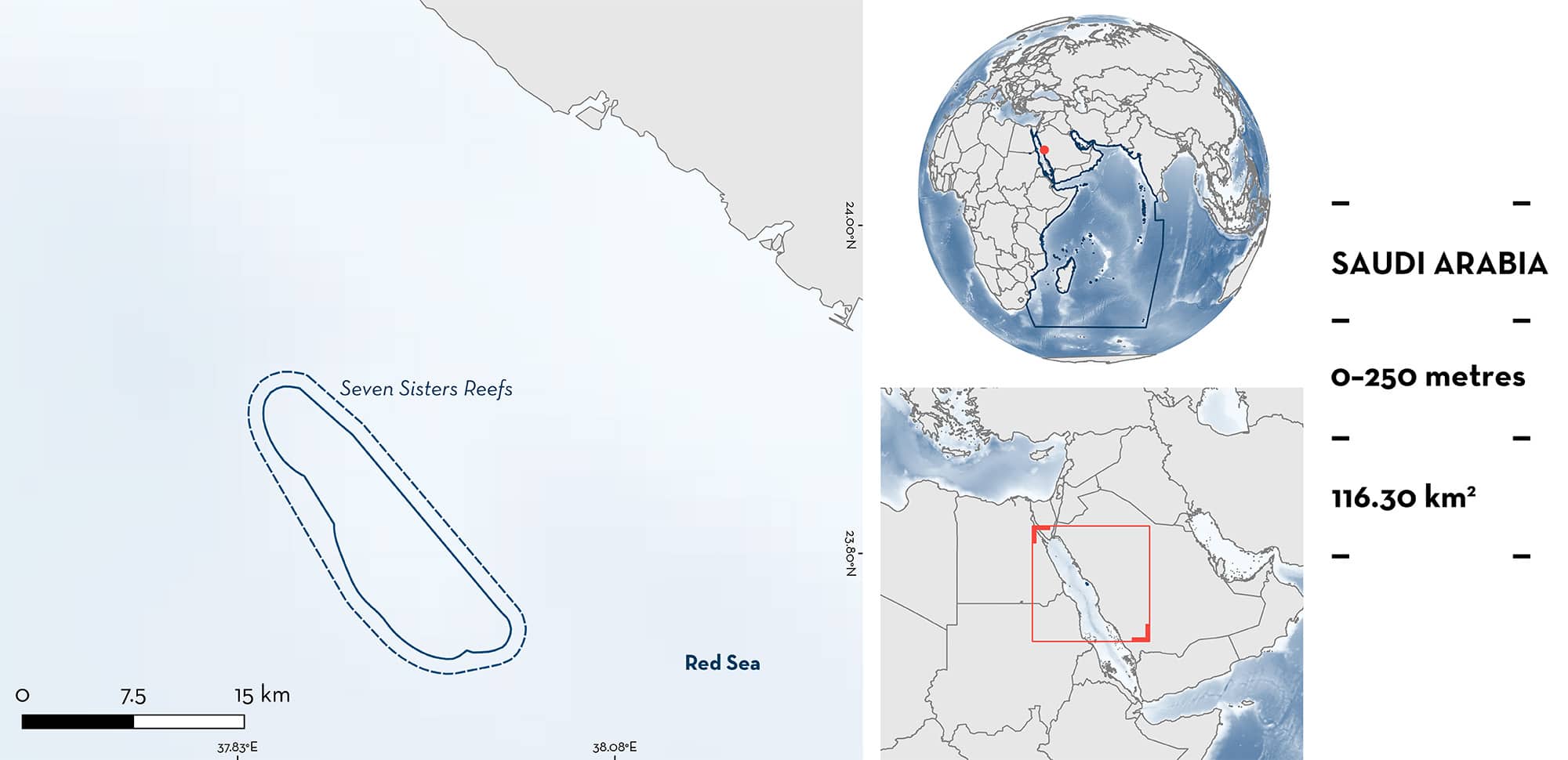
Seven Sisters Reefs
Summary
Seven Sisters Reefs are a collection of submerged reef platforms ~35 km off the Saudi Arabian Red Sea coast near the city of Yanbu. This area is characterised by successions of reef flat, reef crest, and steep reef wall surrounded by open water. Within this area there are: threatened species and undefined aggregations (Scalloped Hammerhead Sphyrna lewini).
Download factsheet
Seven Sisters Reefs
DESCRIPTION OF HABITAT
Seven Sisters Reefs is located off the coast of Yanbu in the Red Sea, Saudi Arabia. This area is characterised by a collection of seven reef platforms interspersed with deep waters with bottom-depths ranging from 100 to 250 metres. Each reef consists of a succession of reef flat, reef crest, and steep reef wall surrounded by open water.
This Important Shark and Ray Area is benthopelagic and is delineated from inshore and surface waters (0 m) to 250 m based on the bathymetry of the area and observations of the Qualifying Species.
CRITERION A
VULNERABILITY
The one Qualifying Species within the area is considered threatened with extinction according to the IUCN Red List of Threatened SpeciesTM. The Scalloped Hammerhead is assessed as Critically Endangered (Rigby et al. 2019).
CRITERION C
SUB-CRITERION C5 – UNDEFINED AGGREGATIONS
Seven Sisters Reefs is an important aggregation area for one shark species.
Scalloped Hammerheads aggregate in groups of 15–20 individuals regularly and predictably. These aggregations have been recorded during dive surveys undertaken from 2003–2023 around all seven reefs in this area. These observations are made year-round (Spaet & Habis unpubl. data 2023) and along with those from the Malathu Archipelago, represent some of the largest aggregations of the species still regularly reported from Saudi Arabian waters (J Cochran unpubl. data 2023).
Download factsheet
SUBMIT A REQUEST
ISRA SPATIAL LAYER REQUEST
To make a request to download the ISRA Layer in either a GIS compatible Shapefile (.shp) or Google Earth compatible Keyhole Markup Language Zipped file (.kmz) please complete the following form. We will review your request and send the download details to you. We will endeavor to send you the requested files as soon as we can. However, please note that this is not an automated process, and before requests are responded to, they undergo internal review and authorization. As such, requests normally take 5–10 working days to process.
Should you have questions about the data or process, please do not hesitate to contact us.


