ISRA FACTSHEETS
ISRA FACTSHEETS
WESTERN INDIAN OCEAN REGION
Shib Habil
Summary
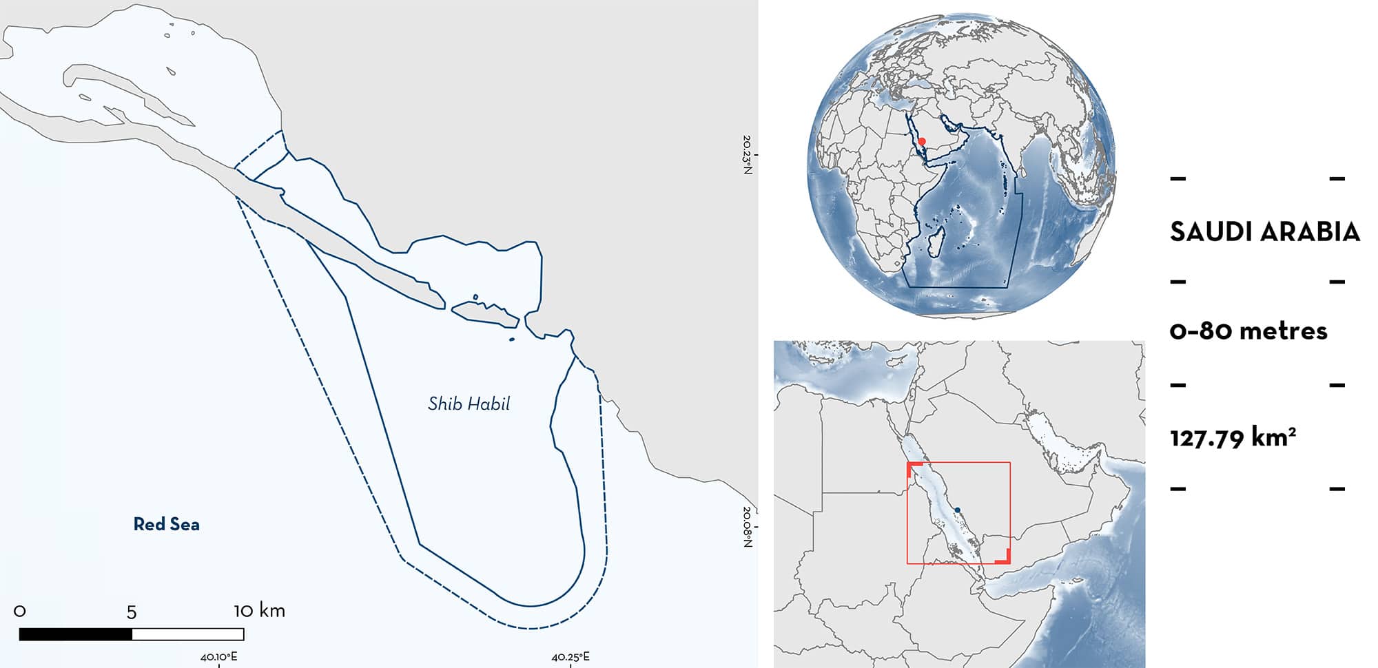
Shib Habil is a submerged reef platform located in the central Saudi Arabian Red Sea. It is characterised by sand and silt substrate with mangrove forests and fringing reefs. The reef crests at ~8 m descends to a bottom depth of 25 m on its sheltered side and to ~80 m on its exposed side. Within this area there are: threatened species (e.g., Reef Manta Ray Mobula alfredi); feeding areas (Whale Shark Rhincodon typus); and undefined aggregations (Reef Manta Ray).
Download factsheet
Shib Habil
DESCRIPTION OF HABITAT
Shib Habil is located in the Red Sea, Saudi Arabia. It is a shallow reef platform off the coastal shelf, with diverse habitats, including mangrove forests and fringing reefs (Cochran et al. 2016). The northern and sheltered sides of the reef platform are exposed to high productivity waters from a large, sheltered mangrove swamp to the north of the reef (Cochran et al. 2019). These enriched waters along with local and mesoscale eddy patterns may influence seasonal blooms of planktonic crustaceans (L Ostrovski unpubl. data 2023). The substrate varies between sand (along the exposed side and in the south), silt (on the northern sheltered side), and small reefs (scattered throughout the area, mostly along the exposed side). Depth varies from 8 m on the reef flat to 25 m on sheltered side and to 80 m on the exposed side.
This Important Shark and Ray Area is benthopelagic and is delineated from inshore and surface waters (0 m) to a depth of 80 m based on the bathymetry of the area.
CRITERION A
VULNERABILITY
The two Qualifying Species within the area are considered threatened with extinction according to the IUCN Red List of Threatened SpeciesTM. The Whale Shark is assessed as Endangered (Pierce & Norman 2016) and the Reef Manta Ray is assessed as Vulnerable (Marshall et al. 2022).
CRITERION C
SUB-CRITERION C2 – FEEDING AREAS
Shib Habil is an important feeding area for one shark and one ray species.
Based on research surveys undertaken since 2010, Whale Sharks aggregate in groups of up to 10 individuals at Shib Habil. However, they are most frequently encountered in groups of 2–4 comprising mostly juveniles and roughly equal numbers of males and females (Cochran et al. 2016). Animals aggregate to feed on seasonal blooms of crustaceous zooplankton (copepods, crab larvae, sergestid shrimp, and euphausiid shrimp; L Ostrovski unpubl. data 2023) in March, April, and May. The seasonal presence of large numbers of juvenile females and the apparent lack of sexual segregation at this site is unique among the known aggregations of Whale Sharks (Cochran et al. 2019). This behaviour is regularly and predictably observed from boat-based surveys that have been conducted in the area in each year from 2010 to 2019 and in 2022. Surveys have included visual census with photo-identification (Cochran et al. 2016), acoustic monitoring (Cochran et al. 2019), and satellite telemetry (Berumen et al. 2014). Photo-identification and acoustic monitoring showed evidence of interannual site fidelity. The combination of these methods points to seasonal immigration, short-term residency (weeks to months), and then emigration when the season ends.
CRITERION C
SUB-CRITERION C5 – UNDEFINED AGGREGATIONS
Shib Habil is an important area for undefined aggregations of one ray species.
Reef Manta Rays have been regularly encountered since 2011 (usually at sunrise or sunset) in a sheltered bay inshore of the area, directly adjacent to the mouth of a large, highly productive mangrove swamp. Acoustic monitoring has shown mobility of nine Reef Manta Rays throughout the area (Braun et al. 2015). There is no clear seasonal pattern in their presence, but satellite telemetry has shown six tagged animals making extensive use of the depth range of this area (Braun et al. 2014). When basking, Reef Manta Rays are usually encountered singularly, but feeding individuals are usually encountered in groups of 2–3. Further information is required to define the nature and function of these aggregations.
Download factsheet
SUBMIT A REQUEST
ISRA SPATIAL LAYER REQUEST
To make a request to download the ISRA Layer in either a GIS compatible Shapefile (.shp) or Google Earth compatible Keyhole Markup Language Zipped file (.kmz) please complete the following form. We will review your request and send the download details to you. We will endeavor to send you the requested files as soon as we can. However, please note that this is not an automated process, and before requests are responded to, they undergo internal review and authorization. As such, requests normally take 5–10 working days to process.
Should you have questions about the data or process, please do not hesitate to contact us.


