ISRA FACTSHEETS
ISRA FACTSHEETS
ASIA REGION
Shirahama
Summary
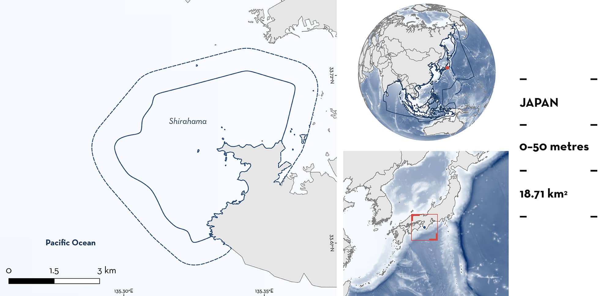
Shirahama is a coastal area located in the Wakayama Prefecture of south-central Japan. The area is characterised by shallow rocky reefs, corals, and sandy substrates. Although it is a shallow area, the shelf is narrow and the shelf edge steeply drops to >1,000 m depth ~15 km from Shirahama. The area overlaps with the Southern Coastal Areas of Shikoku and Honshu Islands Ecologically or Biologically Significant Marine Area, the Yoshino Kumano National Park, and the Shirahama Prefectural Wildlife Protection Area. Within this area there are: threatened species and undefined aggregations (Naru Eagle Ray Aetobatus narutobiei).
Download factsheet
Shirahama
DESCRIPTION OF HABITAT
Shirahama is located in the Wakayama prefecture of south-central Japan. This coastal area has many small peninsulas and islets. The habitat is characterised by sandy substrates and rocky outcrops with corals. Although it is shallow and located on the shelf, the shelf break is only ~10 km away and water >1,000 m deep is ~15 km from the area.
The warm Kuroshio Current influences this area, flowing northward along the steep shelf. Variations in the flow of the Kuroshio influence the sea level at coastal sites in the region (Nakamura 1994). The sea surface temperature varies seasonally from 16–28°C with a mean of 23°C (Yamamori et al. 2017).
Shirahama overlaps with the Southern Coastal Areas of Shikoku and Honshu Islands Ecologically or Biologically Significant Marine Area (EBSA; CBD 2024), the Yoshino Kumano National Park, and the Shirahama Prefectural Wildlife Protection Area.
This Important Shark and Ray Area is benthopelagic and is delineated from inshore and surface waters (0 m) to 50 m based on the bathymetry of the area.
CRITERION A
VULNERABILITY
One Qualifying Species within the area is considered threatened with extinction according to the IUCN Red List of Threatened Species. The Naru Eagle Ray is assessed as Vulnerable (Rigby et al. 2021).
CRITERION C
SUB-CRITERION C5 – UNDEFINED AGGREGATIONS
Shirahama is an important area for undefined aggregations of one ray species.
Naru Eagle Rays regularly and predictably aggregate in the area. Based on sighting reports from the dive centre operating in the area, aggregations of 10–100 individuals occur seasonally between January and March when the water temperature at depth is ~13–16°C (T Harada pers. obs. 2014–2024). Aggregations are generally sighted at ~15 m depth by divers. Sightings fluctuate over the years, ranging from once in a season to other years in which they are seen every day for up to two weeks (T Harada pers. obs. 2024). Elsewhere in Japan, their winter migrations have been documented to be triggered when water temperature drops below 18–19°C (Yamaguchi et al. 2021). The species is regularly observed in Osaka Bay ~100 km north of Shirahama during the boreal summer and autumn, and it is likely that they seasonally move to the area to overwinter in the relatively warmer waters of Shirahama (A Yamaguchi pers. obs. 2024). Further studies are needed to examine the nature and function of these aggregations.
Download factsheet
SUBMIT A REQUEST
ISRA SPATIAL LAYER REQUEST
To make a request to download the ISRA Layer in either a GIS compatible Shapefile (.shp) or Google Earth compatible Keyhole Markup Language Zipped file (.kmz) please complete the following form. We will review your request and send the download details to you. We will endeavor to send you the requested files as soon as we can. However, please note that this is not an automated process, and before requests are responded to, they undergo internal review and authorization. As such, requests normally take 5–10 working days to process.
Should you have questions about the data or process, please do not hesitate to contact us.


