ISRA FACTSHEETS
ISRA FACTSHEETS
WESTERN INDIAN OCEAN REGION
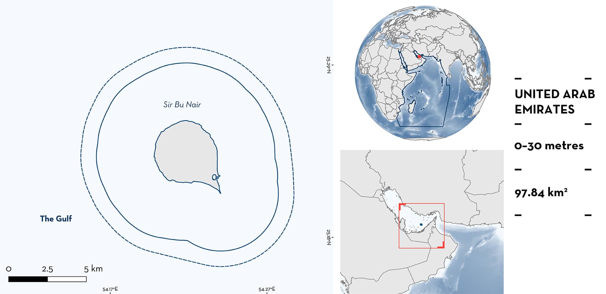
Sir Bu Nair
Summary
Sir Bu Nair is a remote island in the southern Arabian/Persian Gulf (hereafter ‘Gulf’), United Arab Emirates. This area is subject to localised upwelling events and has large colonies of acroporid corals alongside sandy and hard substrates. This area sits within the Sir Bu Nair Island Protected Area, a Wetland of International Importance (Ramsar site), and is recognised as an Ecologically or Biologically Significant Marine Area. Within this area there are: threatened species and reproductive areas (Blacktip Reef Shark Carcharhinus melanopterus).
Download factsheet
Sir Bu Nair
DESCRIPTION OF HABITAT
Sir Bu Nair is an offshore island in the southeastern Gulf in United Arab Emirates (UAE) waters. Waters around this island undergo local small-scale upwelling events in summer, which can keep temperatures lower than what is observed in the coastal waters of the UAE (Cavalcante et al. 2020).
The area is surrounded by coral reef habitats, mainly branching corals, in shallow waters, with coral colonies being more predominant in adjacent slopes to 15–20 m depth (Mateos-Molina et al. 2020). Reefs in Sir Bu Nair have extensive tabular colonies of acroporid corals interspersed with densely spaced coral composed mainly of Porites spp; Bejarano et al. 2022).
This area sits within the Sir Bu Nair Island Protected Area, a Wetland of International Importance (Ramsar site), and is recognised as an Ecologically or Biologically Significant Marine Area.
This Important Shark and Ray Area is benthopelagic and is delineated from inshore and surface waters (0 m) to 30 m based on the bathymetry of the area.
CRITERION A
VULNERABILITY
The one Qualifying Species within the area is considered threatened with extinction according to the IUCN Red List of Threatened SpeciesTM. The Blacktip Reef Shark is assessed as Vulnerable (Simpfendorfer et al. 2020).
CRITERION C
SUB-CRITERION C1 – REPRODUCTIVE AREAS
Sir Bu Nair is an important reproductive area for one shark species.
Blacktip Reef Sharks regularly and predictably occur year-round around the island (Jabado et al. 2021; RW Jabado pers. comms. 2023). Since 2008, neonates and/or young-of-the-year have been observed yearly along the coastline during routine monitoring by researchers or police staff and rangers stationed on the island (RW Jabado pers. comm. 2023). Informal interviews with local police staff and rangers on the island have confirmed, that each boreal spring, solitary individuals, or aggregations of up to 4–5 small Blacktip Reef Sharks of < 50 cm total length (TL) can be seen in shallow rocky or sandy coastal locations around the island at depth of < 2 m. The estimated size-at-birth for Blacktip Reef Shark is 30–50 cm TL (Chin et al. 2013) and size-at-maturity of both males and females is 90–134 cm TL (Compagno 1984; Last & Stevens 2009). The recurring nature of the observations despite regular staff and ranger turnaround suggests that these sightings are not isolated incidents. Further, in a study using Baited Remote Underwater Video Surveys deployed around the island, Blacktip Reef Sharks (n = 6) recorded were within the estimated size range for juveniles (50–100 cm TL; Jabado et al. 2021).
Download factsheet
SUBMIT A REQUEST
ISRA SPATIAL LAYER REQUEST
To make a request to download the ISRA Layer in either a GIS compatible Shapefile (.shp) or Google Earth compatible Keyhole Markup Language Zipped file (.kmz) please complete the following form. We will review your request and send the download details to you. We will endeavor to send you the requested files as soon as we can. However, please note that this is not an automated process, and before requests are responded to, they undergo internal review and authorization. As such, requests normally take 5–10 working days to process.
Should you have questions about the data or process, please do not hesitate to contact us.


