ISRA FACTSHEETS
ISRA FACTSHEETS
ASIA REGION
Sogod Bay
Summary
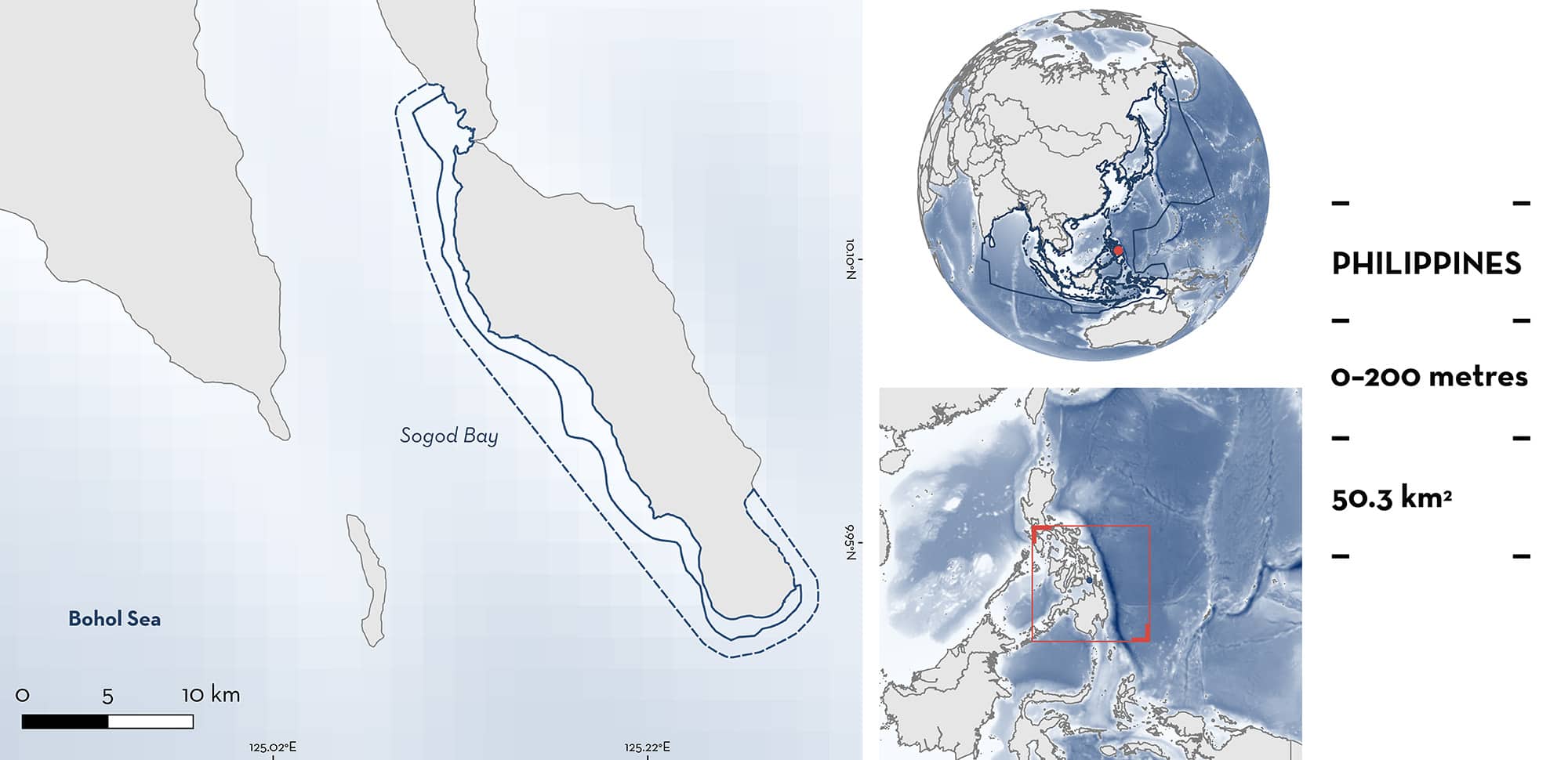
Sogod Bay is located in the northeastern Bohol Sea, southern Philippines. The combination of bathymetric profile, physical oceanographic features, and location of this area produce seasonal upwellings, resulting in plankton productivity between November and April. The southern part of this area, south Panaon Island, is positioned at the easternmost entrance to the Bohol Sea and exposed to the Bohol Jet, representing the main oceanographic feature influencing this area and inducing upwelling events. Sogod Bay is characterised by naturally limited mangrove areas, narrow coral reefs, limited seagrass beds, and narrow intertidal areas and beaches. Within this area there are: threatened species and feeding areas (Whale Shark Rhincodon typus).
Download factsheet
Sogod Bay
DESCRIPTION OF HABITAT
Sogod Bay is located in the northeastern Bohol Sea, also known as the Mindanao Sea, southern Philippines. This area lies west and south of Panaon Island within the Province of Southern Leyte (which includes the Municipalities of Pintuyan, San Francisco, San Ricardo, and Liloan), located off Leyte Island in the Eastern Visayas region of the Philippines.
The area is characterised by naturally limited mangrove areas, narrow coral reefs, limited seagrass beds, and narrow intertidal areas and beaches. Depths in the bay reach a maximum of ~1,460 m in the central channel (Calumpong et al. 1994). The seabed is steeply sloping providing the bay with a minimal coastal shelf and a deep, narrow central channel. There are two major rivers that flow into the northern section of the bay, the Divisoria River in Bontoc and the Subang Daku River in Sogod, which have resulted in high sediment loading in the surrounding area (Calumpong et al. 1994).
In the Bohol Sea, sea surface currents, formation of eddies, and entrainments cause upwellings that drive seasonal variations in productivity which are also influenced by the northeast and southwest monsoons (Cabrera et al. 2011; Gordon et al. 2011). Entrainment appears to be enhanced during the northeast monsoon season (November to April) and is more pronounced in the eastern basin than the western basin (Cabrera et al. 2011). The combination of bathymetric profile, physical oceanographic features, and location of Sogod Bay produce seasonal upwelling, resulting in plankton productivity occurring between November and April. The southern part of this area, south Panaon Island, is positioned at the easternmost entrance to the Bohol Sea and exposed to the Bohol Jet, a south-westward flowing surface high speed current originating from the Pacific Ocean and flowing into the Bohol Sea representing the main oceanographic feature influencing this area which induces upwellings (Cabrera et al. 2011).
This Important Shark and Ray Area is pelagic and is delineated from surface waters (0 m) to 200 m based on the depth range of the Qualifying Species in the area and the bathymetry of the area.
CRITERION A
VULNERABILITY
One Qualifying Species within the area is considered threatened with extinction according to the IUCN Red List of Threatened Species. The Whale Shark is assessed as Endangered (Pierce & Norman 2016).
CRITERION C
SUB-CRITERION C2 – FEEDING AREAS
Sogod Bay is an important feeding area for one shark species.
Between 2013 and 2016, seasonal records (November to April) of Whale Sharks feeding (most probably on sergestid shrimp) were reported from 51.8% (n = 527) of tourist–Whale Shark interactions (Araujo et al. 2017). Similarly, from November 2018 to March 2019, dedicated boat-based surveys observed Whale Sharks feeding in this area on 107 (71%) of sightings (Agustines et al. 2019). As many as six individuals within a 30 m2 have been observed actively ram filter feeding as close as 30 m from the shore (LAMAVE unpublish. data 2023). The months in which sharks are observed feeding overlap with the northeast monsoon season in which upwelling events and plankton blooms increase.
This area has been identified as one of the 25 largest aggregation sites for Whale Shark globally and is ranked second in Asia (where five sites have been identified, excluding Oslob, a provisional site) (Araujo et al. 2022). This is due to the number of individuals identified and those reported per survey (mean = 3.2, highest = 9) (Araujo et al. 2022). Between 2006–2020, 321 Whale Sharks were photographically identified with 66% of them having been resighted in this area (Araujo et al. 2022). Aggregations here are composed mainly of male juveniles (58% of males), with an average total length of 5.72 ± 1.02 m SD (Araujo et al. 2016). Whale Sharks in this area had a mean residency of 27.04 ± 8.46 SE days. Estimates of aggregation size indicated that a mean of 15.6 ± 1.7 SE (95% CI (12.9–19.3) Whale Sharks were present in this area at any one-time (Araujo et al. 2016).
Download factsheet
SUBMIT A REQUEST
ISRA SPATIAL LAYER REQUEST
To make a request to download the ISRA Layer in either a GIS compatible Shapefile (.shp) or Google Earth compatible Keyhole Markup Language Zipped file (.kmz) please complete the following form. We will review your request and send the download details to you. We will endeavor to send you the requested files as soon as we can. However, please note that this is not an automated process, and before requests are responded to, they undergo internal review and authorization. As such, requests normally take 5–10 working days to process.
Should you have questions about the data or process, please do not hesitate to contact us.


