ISRA FACTSHEETS
ISRA FACTSHEETS
ASIA REGION
South Rinca
Summary
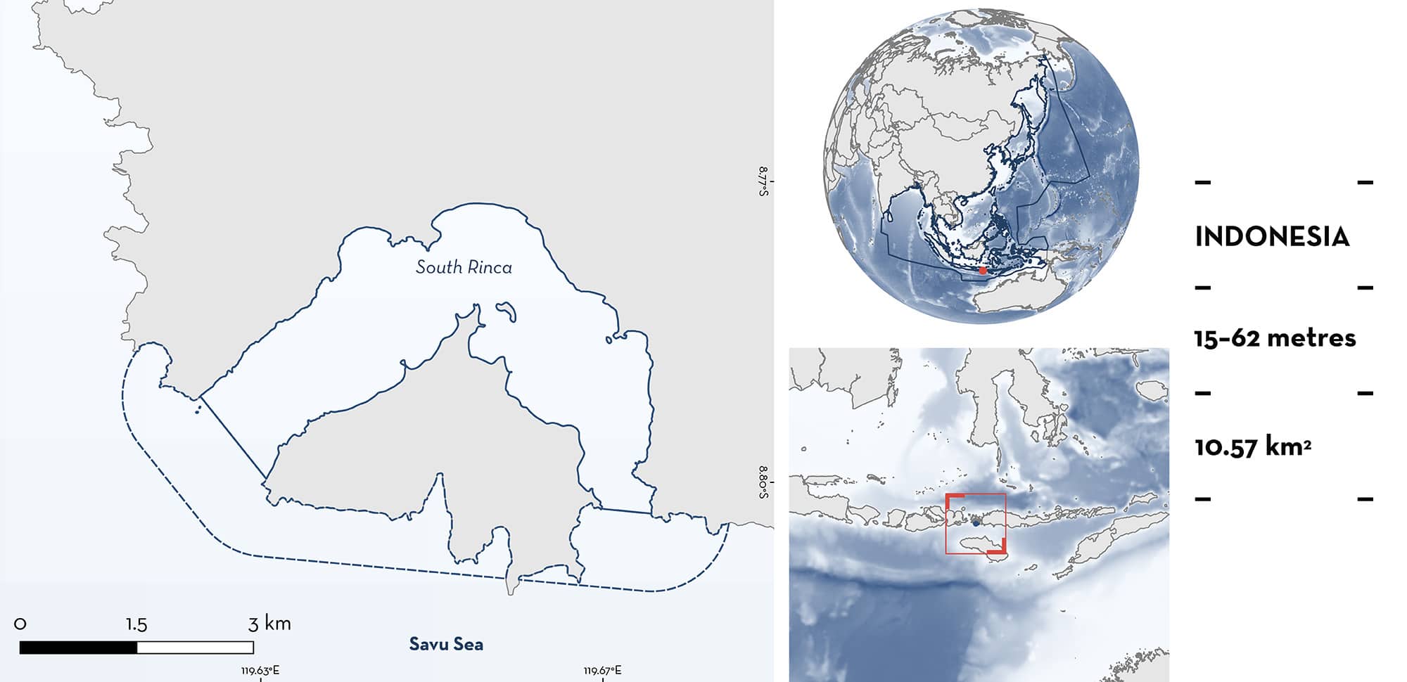
South Rinca is located in East Nusa Tenggara, Indonesia. The area encompasses the strait between Rinca Island and Kode Pulau Motang Island. It is characterised by black sand beaches and soft and hard corals. The area is located within the Perairan Komodo – Rinca Key Biodiversity Area and the Komodo National Park. Within this area there are: range-restricted species (Balinese Numbfish Narcine baliensis).
Download factsheet
South Rinca
DESCRIPTION OF HABITAT
South Rinca is located in East Nusa Tenggara, Indonesia (near Komodo and Flores Island). The area encompasses the strait between Rinca Island and Kode Pulau Motang Island. It is characterised by black sand beaches, and soft and hard corals (Starfish 2017).
It is influenced by down currents created from the Indonesian Throughflow which is strongest between June–August (the southeast monsoon period).
This area is located within the Perairan Komodo – Rinca Key Biodiversity Area (KBA 2024) and the Komodo National Park (Protected Planet 2024).
This Important Shark and Ray Area is subsurface and benthopelagic and is delineated from 15 m to 62 m based on the depth range of the Qualifying Species.
CRITERION B
RANGE RESTRICTED
This area holds the regular presence of Balinese Numbfish as a resident range-restricted species. This species has been recorded in the area during recreational dive surveys over the last 30 years (MV Erdmann pers. obs. 2023). Contemporary underwater dive surveys regularly record Balinese Numbfish, with records of >30 individuals in one survey. South Rinca is a popular dive site (often referred to as ‘Torpedo Alley’ due to the regular presence of the Balinese Numbfish, which were previously incorrectly identified as torpedo rays), with tourists undertaking night dives to observe them. Balinese Numbfish are found at 15–25 m, partially hidden under the sandy substrate, a few metres apart from each other. Most commonly, 2–3 individuals are observed at the same time, however, there are often 5–10 individuals, and sometimes 10–15 individuals. There is no clearly defined seasonality to these aggregations.
South Rinca holds national and regional importance for Baliense Numbfish given the rarity of sightings and landings data for this species outside the area. It is the only known site in Asia where many individuals are found in close proximity to each other (MV Erdmann pers. obs. 2023). The only other location where Balinese Numbfish are reported with contemporary observations is South Sumbawa, Indonesia. Balinese Numbfish occurs only in the Indonesian Sea Large Marine Ecosystem.
Download factsheet
SUBMIT A REQUEST
ISRA SPATIAL LAYER REQUEST
To make a request to download the ISRA Layer in either a GIS compatible Shapefile (.shp) or Google Earth compatible Keyhole Markup Language Zipped file (.kmz) please complete the following form. We will review your request and send the download details to you. We will endeavor to send you the requested files as soon as we can. However, please note that this is not an automated process, and before requests are responded to, they undergo internal review and authorization. As such, requests normally take 5–10 working days to process.
Should you have questions about the data or process, please do not hesitate to contact us.


