ISRA FACTSHEETS
ISRA FACTSHEETS
WESTERN INDIAN OCEAN REGION
South Suakin Archipelago
Summary
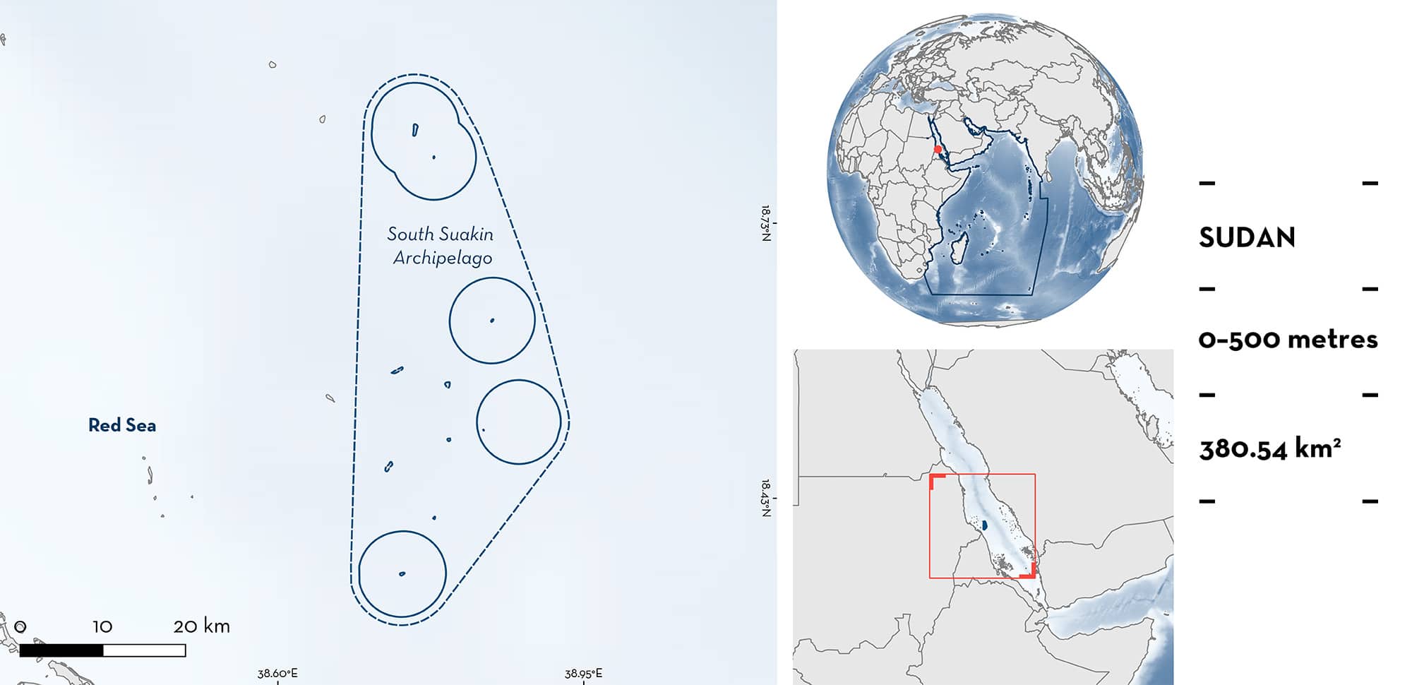
South Suakin Archipelago is located off the southern Sudanese coast in the Red Sea. This area contains four islands and reef platforms interspersed by deep waters, characterised by fringing reefs. It partially overlaps with the Suakin Archipelago and Sudanese Southern Red Sea Ecologically or Biologically Significant Marine Area and the Suakin Archipelago Key Biodiversity Area. Within this area there are: threatened species and undefined aggregations (Scalloped Hammerhead Sphyrna lewini).
Download factsheet
South Suakin Archipelago
DESCRIPTION OF HABITAT
Southern Suakin Archipelago encompasses several offshore islands and reef platforms near the Sudanese-Eritrean border. This is part of the largest group of islets in the Sudanese Red Sea. The islets within this area are mostly < 1 km long (BirdLife International 2023). This area includes Masamarit Island, Island of Dahrat Abid, Island of Ed Domesh, and Adam Reef. The various pinnacle features are separated by deep waters reaching 500 m depth. Islets are largely barren, though the sandy fringes have some vegetation (BirdLife International 2023). This area is characterised by fringing reefs, reef pinnacles, reef flats, and slopes.
This area overlaps with the Suakin Archipelago Key Biodiversity Area (KBA 2023) and the Suakin Archipelago and Sudanese Southern Red Sea Ecologically or Biologically Significant Marine Area (CBD 2023).
This Important Shark and Ray Area is pelagic and extends from surface waters (0 m) to 500 m based on the bathymetry of the area.
CRITERION A
VULNERABILITY
The one Qualifying Species within the area is considered threatened with extinction according to the IUCN Red List of Threatened SpeciesTM. The Scalloped Hammerhead is assessed as Critically Endangered (Rigby et al. 2019).
CRITERION C
SUB-CRITERION C5 – UNDEFINED AGGREGATIONS
South Suakin Archipelago is important for undefined aggregations of one shark species.
This area hosts some of the largest known aggregations of Scalloped Hammerheads in the Red Sea (J Cochran pers. obs. 2023). Opportunistic diver surveys conducted from 2012–2017 by a single dedicated observer have recorded 353 encounters with Scalloped Hammerheads in this area. This includes 73 encounters with large aggregations containing 50–280 individuals from visual estimation (D Coker unpubl. data 2023). Key sites with aggregations of Scalloped Hammerheads include Masamarit islands (n = 8 aggregations encountered), the islands of Dahrat Abid (n = 22) and Ed Domesh (n = 16), and a submerged reef platform informally known as Adam Reef (n = 27 encounters, including the largest schools with 280 individuals counted; D Coker unpubl. data 2023).
Download factsheet
SUBMIT A REQUEST
ISRA SPATIAL LAYER REQUEST
To make a request to download the ISRA Layer in either a GIS compatible Shapefile (.shp) or Google Earth compatible Keyhole Markup Language Zipped file (.kmz) please complete the following form. We will review your request and send the download details to you. We will endeavor to send you the requested files as soon as we can. However, please note that this is not an automated process, and before requests are responded to, they undergo internal review and authorization. As such, requests normally take 5–10 working days to process.
Should you have questions about the data or process, please do not hesitate to contact us.


